Quick Note: Commuter Rail and Urban Bus Hubs
I’d like to introduce the concept of bus hubs with commuter rail connections, but in an urban rather than suburban context. This comes from the project we’re working on to about Queens buses on the assumption that LIRR is modernized, but it should generalize. The suburban bus context is a town center that buses converge on from many directions; the urban one is embedded in a much larger street network that must have multiple stops, and therefore the hub must be planned around both bus and rail service at once, rather than in a rail-first hierarchy.
The importance of two-way planning here is that within an urban grid, there usually aren’t obvious town centers, unless they are built. The topic of this discussion is not city center but outer areas where the commuter trains provide walk-on service, or would if they ran at modern (i.e. non-American) frequencies and charged the same fares as the buses and subway. For example, take Eastern Queens in and east of Jamaica:
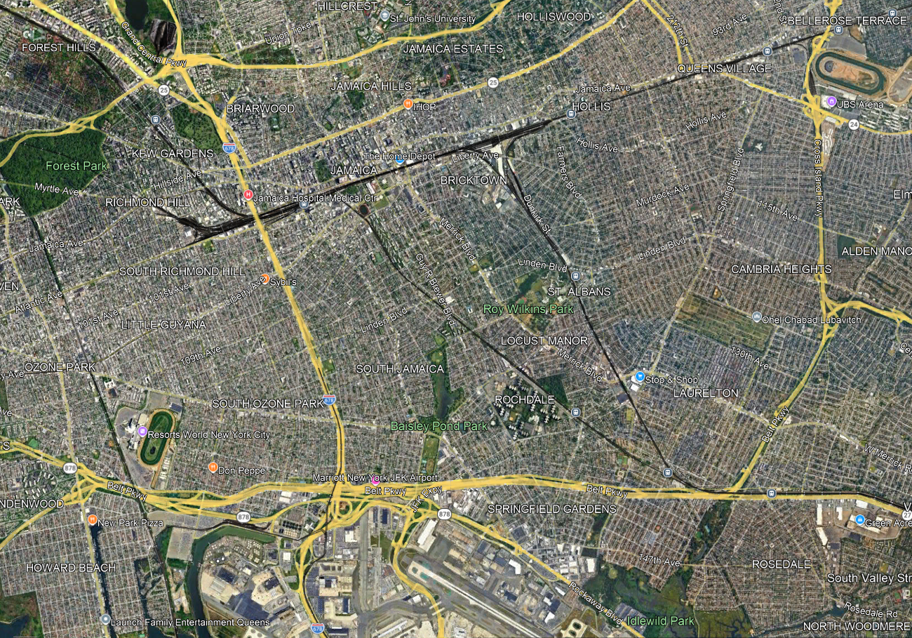
Jamaica is an obvious node, and nearly all LIRR trains already stop there and the rest should, but farther east, it’s a question of how to set up the LIRR to interact better with the city, including its buses. A lot of questions and tradeoffs have to be addressed all at once:
- Stop spacing, trading off station access time with trip times. The LIRR on the Main Line has four tracks through Floral Park so any infill station would be local-only, but that still matters for riders from points east like Floral Park and Hempstead. On the Atlantic Branch and the Montauk Line there are only two tracks, and extensive suburban ridership that would be slowed down by additional stops.
- Intersections with main arterial streets that make for natural bus connection points. The Queens Village LIRR station is at the intersection with Springfield Boulevard, but a little to its west Francis Lewis intersects the Main Line without an LIRR stop, while Hollis is not so well integrated with the street network (it’s near Farmers Boulevard, which more or less parallels the Monrauk Line). On the Montauk Line and Atlantic Branch, strong east-west bus connection points are useful; St. Albans is at the intersection with Linden, but the Atlantic Branch has no such stop at the intersection with Linden.
- Stops that permit buses to avoid congested nodes, in this case Jamaica; farther north, off-map, the same is true of Flushing. One of the goals of bus redesigns replacing traditional radial networks with grid is to get buses out of the areas where they are the slowest; this was explicit in the replacement of the radial network with the Nova Xarxa grid, increasing average speed even without any other interventions like bus lanes and stop consolidation.
- Some bus routes duplicate rail routes and could be removed or curtailed, if enough infill stops are built: for example, Merrick and Guy R. Brewer Boulevards are very closely parallel to the Montauk Line and Atlantic Branch respectively.
Without doing more detailed work yet, I suspect that the speed-access tradeoff encourages more infill stops on the Main Line and Atlantic Branches and fewer or even none on the Montauk Line, since the Atlantic Branch only continues to fairly close-in suburbs whereas Montauk carries the Babylon Branch on it, and that the buses can then be moved to a grid to connect with these stations. But the point is that this is not a decision that can be made rail-first, unlike timed connections in secondary cities and suburban town centers. The top-down hierarchy that for example Marco Chitti brings up when setting up a Takt system breaks down when one does coordinated bus-rail planning within the city.
