Category: Transportation
Who Rides Commuter Rail?
I’ve had an argument in comments with the author of Purple City about who commuter rail should serve. He’s argued before that cities should make sure outer suburbanites can get to the center via express commuter rail, and I will add that American cities do do that, and orient commuter rail too much around the needs of peak-hour outer suburbanites. Insofar as I think cities should have commuter rail there’s no disagreement, but what I think they do wrong is focusing too much on the peak. The two practices in contention are the low off-peak frequency (for example, Metra’s Union Pacific-North Line, which has no freight to speak of, has worse than hourly off-peak service), and the stop distribution, which has trains making few or no stops in the city proper.
The common thread of these two practices is that they optimize one variable: peak travel time for a suburban commuter to the CBD. This neglects other sources of ridership on commuter rail, which are suppressed in the US but significant in countries with more modern operating practices. I will contrast the peak-focused approach with a rapid transit approach, using examples that I believe will show that the latter is bound to get far more ridership, even in the suburbs.
First, let us imagine a contrasting system, one in which North American commuter rail looks more like an RER, an S-Bahn, or a Japanese commuter rail network. Such a system will have the following features:
1. Relatively consistent stopping pattern. The busier lines may have local and express trains, but the express trains will stop at the same major stops. Local trains will make all local stops over a fairly wide stretch.
2. Low ratio of peak to off-peak frequency, in the vicinity of 2:1 or even less. In a major city like Chicago or New York, a line that can’t support half-hourly service all day, at a bare minimum, will likely have no service at all; the only exceptions I can think of are services at range so long they’re practically intercity, like New York-Hamptons or New York-Allentown.
3. An urban stopping pattern that’s not too express. If there’s a parallel subway then it’s okay to have a somewhat wider stop spacing than in the inner suburbs beyond the subway’s range, but still closer to the 2-3 km range than the 4-5 km range of Metra.
If it’s possible to do so technologically, then the commuter line may be interlined with a subway line, even. This is usually hypothetical, since subways and commuter trains, where both exist, are almost always technologically incompatible; Tokyo and Seoul are the two major exceptions, with London a borderline case. However, it’s useful to consider such hypothetical cases, to examine what would happen to train service. I will consider two such cases: having Vancouver’s Evergreen Line take over West Coast Express (the original argument), and having Boston’s Red Line take over Old Colony Lines. Neither situation is technologically possible, even ignoring FRA and Transport Canada regulations, as both Boston and Vancouver build subway tunnels for much smaller trains than run on the mainline, but this discussion may be useful in cases where a takeover is feasible, such as when the commuter line is an isolated branch. I prefer to discuss the hypotheticals since the two examples in question are purer examples of priorities: outer-suburban peak service, or rapid transit-style service.
Vancouver
Vancouver’s rail service consists of the SkyTrain network, which gets about 400,000 weekday riders, and the West Coast Express, a peak-only commuter rail network running 5 trains per day per direction, with 11,000 weekday riders. SkyTrain’s under-construction Evergreen Line will intersect the West Coast Express at Port Moody and Coquitlam, and then serve more stations in Coquitlam off the mainline, while the WCE continues much farther to the east, into the Vancouver exurbs. The WCE connects Port Moody to Waterfront in 25 minutes and Coquitlam in 30 minutes; the Evergreen Line is projected to take 33 and 38 minutes respectively, with a transfer at Broadway/Commercial. Despite the slower service, the much higher frequency, all-day service, and connections to more of the Vancouver metro area win: the projected ridership for the Evergreen Line is about 23 million a year (see Table 2 on PDF-p. 4 here), which corresponds to about 75,000 per weekday.
Now, what’s in contention is whether it would be wise to have the same treatment at WCE stations farther east. The potential ridership at those stations is lower since they’re in less built-up areas, so it is likely cost-ineffective to build an Evergreen Line branch along the Canadian Pacific mainline and have it replace the WCE, but if such a line were built, it would most likely have the same effect on travel times: people would have to transfer at Broadway/Commercial, and not including the transfer time take 8 minutes more to get to Waterfront. The eastern end of the line, Mission, has 75-minute service now, and this would change to 83-minute service plus a transfer.
I claim that Mission residents would still take the train more often if it were 8 minutes lower. The reason is simple: as a proportion of overall travel time, the 8 minutes are more important to a 25-minute Port Moody commuter than to a 75-minute Mission commuter. Mission commuters live farther out, so they’re somewhat less likely to care about service to various neighborhoods along the way, but they’re even less likely to care about 8 minutes. They also are less likely to care about very high frequency, since their trips are longer, but they do care about service availability all day, even if they’d be okay with half-hourly service. Moreover, the Evergreen Line will connect to secondary nodes like Metrotown better than the WCE does, and eventually have direct service to Central Broadway and UBC, both of which draw commuters from the entire region.
In the present, the WCE works as a placeholder – it’s possible to reduce staffing and improve turnaround times to allow off-peak service, but there’s too little population east of Coquitlam to justify a SkyTrain extension, and so far population growth is fastest in inner-suburban Port Moody and Surrey (see here and here) and not east of Coquitlam. In the future, if those areas grow then it will make sense to replace the WCE with SkyTrain. WCE upgrades are unlikely – adding infill stations is practically impossible, as the line hugs an active port, with no good station sites. While SkyTrain’s driverless configuration keeps operating expenses down, it makes it impossible to extend branches to the suburbs cheaply by running them at-grade and in mixed traffic with freight.
Boston
Several of Boston’s subway branches are parallel to extant or closed commuter lines. The Orange Line runs alongside the Northeast Corridor to Forest Hills, the Blue Line took over parts of the narrow-gauge Boston, Revere Beach and Lynn Railroad, the Green Line D Branch took over a commuter rail loop used by the Boston and Albany, and the Red Line took over a New Haven Railroad branch line to Ashmont and runs alongside the Old Colony Lines to Braintree. At the time the Braintree extension opened the Old Colony Lines were closed for passenger service, but they have been since reopened, running from Braintree to South Station with just one stop in between, either JFK-UMass or Quincy Center (never both, except on trains that skip Braintree); off-peak frequency is about every two hours on each of two lines, and with some off-peak trains skipping Braintree, service to Braintree is worse than hourly. The Red Line takes 26-27 minutes to go from Braintree to South Station, the Old Colony Lines take 19-21 minutes.
As is projected in Vancouver, ridership on the Red Line is much higher: according to the 2014 Blue Book, on PDF-pp. 14 and 74, the busiest MBTA commuter rail station, Providence, gets 2,325 riders per weekday and the busiest Old Colony station, Bridgewater, gets only 1,036, while the Braintree extension’s five stops get 6,975, 4,624, 8,655 (Quincy Center), 4,785, and 5,122 (Braintree). Those five stops get 30,000 riders between them, meaning 60,000 since it’s unlikely people ride internally on the extension; this is nearly half the entire MBTA commuter rail ridership, and three times the ridership on the Old Colony Lines (counting Greenbush, which diverges at Quincy, as a third line).
As in Vancouver, I claim that a Red Line extension taking over the Old Colony Lines would have much higher ridership. Of course the frequency per line, already middling since the Braintree extension is a branch, would not be very good; but at the range of the suburbs served by these lines, half the current frequency of the Red Line, giving about 20 minutes at the peak and 30 off-peak, is enough, and is a massive improvement over multi-hour headways. The extra 5-8 minutes of travel times matter less as one moves farther out, again; travel time to South Station from the first Old Colony stations past Braintree, South Weymouth and Holbrook/Randolph, is 28 minutes, about the same as from Braintree on the Red Line, and those two stations have a bit more than 500 weekday riders each.
Moreover, the Red Line has something the commuter trains don’t: service to multiple centers within the inner Boston region. Downtown Crossing is closer to most jobs than South Station, saving people the walk. Cambridge is a major job center in its own right (it has more jobs than any New England city except Boston, ahead of Providence, Worcester, and Hartford). Back Bay is a bit more accessible via the Orange Line at Downtown Crossing or the Green Line at Park Street than via commuter rail at South Station.
Like SkyTrain, the Red Line can’t run on mainline rail tracks, and there is not enough population to justify an extension, nor enough population growth in New England for such an extension to ever pencil out. However, it’s possible to modernize commuter rail, as I have written before. This would not provide direct service to Downtown Crossing or Cambridge, but could provide cross-platform transfers to Back Bay, decent frequency all day, and, since regional EMUs can have very good performance characteristics, much higher average speeds than with today’s slow diesel locomotives even if trains make more stops.
General Remarks
The examples of Boston and Vancouver’s ridership patterns suggest that it’s okay to sacrifice speed to provide coherent service. It’s worth noting here that the bulk of present-day ridership on North American commuter rail would not benefit too much from such sacrifice. North American commuter rail provides awful service in the off-peak or to non-CBD destinations: even the Newark CBD, relatively well-served by New Jersey Transit, has a 26% mode share as a job center as of 2000, as per an Alan Voorhees Transportation Center report called Informed Intuition (PDF-p. 13). There’s a huge amount of latent ridership on North American commuter rail, which is why rapid transit gets so much more ridership than peak-focused commuter rail.
This doesn’t change much at different ranges of distance from the center. The few minutes saved by expressing through the city to the CBD matter a great deal to the suburbs right beyond city limits, but those innermost suburbs are precisely the ones that could make the most use of service to multiple city nodes. Farther out, where commuters to the city tend to be more likely to be working at the CBD, since it is more specialized than most secondary nodes, frequency and service to everywhere matter less, but the extra few minutes matter even less.
However, since present-day riders are precisely the narrow slice of potential users who are okay with the current setup, they have the potential to engage in NIMBY protests against any attempt at modernization. Why change what works for them? This is why Long Island representatives oppose such modernization attempts as letting Metro-North access Penn Station; it’s entirely a turf war. Even reforms that do not degrade trip times to the CBD are unlikely in this political situation, for example mode-neutral fares: the people paying premium fare to ride the LIRR or (to some extent) Metra are the ones who are okay with paying this fare, and who may object to increased train crowding coming from lower fares.
Judging by the ridership multiple between the Evergreen Line and WCE, there are likely to be a few million weekday rides coming out of Eastern Queens and Long Island if the LIRR is modernized, but those are not the Manhattan-bound commuters who dominate the discussion today. Instead, they are people who have gotten used to unusable commuter rail, and drive to work, or take long bus-subway commutes to avoid paying higher fares. They do not seem like a significant source of regional rail ridership because they are not current riders (or they ride local transit instead), but they are precisely what makes the difference between the low ridership of every North American commuter rail system and the higher ridership of many European systems.
Mixing Circumferential and Radial Transit
Nearly all rapid transit lines belong to one of two categories: radial lines (a large majority), which connect city center with outlying neighborhoods or suburbs; and circumferential lines (a minority), which go around city center and often serve secondary centers and usually intersect all or nearly all radial lines perpendicularly, such as Paris’s Lines 2 and 6, Moscow’s Circle Line, Seoul’s Line 2, New York’s G train, and Shanghai’s Line 4. In this post, I’m going to discuss an uncommon third category, that of lines that combine circumferential and radial functions: they go toward city center, like a radial line, but then change direction and become circumferential. The G train in New York was like this until 2001, and Line 3 in Shanghai is like this today. This is apropos a proposal by a team Penn Design graduate students to build a variant of Triboro RX in New York that combines Triboro’s circumferential orientation with a radial commuter line. I believe such mixed lines are a recipe for low ridership and strained transfer points, and the Penn Design proposal is inferior to the original Triboro proposal.
First, some details about the mixed lines in question. The example most accessible to most readers is the historical G train in New York. When it first opened in the 1930s as part of the IND, it was designed to both connect Brooklyn and Queens without going through Manhattan and provide local service along radial lines, running alongside express trains that would serve Manhattan. Thus the northern half of the G ran under Queens Boulevard as a local, while the E and F trains provided express service and went to Manhattan. From the start, this arrangement was unstable. Demand for service to Manhattan was much greater than to Brooklyn, so people riding the G inbound changed to the E or F at the first express station after the one they boarded. With overcrowded express trains and undercrowded local ones, the Transit Authority was compelled to build a track connection in 1955 to add a Manhattan-bound local service, and to build a second track connection in 2001 to add another Manhattan-bound local train and remove the G from Queens Boulevard entirely.
In Shanghai, Line 3 was built as an (almost) entirely above-ground line, interlined for part of the way with the circular Line 4. The northern half of Line 3 is radial, running parallel to the overcrowded Line 1. However, where Line 1 enters the traditional center and serves People’s Square, Line 3 swerves west to go around it (missing Lujiazui, the new high-rise CBD to the east of People’s Square), interlining with Line 4, and leaving the loop southward to intersect Line 1 again at Shanghai South Railway Station. Its ridership disappoints not only by the standards of Line 1, but also by those of Line 4: 642,000 on 2014/4/30, the system’s busiest day, compared with 1,384,000 on Line 1 and 907,000 on Line 4. Line 6, which likewise combines a radial function at its northern end with a circumferential one at its center, serving Century Avenue but not Lujiazui or People’s Square, has even lower ridership, 376,000, although this is several times the original projection.
There’s a discussion on Human Transit, in which consensus is that the best circumferential lines connect secondary activity nodes that generate trips in their own right. Now, the G train connects Downtown Brooklyn (the largest business district in New York outside Manhattan) with Long Island City (one of the business districts of Queens), but it lacks the other positive feature of circumferential lines: transfers to the radial lines, to allow one-transfer trips from anywhere to those secondary nodes. The G has good transfers only to other IND lines, and at the Queens end, its transfer to the Queens Boulevard trains was cut in 2001 since, for operational reasons, it was cut not to its old junction with the E and F (Queens Plaza) but one station short (Court Square). Other G transfers are very recent and require a considerable amount of walking.
In contrast to the underperforming G, circumferential lines that both connect important activity nodes and have plenty of radial transfers are backbones of their cities’ transit systems. Shanghai’s Line 4 is fairly busy as noted above. Seoul’s Line 2 is according to a forum post the busiest in the system. Paris’s Lines 2 and 6 are only about average in ridership but combined would be the second busiest after Line 1 (and per route-km are third and fourth, only behind Lines 1 and 4, but are only narrowly ahead of many other lines). The juxtaposition of Shanghai’s Lines 3 and 4 in particular suggests that subway lines shouldn’t try to mix radial and circumferential functions.
Let us go back to the impetus for the post, Triboro RX. The proposal is to largely use existing freight rail lines, all of which are lightly used and could be turned over to the subway, to provide a semicircular line connecting nodes of activity in the Bronx, Queens, and Brooklyn. Because of the focus on using an existing right-of-way to reduce costs, the line misses the most important nodes in Brooklyn and Queens, which are served by the G in any case. However, it passes within half a kilometer of the Hub in the Bronx and, via a short greenfield tunnel, connects to Yankee Stadium, the Bronx’s busiest subway station; it also connects to Brooklyn College and 74th Street/Broadway in Queens, both busy stations if not as central as Downtown Brooklyn or Long Island City. Moreover, it provides direct Bronx-Queens service, which in the existing system requires circuitous routes through Manhattan with difficult transfers, and has reasonable transfers to nearly all subway lines. At the end, the lack of service to Downtown Brooklyn ensures it cannot be a very well-patronized line, but as the right-of-way is almost entirely in place, its cost per rider could be quite low.
In contrast, the Penn Design proposal, called Crossboro, severs the connection to the Hub and Yankee Stadium, and replaces it with service along the Northeast Corridor to Coop City, making sparse stops, at the same locations Metro-North plans to for Penn Station Access; this is 4 stops in 10 km in the Bronx, compared with stops spaced roughly every 800 meters in Queens and Brooklyn, as in the original proposal. The trains would be certified for mainline operation, on the model of the London Overground, rather than segregated from mainline traffic.
The problem with the Crossboro idea is essentially the same as that of the G train until 2001. Most riders at the four Bronx stops are interested in getting to Manhattan, and not to the neighborhoods served by Crossboro, so they’d look for transfer opportunities. The only such opportunity in the Bronx is at Hunts Point, to the 6, which unlike the E and F on Queens Boulevard runs local and provides slow service to Manhattan. With the extra transfer, there is no advantage to Bronx riders over continuing to walk or take the bus to the 2, 5, and 6 trains to Manhattan. Moreover, because of the poor transfers within the Bronx, it’s impossible to use the line to connect from Queens to anywhere in the western half of the Bronx, including Yankee Stadium and the Hub: there’s a connection only to the 6, and none to the 2, 4, 5, or B/D, or to Metro-North.
The principle in action here is that, especially when there are no compelling destinations, it’s critical to make sure the line provides connectivity between large regions. This means connecting to all or almost all radial lines in a region well-served by radial subways but poorly served by preexisting circumferential ones. Not including the 1, which no proposal connects to, the Bronx has five subway lines, all providing radial service to Manhattan; it is a feature of Triboro that it connects to all five (though the connection to the 2/5 requires a long walk), ensuring that people from nearly everywhere in the Bronx can use the line to get to its destinations in Queens and Brooklyn with one transfer. To get from anywhere to anywhere would require two transfers, but to get from a random station in the Bronx to one in Queens or Brooklyn often already requires two transfers, usually at busy Manhattan stations that are out of the way for the crosstown traveler.
Mixing radial and circumferential service interferes with this principle, since the radial component has to come at the expense of completing the circle (or semicircle in a geographically-constrained city like New York). Thus, it’s harder to use the line to get to a large enough variety of points of interest to make up for the fact that it misses the city’s most important destinations. Of course, such a line is also wanting as a radial line, since it misses the center. Thus, ridership underperforms, and the line usually fails to achieve its stated purpose.
New York Regional Rail: the Central Segments
I’ve written a lot of articles over the years about what should be done with regional rail in the New York area, focusing either on the overall shape of the system (as on The Transport Politic) or on specific aspects of the central links (as in past posts here). I’d like to synthesize these ideas into one coherent proposal. Unlike my posts on The Transport Politic, I’m going to pay relatively little attention to how to match branches for ridership, but more attention to what to do in a central region consisting of the city proper, New Jersey as far as Newark, and New Rochelle. I will also indicate things that can be done to keep construction costs under control for a plan that includes 30 kilometers of urban and underwater tunnel, about six times as much as the planned tunnels across the Hudson.
The Principles, Restated
The most important principle for infrastructure planning in developed countries is organization before electronics before concrete. In New York, it’s possible to squeeze some extra capacity out of the first two: notably, the LIRR and Amtrak together only run about 40 trains per hour into Penn Station from the east on four tracks, whereas the maximum capacity is about 50, and this is before trains are diverted to the East Side Access tunnels to Grand Central. The LIRR’s bottleneck is not the East River Tunnels, but the platforms at Penn Station, and this means it’s possible to use improved operations, including through-running, to squeeze extra capacity even before East Side Access opens.
However, the biggest bottleneck in the region is from the west, across the Hudson, and there, present traffic peaks at 24-25 trains per hour on just two tracks. I know of limiting cases in which mainline operations achieve about 30, using moving-block signaling on captive tracks (e.g. the RER A, which shares tracks with nothing else in its central segment), with one example that uses fixed blocks (the shared RER B and D tunnel achieves 32). Here, concrete is unavoidable, so new tunnels are required. In addition, providing service to more points than Penn Station, or Grand Central for commuter lines connected to it, requires new tunnels as well.
However, this new infrastructure should be built economically. The posts I linked to in the initial paragraph of this post provide some ideas, including the use of large-diameter tunnel boring machines to reduce station construction costs, and the use of the existing station cavern at Penn Station. This should be paired with seamless fare and schedule integration, including through-routing, and a fleet replacement plan to get rid of locomotive-hauled trains and replace them with EMUs (electrifying unelectrified branches as needed).
Subject to the requirement for new infrastructure, New York should remember that it’s a major city, and as such, it’s capable of supporting multiple independent commuter lines. Paris has five RER lines, of which only the B and D share tracks, and only between one pair of stations, on top of several major commuter lines disconnected from the RER network. It’s better to keep the map relatively coherent, so that one central trunk will split into several outer branches, but nearly all outer branches will feed into consistent central trunks. (As an example, the London Underground’s deep-level lines’ branching is coherent, while the New York subway’s mostly isn’t, with the E, F, M, and R trains running on what’s technically a branch and then diverging to three different Manhattan trunks.) This simplifies the junctions that need to be built just outside the city core, and also makes the network easier to remember.
The Tunnels
There should be a new pair of tunnels between New Jersey and Penn Station, parallel to and south of the existing tunnels. Those tunnels should then continue to Grand Central. This is the core of ARC Alternative G, which was removed from consideration in the original ARC project for reasons that were never explained adequately (Stephen Smith has been making freedom of information requests for years). However, unlike Alt G, it should not include new railyards in Manhattan, as those belong in areas where land is cheaper, nor should it include a loop for trains from the Erie lines to get to Penn Station.
The lynchpin of the plan is not the tunnels to Penn Station, which are already on the political radar in the form of the Gateway Project, albeit at a large multiple of an acceptable cost, due to such frills as new Penn Station tracks. Rather, it’s a new set of tunnels, meeting at Lower Manhattan in the vicinity of Fulton Street, going in four directions: north to Grand Central, south to Staten Island under Lower New York Bay, northwest to New Jersey via the Erie Railroad’s old Pavonia terminal, and southeast to Brooklyn to the Flatbush Avenue LIRR station. Using a double-O-tube large-diameter TBM, the Fulton Street station should feature cross-platform transfers, large banks of escalators to the street, and, to reduce costs, no station structures outside the tunneled station, putting timetables and ticket-vending machines on the street. All connections should be to Grand Central’s existing station and not the new East Side Access cavern, as the cavern leads only to the LIRR, which is already connected with both Penn Station and Flatbush Avenue. The existing tracks connect to Metro-North, which is not.
A possible additional tunnel in the far future would connect Hoboken with Grand Central’s new cavern, via Union Square. This is only in case the existing lines become congested. Current commute patterns make such congestion very unlikely, but things could change if, as a result of the new capacity, more people choose to live in suburban North Jersey and work in Manhattan.
The Network
There should be five lines running through Manhattan, without any track-sharing between them, and one using East Side Access and terminating in Manhattan. I am going to try using consistent numbering, different from the order I used in my posts on The Transport Politic, in order to group the lines using Penn Station and the lines to Lower Manhattan separately.
Line 1 is the existing mainline. Its inner route goes from Secaucus Junction to Sunnyside Junction, via the existing tunnels to Penn Station. Intercity trains use it (and should continue doing so), but most traffic will always be on commuter rail. Beyond Secaucus, trains can go to either the Northeast Corridor or the Morris and Essex Lines; to simplify junctions, most trains should use the Northeast Corridor (including the Raritan Valley Line, which splits past Newark). Beyond Sunnyside, they can go to the LIRR or the Northeast Corridor; to ensure adequate capacity for intercity trains while still providing service to the eastern Bronx, trains should use a mixture; in the long run, four-tracking everything north of Hell Gate Bridge will be necessary. It may be best to dedicate Port Washington trains to this line. At Penn Station, it uses middle-numbered tracks.
Line 2 uses the new tunnels to Penn Station and Grand Central. Its inner route goes from Secaucus to Penn Station, Grand Central, and Harlem-125th Street, splitting into branches thereafter. Most trains should go to the New Haven Line, since Line 1 could never provide adequate traffic for it; the rest should go to the Hudson Line – see below for Line 3. At the New Jersey end, it should run to a mixture of Northeast Corridor trains (including to the North Jersey Shore and Raritan Valley) and Morris and Essex trains, as required by demand. At Penn Station, it uses low-numbered tracks, potentially just 1-4. I expect it to be the most crowded, because of the service to both primary Midtown Manhattan stations.
Line 3 uses the Empire Connection, realigned tunnels to Penn Station, and the northern pair of the East River Tunnels to reach the LIRR. Its inner route goes from Yonkers to Penn Station and thence to Sunnyside. Intercity trains to Upstate New York use this line, but there are fewer of them than on the Northeast Corridor. Beyond Yonkers it can only go on the Hudson Line, so most Hudson Line trains should use it rather than Line 2. At the LIRR end it should run alongside trains to the East Side Access tunnel; as the splits are far to the east of Sunnyside, it may be prudent to have each branch serve both it and East Side Access, but in either case, timed East Side Access/Line 1 transfers at Sunnyside are necessary. At Penn Station, it uses high-numbered tracks. I expect it to be the least crowded, since to the west it only reaches one commuter line, one whose present traffic is moderate.
Line 4 is the main north-south line, from Staten Island (both the existing Staten Island Railway and the North Shore Branch) through the underwater tunnel to Fulton Street, Grand Central, and Metro-North. North of Harlem-125th Street, it can connect to any line, but I think the Harlem Line is the most coherent, as the only Metro-North line that is not needed for lines that don’t go to Grand Central. I expect it to be very crowded with inner-suburban and outer-urban traffic, as it serves Staten Island and underserved neighborhoods of the Bronx and the suburbs to its immediate north.
Line 5 is the combination of the Erie Lines, and possibly also the Northern Branch and the West Shore Line, and the LIRR’s Atlantic Branch, via Pavonia and Flatbush. For interlocking simplicity, all trains should go to one or two lines beyond Jamaica, ideally the Atlantic and Montauk Lines (the existing turnouts already favor trains from the Brooklyn Atlantic Branch continuing along the branch to Far Rockaway and Long Beach), leaving the Main Line to Line 3 and East Side Access. As there are five possible branches in New Jersey – the Northern Branch, the West Shore Line, the Pascack Valley Line, the Bergen County Line, and the Erie Main Line – frequency would be limited if all were used, so it may be best to choose just three.
Here is an unlabeled map of the five lines, with only inner branches shown; the decision of what station to terminate branches at has nothing to do with the desired service pattern, and is purely illustrative.
A potential Line 6 would take in all Morris and Essex lines, go to Hoboken, cross into Manhattan via a new tunnel with an extra stop at Union Square and then go to Grand Central and East Side Access; as discussed above, it’s omitted due to its very long-term nature.
Penn Station
I have discussed what to do with the Fulton Street Station. Penn Station is more complicated. The easiest thing to do is nothing, beyond new tunnels. There would be many platform tracks, two per access track for Line 2 and more than two for Lines 1 and 3; Line 3 would involve difficult switching moves and slow speeds through the station. Line 1 is the most important priority for allowing intercity trains to serve the stations with few (ideally no) diverging moves at turnouts, to maintain speeds.
To avoid platform congestion, especially on Line 2, more staircases and escalators should be installed. This, however, clutters the narrow platforms.
The second possibility is to pave over tracks to widen the platforms. I vacillate between preferring paving over pairs of tracks to create very wide platforms, and paving over every other track to create wider platforms at which trains can open doors on both sides. Right now I lean toward the former, as it would allow reusing preexisting escalators: the platforms currently have single-direction escalators as they’re too narrow for an adjacent pair of escalators, one per direction, and merging two platforms would be the easiest way to allow wider escalator banks.
Unfortunately, on the line with the biggest platform crunch, Line 2, this would imply a single platform with two tracks serving two tunnel tracks, so that dwell times would limit capacity somewhat. This limit is not too sharp – 24 trains per hour are achieved at through-stations in many cities without additional tracks, with some limiting cases of 30 (such as the moving block signal-equipped RER A) – but it’s still a limit, and requires good timetable adherence departing the station. These are only commuter trains, which run shorter routes than intercity trains, but Line 2 is likely to involve some long-range commuter runs, as far as Trenton or Dover or New Haven. (Since Line 1 is the only one serving local Northeast Corridor stations in the Bronx, it should only get the local trains, while longer-range trains to New Haven should use Line 2.)
The most expansive solution is to rebuild the station’s track level. There is an RPA study Penn Design study in that direction. For optimal passenger usage, the two concourse levels would be replaced by one, and the station’s 21 tracks would be reduced to 12, facing six 15-meter-wide platforms; the platforms’ eastern ends would be shaved slightly, to allow longer curve radii heading from the Lines 2 and 3 tunnels with simple turnouts, each tunnel track turning into two station tracks facing the same platform. In principle, it can be sequenced to shut down parts of the station in succession: first the southern tracks (New Jersey trains would be immediately interlined with Northeast Corridor and LIRR trains for a combination of Lines 1 and 2), then the northern tracks (the LIRR would have East Side Access by then), and finally the remainder of the central tracks. The bulk of the work on the central track could be done in conjunction, first removing the platform between the existing tracks 11 and 12 and then realigning tracks from the center outward.
I want to clarify that I do not support the most expansive solution, as it is likely to cost billions of dollars. It would create a nice Penn Station for train travelers. Those 15-meter platforms could have 6 escalators side by side with not too much obstruction, and 4 with practically none (the widest escalator is 1.6 meters wide outer end to outer end, with 1 meter used for the moving stairs). Reducing the two concourses to one would allow taller ceilings throughout, and redesigns of passageways for maximum passenger throughput. The only problem: it would be extremely expensive.
I bring this up only because the Municipal Arts Society and the RPA have teamed to propose a multi-billion dollar remake of Penn Station above track level, with high aesthetic value and zero transportation value. In addition, Amtrak wants to move its passenger facilities one block west, in the wrong direction, which has negative transportation value. If there has to be a redo of the station, it might as well be one that improves it at track level as well, rather than just making it pretty from the outside.
Phasing and Costs
The ideal phasing is “as soon as money becomes available.” There is a tendency in the US to be overly cautious about everything and chop projects into little pieces, in the name of prudence. It’s always easy to show one’s moderation by chopping a fixed amount of money from every proposal (quintessential moderate Senator Olympia Snowe was famous for this) and by funding many projects by small amounts. These small projects then fail because of reduced network effects or sometimes higher costs due to smaller orders.
The tunnels I proposed in this post sum to about 30 kilometers. These 30 kilometers are objectively difficult to build. The tunnels for Lines 4 and 5 of this proposal go under wide rivers and a bay, and once they reach Manhattan land they have to go under the entire Lower Manhattan subway network. Half a billion dollars per kilometer would be a good deal: Crossrail is more than a billion dollars per double-track tunnel kilometer, assuming there is nothing to build except tunnels (which is far from true), while Crossrail 2’s cost range is $600-850 million per km (see also my first comment in the link). London is a high-construction cost city, but New York is even higher-cost; building a line for London’s costs would be a major achievement for New York.
Bear in mind that Amtrak thinks the Gateway Project alone would be $16 billion. When I propose to build an entire regional rail network for perhaps $20 billion (in 2010 dollars, not year-of-expenditure dollars), based on what it would cost in other cities, I am not taking into account the bloat that leads to high costs in New York. At the per-km costs Amtrak thinks are appropriate for what would be one of the simpler tunneling projects for this system, this is plain unaffordable.
Still, precisely because of the network effects, and because this plan neatly separates branches of the existing commuter rail system, it should be proposed all at once. If it’s expensive then it will also be delayed; it’s better to have six mainline rail tracks under the lower Hudson by midcentury, than to have four and then realize there’s a capacity crunch and six tracks are required after all. Of course it’s best if everything is in place by the late 2020s, on the schedule of the Grand Paris Express. But the point is that longer project latency encourages bigger rather than smaller plans. The Line 2 tunnel, by whatever name, is still the most important priority, but the phasing then becomes “whenever it can be designed and built.”
The lower-end cost I’m proposing is for a project without any frills. It includes a bare minimum touch for Penn Station – simpler interlockings at places and some extra access points, but no more. It includes no Sunnyside decking or other redevelopment, which should be funded separately in any case. (When people build highways, do their projected cost figures ever include the construction of the suburban subdivisions they’d sprout?) It doesn’t include electrification of branches, although that is cheap enough as to be well within the uncertainty in even a first-order estimate. It doesn’t even include rolling stock, although the large preexisting fleet of decent EMUs means there’s no need for immediate fleet replacement as on the MBTA and other diesel-hauled railroads.
The only thing this project does include is more paths for more commuter trains to serve Manhattan and other regional job centers.
Quick Note: High Third-World Construction Cost Examples
Dhaka, the world’s poorest megacity (at least until Kinshasa crosses 10 million and qualifies as a megacity), is building a metro system. Using Japanese financing and Indian consultants, it is planning to build a multi-line system, and getting bids for the first line. This line is going to be elevated, and 20-21 kilometers long; construction costs are 220 billion takas, which is $2.8 billion in exchange rate terms and about $8.5 billion in PPP terms.based on the 2013 conversion factor here. This is a bit more than $400 million per kilometer, which is high for a fully underground line, let alone an elevated line.
Jakarta, which is much richer, but still third-world (Indonesia is slightly poorer than China, as of 2014), is building a metro as well. Its first line’s first phase is mixed underground and above-ground: 15.7 kilometers, of which 9.2 are underground. The cost is $1.4 billion, or about $4.2 billion after PPP conversion, giving $266 million per km, still on the high side for a 59% underground line, but nothing as extreme as in Dhaka.
It’s a reminder that poor countries aren’t just low-cost. Things usually are cheaper in the third world, but by a much smaller factor than the income difference. Bangladesh’s GDP per capita, before any PPP conversion, is about $1,000. It is cheaper than the US and Europe, but not by a factor of forty or fifty, but by a factor of about three. Three is an average – imported electronics cost about the same in exchange rate terms everywhere, whereas rent is much more sensitive to local wages – but, for rapid transit construction cost, the average turns out to level the entire difference between the first and third worlds. Some countries, like China, are still a bit cheaper than Europe, while others, like Bangladesh, overshoot.
Why Avoiding Stereotypes is Important (Hoisted from Comments)
In the transit-related forums I participate in, people know that the US builds subways at higher costs than all other countries, because I talk about it often. This feeds into various stereotypes Americans have of government effectiveness; Americans of many political stripes understand that there are serious problems with US governance, and compare the US negatively with certain countries that are famous for getting things done. Thomas Friedman periodically raves about China’s massive infrastructure investment; when he was secretary of transportation, Ray LaHood made the same praise, and connected this to Chinese authoritarianism, while saying that American democracy was still overall a better system. More recently, there’s been praise for Germany, or more generally Northern Europe, as a place with effective infrastructure investment (even as the actual state of German infrastructure is in decline). I was reminded of these stereotypes in the discussion of New York’s shrug-worthy reinvention report at Second Avenue Sagas: once again, the commenters praised the usual-suspect countries, and sometimes connected low construction costs with authoritarianism.
Several more examples from this month have made me notice that people overstate certain cultural differences, especially ones that are in line with stereotypes, such as Western individualism versus Asian collectivism or Northern European efficiency versus Southern European corruption. Cultures are far too diverse to be reduced to these oppositions, and this is especially true on the level of political subcultures, such as transit investment.
The reality is that the places with the lowest construction costs do not really match the stereotypes. Peruse my various posts about subway construction costs again: the main three, but also some of the side ones. Authoritarian countries like China and Egypt do not have unusually low construction costs. Countries with reputations for efficiency run the gamut: Scandinavia and Switzerland are relatively cheap, but Germany and the Netherlands are expensive, with some German projects needlessly expensive because of political influence over alignment choices. Labor costs seem to have a weak if any effect on construction costs: India, by far the poorest country on my lists, is fairly expensive to build in, and within the first world, low-income Naples has cheap construction but so do high-income Swiss cities and middle-to-high-income Milan. Culture in the sense of Samuel Huntington’s civilizations has a weak if any effect, again: there are multiple examples of subway lines built in the Western world, the Islamic world, and East Asia, and the cost differences within each bloc are far greater than the cost differences between the blocs.
I try to avoid giving explanations for these patterns of construction costs. If I knew for certain what caused them, I would not be blogging; I would be forming a consultancy and teaching New York and other high-cost cities how to build subways for less than $100 million per kilometer. I have seen two explanations by professionals. Manuel Melis Maynar, the former CEO of Madrid Metro, explained briefly how Madrid has the world’s lowest construction costs, in terms of design compromises, avoidance of outside consultants, and structuring bids based primarily on technical merit and not cost. And Paul Barter’s thesis explains Japan’s relative lack of urban freeways as a result of high land costs and a costly eminent domain process; this also explains the pattern of Japan’s high urban subway construction costs compared with relatively cheap Shinkansen tunneling (the 50% underground Shin-Aomori extension was only about $55 million per km).
The key here is that neither of these two particular explanations has anything to do with cultural stereotypes of the nations in question. When people think of Hispanic culture, many stereotypes come to mind, but none of them involves having hyper-competent local agencies designing subway systems with small in-house staffs. On the contrary, given the stereotype of Southern European corruption, an American or Northern European who was informed that Madrid Metro awarded contracts based on a combination of technical merit, speed, and cost, and did not use outside consultants, might conclude that it has a bloated in-house staff and that it uses the discretion of technical merit to favor the politically connected. Likewise, although Japan is notorious for the expense of its urban land, it does not have a reputation for strong property rights protections; Anglophone and Western supremacists take it for granted that the West has stronger property rights protections than East Asia, even if in reality English common law makes takings easier than Japanese law.
In addition to the thread on Second Avenue Sagas, in which I felt compelled to constantly defend Southern Europe’s record on building rail infrastructure efficiently, I was recently exposed to another set of stereotypes, in a four-week-old blog post by Andrew McAfee on Financial Times repeating all the usual American exceptionalist tropes of innovation. According to McAfee, the rise of the tech sector of Silicon Valley underscores how the US is going to keep winning the new global economy, giving Tesla as the prime example.
I have a simple bullshit detector for articles about innovation, especially in the tech sector: if they praise Israel’s entrepreneurial cultures, I know with a high degree of certainty that they’re familiar with too small a slice of the nation to be informed. The real Israel, even the upper middle-class slice that I grew up in, is a country at the bottom end of the first world, with Southern Italian average salaries (average household income per capita is about $14,000 a year in PPP terms, about half as high as in the US), with people who move to the US and are floored by the plenty they see at American supermarkets. It has a lot of tech workers, who function as a back office to Silicon Valley, and a handful of inventors who make exit and become rich; neither group is large enough to raise average salaries to proper first-world levels.
But McAfee’s wrongness goes well beyond the line about Israel. In a global economy with specialized regions, people tend to overvalue the sort of production that accords with their sense of identity, and this leads to either regional pride or nationalism. For a certain class of Anglo-American boosters, this is finance; New York and London are global financial centers, and this makes them worthier in this view than cities with different economic roles, such as Paris. McAfee belongs to the class that views the tech sector as the most important, and sees Silicon Valley’s wealth as superior. This is simply the modern equivalent of the 19th-century Manchester boosters’ denigration of Birmingham as a city that didn’t have Manchester’s culture of mass production of cotton, as described in The Economy of Cities; back then the boosters viewed the world as a giant factory, and today they view it as a giant smartphone app. The epitome of this is the overrating of Tesla, which is special only in that it’s made by someone with a background in online companies and not in the auto industry. Who needs the Tokyo rail system when there are luxury electric cars exciting the tech boosters?
As it happens, Europe has a lot of innovation in new fields – it’s not just Siemens making incremental industrial progress; it’s also the Human Brain Project. So do Japan and South Korea: McAfee brushes aside patent statistics, perhaps because Japan and South Korea have by far the highest numbers of patents per capita.
Now, to clarify, it’s possible to relate the US strength in online companies like Facebook to its business culture of superstars, which relates to individualism. In traditional manufacturing sectors, big businesses are built slowly, and require immense amounts of capital; in the tech sector, Mark Zuckerberg could start with a relatively low amount of capital, supplied by an angel investor like Peter Thiel on the strength of an already successful demonstration, and obtain a very large market share via network effects. However, this explanation still requires mediation via business culture. Quoting Marc Andreessen, McAfee lists four explanations, two of which do indeed involve business culture, but two of which play well into the European stereotype of American ignorance: great research universities, and rule of law and respect for contracts and property. Paris has some amazing research universities, judging by the intellectual achievements of their faculty, and as noted above, in some respects the Anglosphere actually has weaker property rights than Japan. But American tech boosters have learned that great universities lead to software and tech businesses, so if the Grandes Ecoles don’t have that then they can’t be that great, right? The national stereotype is stronger than the reality, just as with the insistence of many people in the transit infrastructure debate to talk about China and Northern Europe.
I’m reminded by a point that I made three months ago, in response to a proposal to move Silicon Valley to a growth-friendlier metro area like Houston. Facebook, Uber, and other hot Silicon Valley firms have a culture that works for their industry and that has led to useful inventions. This does not mean that the entire world has to operate like a Silicon Valley firm, nor does this mean that everything in the US operates like one. The same is true of other national stereotypes. The Spanish economy is weak, but happens to have a small segment, corresponding to infrastructure engineering and management, that works very well; other countries would be wise to copy this culture in the realm of infrastructure, and in nothing else, until it can be verified that the same principles work in other settings.
This sort of imitation, focusing on specific aspects of business culture in a particular industry, is harder than general handwaving about how to think like a German or Japanese business manager (a common trope in the 1980s and early 90s) or how to think like a Silicon Valley manager. It requires much more detailed knowledge of several different countries to make comparisons, and this is uncommon, since usually the sort of knowledge that leads to comparative analysis is broader and less specific. I certainly don’t have it – I only know the construction cost output, not the inputs that go into it. Even small mistakes are hazardous: it’s likely that the best performers’ cultures have many distinct features, of which some are crucial to their success but others are irrelevant, and it requires specialized knowledge to sort out which is which.
To add to my previous post about the MTA reinvention report, this is why I’m so disappointed in official efforts to improve American transit governance. The MTA and similar bodies have enough institutional clout and money to hire people who do understand the intricacies of various success stories abroad, and could make specific recommendations, which could appear small but could also be revolutionary. Commentators have to default to first-order information about costs, or to national stereotypes, but the MTA could have detailed knowledge about what’s needed. Instead, the MTA did nothing of the sort, and left the sweeping changes to mongers of stereotypes.
What is the MTA Reinventing, Anyway?
In the last few years New York’s MTA has gone through multiple cycles in which a new head talks of far-reaching reform, while only small incremental steps are taken. The latest is the MTA Transportation Reinvention Commission, which has just released a report detailing all the way the MTA could move forward. Capital New York has covered it and hosts the report in three parts. Despite the florid rhetoric of reinvention, the proposals contained in the report are small-scale, such as reducing waste heat in the tunnels and at the stations on PDF-pp. 43-44 of the first part. At first glance they seem interesting; they are also very far from the reinvention the MTA both needs and claims to be engaging in.
Construction costs are not addressed in the report. On PDF-p. 53 of the first part, it talks about the far-reaching suburban Grand Paris Express project for providing suburb-to-suburb rapid transit. It says nothing of the fact that this 200-km project is scheduled to cost about 27 billion euros in what appears to be today’s money, which is not much more than $150 million per km, about a tenth as much as New York’s subway construction. (Grand Paris Express is either mostly or fully underground, I am not sure.) The worst problem for transit in the New York area is that its construction costs are an order of magnitude too high, but this is not addressed in the report.
Instead of tackling this question, the report prefers to dwell on how to raise money. As is increasingly common in American cities, it proposes creative funding streams, on the last page of the first part and the first six pages of the second part: congestion pricing, cap-and-trade, parking fees, a development fund, value capture. With the exception of congestion pricing, an externality tax for which it makes sense for revenues to go to mitigation of congestion via alternative transportation, all of these suffer from the same problem: they are opaque and narrowly targeted, which turns them into slush funds for power brokers. It’s the same problem as the use of cap-and-trade in California.
One of the most fundamental inventions of modern government is the broad-based tax, on income or consumption. Premodern governments funded themselves out of tariffs and dedicated taxes on specific activities (as do third-world governments today), and this created a lot of economic distortion, since not all activities were equally taxed, and politically powerful actors could influence the system to not tax them. The transparent broad-based tax, deeded to general revenue through a democratic process, has to be spent efficiently, because there are many government departments that are looking for more money and have to argue why they should get it. Moreover, the tax affects nearly all voters, so that cutting the tax is another option the spending programs must compete with. The dedicated fund does neither. If the broad-based tax is the equivalent of market competition, a system of dedicated funds for various government programs is the equivalent of a cartel that divides the market into zones, with each cartel member enjoying a local monopoly. In this way there’s a difference between the hodgepodge of taxes the MTA levies and wants to levy and Ile-de-France’s dedicated 1.4-2.6% payroll tax: the payroll tax directly affects all Francilien workers and employers, and were it wasted, a right-wing liberal politician could win accolades by proposing to cut it, the way New York Republicans are attacking the smaller payroll tax used to fund the MTA.
The proposals of where to spend the money to be raised so opaquely are problematic as well. There is a set of reforms, based on best practices in Continental Europe and Japan, that every urban transit system in the first world should pursue, including in their original countries, where often only some of those aspects happen. These include proof-of-payment fare collection on buses, commuter trains, and all but the busiest subway systems; all-door boarding on buses; mode-neutral fares with free transfers; signal priority and bus lanes on all major bus routes, with physically separated lanes in the most congested parts; a coherent frequent bus network, and high off-peak frequency on all trains; and through-service on commuter rail lines that can be joined to create a coherent S-Bahn or RER system. As far as I can tell, the report ignores all of these, with the exception of the vague sentence, “outfitting local bus routes with SBS features,” which features are unspecified. Instead, new buzzwords like resiliency and redundancy appear throughout the report. Redundancy in particular is a substitute for reliability: the world’s busiest train lines are generally not redundant: if they have parallel alternatives those are relief lines or slower options, and a shutdown would result in a major disruption. Amtrak, too, looks for redundancy, even as the busiest intercity rail line in the world, the Tokaido Shinkansen, has no redundancy, and is only about to get some in the next few decades as JR Central builds the Chuo Shinkansen for relief and for higher speeds.
The only foreigners on the Commission are British, Canadian, and Colombian, which may have something to do with the indifference to best industry practices. Bogota is famous for its BRT system, leveraging its wide roads and low labor costs, and Canada and to a lesser extent the UK have the same problems as the US in terms of best industry practices. Swiss, French, German, Japanese, Spanish, and Korean members might have known better, and might also have been useful in understanding where exactly the cost problems of the US in general and New York in particular come from.
The final major problem with the report, in addition to the indifference to cost, the proposal for reactionary funding sources, and the ignorance of best industry practices, is the continued emphasis on a state of good repair. While a logical goal in the 1980s and 90s, when the MTA was coming off of decades of deferred maintenance, the continued pursuit of the maintenance backlog today raises questions of whether maintenance has been deferred more recently, and whether it is still deferred. More oversight of the MTA is needed, for which the best idea I can think of is changing the cycles of maintenance capital funding from five years, like the rest of the capital plan, to one year. Long-term investment should still be funded over the long term, but maintenance should be funded more regularly, and the backlog should be clarified each year, so that the public can see how each year the backlog is steadily filled while normal replacement continues. This makes it more difficult for MTA chiefs to propose a bold program, fund it by skimping on maintenance, and leave for their next job before the ruse is discovered.
I tag this post under both good categories (“good transit” and “good/interesting studies”) and bad ones (“incompetence” and “shoddy studies”) because there are a lot of good ideas in the report. But none of them rises to the level of reinvention, and even collectively, they represent incremental improvement, of the sort I’d expect of a city with a vigorous capital investment program and industry practices near the world’s cutting edge. New York has neither, and right now it needs to imitate the best performers first.
Toward a Tel Aviv S-Bahn
I have been thinking of alternatives to the current plan for a Tel Aviv Subway for several years now; last year I expounded on some principles for a better plan. As I mentioned last year, Tel Aviv’s subway system should be shaped roughly like the letter E, with a single north-south spine paralleling the rail mainline and three east-west lines intersecting the mainline at the city’s three main train stations. Today I would like to give more details about this system, with special focus on commuter rail. While thinking of how to create an optimal system serving the region’s secondary centers, I came upon an important principle used on the Paris RER and the Zurich S-Bahn, which past posts (including my own) on the subject downplayed in favor of city-center tunnels: namely, it is often correct to deviate from legacy alignments for a few kilometers in order to better serve a secondary center, even if it requires some greenfield tunneling.
Before I go on, I will note that this plan is intended to be politically neutral, in the sense of serving the dense primary and secondary urban centers of Gush Dan regardless of ethnicity, and with only weak regard for income. In my view, if there are anti-government riots in response to police shooting of a young minority, this is not a reason to deny service to the area; on the contrary, denial of social services is what creates the social alienation that contributes to rioting. But more than this, this plan assumes everyone travels to the same destinations, a reasonable approximation in a country with the level of social integration of the US or a monolingual European country, but a problematic one in Israel.
About 18% of Israel’s population is Arab, and another 12% is ultra-Orthodox; both groups are highly segregated, and have their own job centers. On 972Mag’s Hebrew-language sister site, Noam Sheizaf reports that MK Hanin Zoabi (the Knesset’s sole Arab woman), best-known for her incendiary rhetoric against the IDF, criticized the state’s emphasis on developing fast transportation to Tel Aviv on the grounds that Arabs, especially Arab women, typically work close to home. Incomes are much lower than those of mainline Jews as well: I have no ultra-Orthodox data, but making mild assumptions on income distribution within each decile from Central Bureau of Statistics data, per capita income from work is about $6,000 per year for Arabs, a bit higher than Romania excluding Bucharest, and $16,500 for Jews, a bit higher than Greece or Southern Italy. The best American analogy I can think of is the development of dedicated buses for Chinese immigrants in New York City proper and ultra-Orthodox Jews in the New York area, as both groups are very poor and have different centers bypassing Midtown and Lower Manhattan.
With this deliberate decision to ignore ethnic composition in mind, my plan is to build an E-shaped subway system, with the E’s southern leg turning north at its western end to provide a second north-south line in Central Tel Aviv. Here is a link to the map I currently think works the best. The brown lines are an electrified commuter rail system running at very high frequency between Tel Aviv HaHagana and Exhibition Center (currently called Tel Aviv University, though the station is quite far from the center of campus). Observe that the lines deviate from the current network in a few places:
* The circumferential service running along the Eastern Line loops to serve Elad better.
* There is a new branch into Kafr Qassem, passing much closer to Rosh HaAyin’s built-up area than the current Rosh HaAyin North station does.
* The Kfar Saba branch is completely redone. There are plans to connect it to the Coastal Railway concurrently with building a freeway along the same alignment, going due west from its current terminus alongside Route 531. The freeway should be scrapped – Israel is building too many of them, and insists of bundling every transit project with a freeway (even the currently proposed Red Line is planned to come together with a freeway tunnel through an alignment near Jaffa Road in South Tel Aviv, forcing the line to go deeper and raising its costs). Moreover, the connection west of Kfar Saba should be more direct. Conversely, east of Kfar Saba there is a right-of-way that can be used to send trains up to Tira, and perhaps farther into the Triangle, into Tayibe or Qalansawe.
* There is a new branch to Glilot and Herzliya Pituah, an edge city located a bit too far from the Herzliya train station to be a comfortable walk, especially along the wide, pedestrian-hostile access road.
* The line enters Netanya along a new alignment, with a short tunnel; the current Netanya station is at the edge of the built-up area.
* There is a reactivated branch serving Tsrifin.
* The route through Rishon LeZion avoids the current plans to connect Rishonim Station (Kiryat Simha on my map, to avoid confusing with Ramat HaSharon Rishonim) to the Ashdod Branch via Route 431, avoiding the Rishon LeZion built-up area. Rishon is a sprawling suburb, but has more than 200,000 people, and secondary centers; it is better to spend a bit more money, tunneling under the center of the city and going above-ground to its west to serve the College of Management Academic Studies, Israel’s largest independent (i.e. non-university) college.
These short tunnels are in line with construction in European cities: the Paris RER’s centerpiece is the connecting tunnels in central Paris, but as seen on this map, which includes chronology, the Charles-de-Gaulle branch opened in 1976, shortly before the RER B it connects to, and the Disneyland branch opened in 1977, concurrently with the RER A. The Zurich S-Bahn includes short greenfield tunnels to access the airport from both directions. The Stockholm commuter rail system includes a tunneled loop serving Arlanda, which was built for the Arlanda Express and then extended and used by the regular commuter trains. Usually these new tunnels serve airports or other new centers such as Disneyland, since the old secondary centers already have legacy lines, but in Israel, most towns’ train stations are located at the edge of the built-up area rather than in the center, and in the larger secondary cities, this justifies some additional tunneling.
On the same principle, the Jabotinsky subway line, which is otherwise elevated outside the Tel Aviv core, tunnels to reach central Petah Tikva, in lieu of the current plan to skirt the center of the city and go in tram mode to Petah Tikva Central Bus Station.
I expect most ridership, and by far most of the cost, to come from the subway lines, colored red, green, blue, and yellow; I call them subways, but out of the system’s 60 km, 27 are above ground and only 33 are underground, mainly in Tel Aviv proper and in the parts of Ramat Gan and Givatayim that do not have wide roads for a right-of-way. I chose names for political reasons: the north-south line is called the Jaffa Line since it passes through Jaffa, a low-income left-wing Arab area; the northern leg of the E is called the Jabotinsky Line since it runs largely along streets named after Zeev Jabotinsky, founder of Revisionist (right-wing) Zionism; the central leg of the E is called HaShalom Line since it intersects the mainline at HaShalom train station, and the peace process (shalom in Hebrew) is a cornerstone of the Zionist left; and the southern leg of the E is called HaTikva Line since it passes through HaTikva, a low-income right-wing Mizrahi neighborhood. I tried to steer clear of politics in the route choice: only the choice of names, constrained by the need to refer to features of the lines, is political.
In the remainder of the post, I will deal with possible objections to the proposal, and with various doubts and drawbacks.
1. Probably the biggest objection I expect is that the system skirts the proposed Tel Aviv CBD, which is District 6 on this map. Unlike the current plan, there are no tunnels under Namir Road, but rather the tunnels are farther west, in the city’s traditional center. This is deliberate. I do not have bus traffic data, but I do have frequency data for the most frequent buses, expressed in daily departures in both directions. It is in Hebrew on the Israeli Bike-to-Bus Rider blog; the key is that a gold medal denotes at least 4 buses per hour, a bronze one denotes at least 3, a silver one denotes at least 3 and at least 4 at and on the shoulders of the peak, and a V on the left column denotes at least 6 at rush hour. The bus route numbers are on the second column from the right. See also this frequent bus map to match route numbers to streets.
While I criticized the use of bus corridors for subway planning last year, noting that buses serve the wider Jerusalem Boulevard through Jaffa and not the narrower but more centrally-located Yefet Street, the map provides a rough guide to which regions and which directions of travel have the most demand. North-south travel along Ben Yehuda, Dizengoff, and Ibn Gabirol Streets and Namir Road is very popular. Ben Yehuda’s routes 4, 104, and 204, which HaTikva Line roughly parallels, have 642 buses per day. Dizengoff’s routes 5, 39, 72, 129, 172, and 239 have 1,071. Route 9, which runs along Ben Yehuda and Dizengoff in a one-way pair, has 162. Ibn Gabirol’s routes 24, 25, 125, 126, 189, and 289 have 986. And Namir Road’s routes 1, 40, 42, 51, 60, 71, 160, 171, 240, and 271 have 1,726. Despite the large number of buses on Namir, these buses closely parallel mainline rail, and moreover, there are 65% more buses on Ibn Gabirol and points west.
2. My plan ignores many active plans made by the state. This is on purpose: until such projects as combined freeway-rail lines are built, they should be opposed, since the road construction will ensure connectivity by road will be faster than by rail, frustrating any attempt to maintain a high public transit mode share. To my understanding, the most expensive portions of the planned subway, namely the underground parts, have not been built, and on the contrary there are constant schedule and budget slips; the current timetable calls for the completion of the Red Line in 2023, and the budget has slipped from 10.7 to 14 to 17 billion shekels; this is $200 million/km, accounting for PPP but not future inflation (if Israel holds to 2% inflation, it will be about $180 million/km), for a line that’s only 43% underground.
3. Four-tracking the mainline rail route through Tel Aviv is going to be expensive, since it requires building over or rerouting the Ayalon River. In the long run, rail growth makes such construction necessary: Israel’s economic geography forces all travel between the north and the south to go through or right next to Tel Aviv, which means potential travel demand is higher than through Stockholm, which is currently four-tracking its main route through T-Centralen to provide for both additional commuter rail and intercity rail service.
In the short run, there are two ways to cut initial costs. First, it may be the case that there is room for four tracks along the Ayalon right-of-way, as long as only two are served by station platforms. If that is true, then HaShalom should be reconfigured as a local station, with two nonstop tracks, while all trains should continue to stop at Tel Aviv Center and HaHagana, both of which already have more than 4 tracks. While HaShalom is Israel’s second busiest train station (see file here, shared by a forum member back in 2008: the leftmost column is total daily entries and exits), high-frequency local commuter rail service connecting it with Tel Aviv Center and HaHagana is an acceptable substitute if it saves a lot of money.
And second, Israel Railways runs very inefficiently, partly because of single-tracking and partly because of the use of slow-accelerating diesel locomotives. Peak traffic on the two-track mainline, excluding the third track (which is run as a captive single-track commuter line), is still in the single digits of trains per hour. While my plan calls for 10-minute peak frequencies on each of 5 branches, I believe that for a long while, several branches could make do with 20 minutes; with high-capacity signaling, and the use of the third track for emergencies if a train is late, 30 trains per hour are possible, permitting space for commuter trains as well as the four hourly intercity trains to Haifa, two to Beer Sheva, and future trains to Jerusalem.
4. Too much service to the north. The way the map is presented, without extra proposed extensions, the best-served part is District 6, which has almost no residential population: counting transfer stations twice and jurisdiction-boundary stations as belonging half to each jurisdiction, it has 1.5 stations for 4,600 residents, or 1 per 3,000. But the second best is District 3, the Old North, and even Herzliya is better-served than District 8, South Tel Aviv. It’s an unfortunate fact that Herzliya’s train station is located on a pedestrian-hostile road, between the two centers of Herzliya and Herzliya Pituah and beyond walking distance to both, requiring considerable additional construction; but it’s also possible to either eliminate the Herzliya Pituah commuter rail branch or cut the Jaffa Line to KKL Junction. The Old North needs this much service, because of the high demand for bus service along both Dizengoff/Ben Yehuda and Ibn Gabirol, as well as the presence of several major retail and entertainment centers, such as the Port, the Marina and waterfront hotels, and Dizengoff Center, making the neighborhood more than just residential.
5. Not enough service to the south, especially Holon. The official plan calls for building a second line going north-south from Tel Aviv University to Holon and Rishon LeZion, giving two north-south branches to the south (including the initial one to Bat Yam) versus one in my plan. I admit that the indirect service to Holon is problematic, but counter that the city is substantially less dense than Bat Yam, and moreover the east-west orientation of the Jaffa Line connects the two cities while giving Holon a transfer to a direct mainline rail connection to Tel Aviv. Rishon LeZion is completely cut from my subway plan, but gains a centrally-located commuter rail station.
South Tel Aviv has relatively little service, too, since the Jaffa Line and HaTikva Line have stops just outside it. The alternative I proposed within the map file, in which HaShalom Line is extended two more stops to Old Jaffa while the Jaffa Line is rerouted along the more southeasterly Shalma Road alignment, provides several more South Tel Aviv stations and makes Central Bus Station the Jaffa/HaTikva transfer point, at the cost of a detour that lengthens end-to-end trips as well as about 3 km of additional tunneling. In either case, the center of South Tel Aviv today is close enough to Central Bus Station to be serviceable, even if it’s only by one line rather than two.
6. Tight timed transfers. Unlike the simply-connected lines branching to the north, the lines to the south have multiple mergers, to be dealt with using timed transfers at Lod and Lod Junction. The plan is, using a 20-minute clockface schedule, to have Airport Branch trains leave 4 minutes before mainline Lod trains, be slowed down by the airport detour and the extra stops, and have a timed transfer with the Eastern Line at Lod Junction, which then has a timed transfer at Lod. This corresponds to a 4-minute slowdown as planned, but requires two successive transfers. I do not know to what extent this is robust, although given relatively low frequency per branch, I do not think it’s a trouble on a railroad with reliable trains and level boarding. Israel’s current diesel rolling stock is unreliable, but this can be fixed with EMUs, and there’s already level boarding.
7. Station locations. I tried keeping station spacing to one per kilometer, but ended up finding more good locations, so station spacing is slightly narrower. More fundamentally, at several spots, mainly east of Ayalon, I chose station locations based on destinations rather than street intersections. The tradeoff is that the destinations can provide better waiting spots than an intersection of two wide roads built for high car speeds, and by definition have something within walking distance, but street intersections make it easier to run connecting buses.
8. Quibbles on termini. These I am happy to be convinced about, including the eastern termini of HaTikva Line (on Twitter, Moshe Schorr proposes avoiding Kiryat Ono, and instead swerving southeast to serve Or Yehuda and Yehud), the southern terminus in Ashdod (it is possible for trains to enter the city on viaducts and serve it more centrally), and extensions or cutbacks to lines already mentioned.
9. Quibbles on routes. As with the termini, I am happy to make changes. These include the route through Ramat Aviv (the current map provides a stop on the south side of the Tel Aviv University campus, but it’s possible to instead take two sharp turns and serve Ramat Aviv Mall), and the routes of HaShalom and HaTikva lines through Ramat Gan and Givatayim, which could both be moved south. There are no compelling destinations west of the eastern anchors at Bar Ilan and the Bakum/Kiryat Ono and east of the neighborhoods abutting Ayalon such as HaTikva, which makes the routes more flexible.
The first two objections are the most fundamental, and the ones I feel the most strongly I am right again. The others are smaller changes, in descending order of importance, and do not conflict with the concept of an E-shaped rapid transit system supporting a single frequent S-Bahn spine.
Pedestrian Observations from Central Stockholm
I like Stockholm. There’s something reassuringly familiar about it, despite the language barrier, which I think comes from the fact that the Central Stockholm housing stock is of similar vintage as the residential parts of Manhattan. It even avoids New York’s most annoying (to me) architectural tic, the exposed brick. The buildings here are similar in style to the ones in New York (and more generally northern Europe), but most have smooth exterior, with enough variation of colors between buildings to make it interesting.
The streets here vary a lot in width, but outside the older sections of the city, they are never very narrow. In Gamla Stan (“the old town”), the medieval core of the city that is now a tourist ghetto, complete with stores selling Swedish flags or English-language books, there are some pedestrianized streets with single-digit building-to-building width. But in my part of the city – Roslagstull, near the outer end of what’s considered Central Stockholm – the street width ranges are almost identical to those of Manhattan. My street, Birger Jarlsgatan, is about 30 meters wide, while less important parallel streets are about 15 or 20. Like the rest of city center, it’s lined with almost uniformly mid-rise buildings, six to seven stories tall. See photos here, from Södermalm, and here, from Regeringsgatan, a street that for a portion of its length is elevated over intersecting streets.
A feature of Stockholm streets that I have not seen in other cities is that on-sidewalk bike lanes. While the overall sidewalk width on Birger Jarlsgatan is generous, the sidewalk is broken by the bike lane. The inner side of the bike lane is interrupted by trees, and the outer side by sidewalk cafes, and as a result, sometimes walking in the bike lane is unavoidable if one wishes to avoid walking in zigzags. In any case, cyclist traffic does not seem to be heavy; there is much more pedestrian traffic.
Crossing the street is rarely difficult. There are beg buttons at intersections, but the pedestrian light will turn green even without pressing them. The stoplight phasing is simple: most of Central Stockholm is on one of several grids, and even at intersections of two-way streets (one-way streets are uncommon, at least around Roslagstull), there are only two phases per stoplight cycle. Without grade-separated freeways in the city core, the worst streets for the pedestrians are the occasional freeway-like structure, or one of several excessively wide roads. I walk to work on one of those roads, Valhallavägen, and during the daytime, the cars’ noise and air pollution are uncomfortable unless I walk through the parking lots behind the street or the bus bay in its median.
The transit system is useful, though I almost never take it. This is a combination of very high fares (with my pay-per-ride smartcard, I pay 25 kronor per ride, about PPP$2.70) and a city core that’s small enough and pedestrian-friendly enough that I can get around most of it on foot. The pedestrian orientation of the streets matters: my apartment is 2.3 km from the CBD mall and 1.7 km from Stockholm University; but I will walk to the mall, whereas to get to and from a conference at SU, I didn’t walk on Roslagsvägen (which is almost a full freeway) but instead took the subway from my university, KTH, which is more centrally located within the city.
Of course, most people in the region don’t live in Central Stockholm, and for them the T-bana is a lifeline. Subway ridership here, excluding commuter rail, is about 900,000 per day (not weekday), not much lower than on the U-Bahns of much larger Berlin and Munich. As a curiosity, there are many light rail lines that connect outlying suburbs to a T-bana station, requiring a transfer to get to the CBD; the busiest, Roslagsbanan, is a narrow-gauge commuter rail system terminating next to KTH, with one T-bana branch, the T14, running parallel to it for a few stops before terminating. This is in addition to a mainline commuter rail system, with 267,000 daily passengers; this ratio of about one commuter rail rider to three subway riders is higher than anything most (see first two comments) in North America, but is much lower than in major European transit cities like Paris and London, where commuter rail and the metro have roughly equal ridership levels. Among the transit projects under construction in Stockholm is a new rail tunnel, which will increase the capacity of commuter rail.
Dispersing Expensive Centers: Edge City Version
This is somewhat of an addendum to my post before about dispersal of urban networks toward cheaper cities. I addressed the question of dispersal from rich, expensive metro areas, especially San Francisco, to cheaper ones, as a way of dealing with high housing prices. But more common is dispersal within metro areas: gentrification spilling from a rebounding neighborhood to adjacent neighborhoods that remain cheaper, and office space spilling from the primary CBD to the edge cities. I am going to address the latter issue in this post.
CBDs are expensive. They have intense demand for office space, as well as high-end retail and hotels. In many cities, there’s demand for office space even at the construction costs of supertall skyscrapers, going up to about $5,000-6,000 per square meter in privately-built New York towers. Zoning regimes resist the height required to accommodate everyone, and this is worse in Europe than in North America and high-income East Asia. Paris proper has many towers just above the 100 meter mark, but only three above 120. On a list of the tallest buildings in Sweden, not a single one above 100 meters is in central Stockholm, and the tallest within the zone are not in the CBD but in Södermalm; compare this with Vancouver, a metro area of similar size. But in the US, too, expanding CBDs is difficult in the face of neighborhood opposition, even in Manhattan.
The solution many cities have adopted is to put the skyscrapers in edge cities. Paris famously built La Defense, which has far more skyscrapers than the city proper does; Stockholm is building skyscrapers in Kista; London built Canary Wharf; Washington, the major US city with the tightest CBD height limits, sprouted skyscraper clusters in several suburbs in Maryland and Virginia. Ryan Avent proposed this as one solution to NIMBYism: in new-build areas, there are few residents who could oppose the new development. In contrast, near zoning-constrained CBDs, not only are there many residents, but also the land is so desirable that they are typically high-income, which means they have the most political power to oppose new development.
The problem with this solution is that those secondary CBDs are not public transit hubs. In Paris, this has created an east-west disparity, in which people from (typically wealthy) western suburbs can easily reach La Defense, whereas people from poorer ones need to take long RER trips and often make multiple transfers. In every transit city, the CBD is unique in that it can be reached from anywhere. To give similar accessibility to a secondary center, massive investment is required; Paris is spending tens of billions of euros on circumferential regional rail lines to improve suburb-to-suburb connectivity, expand access in the eastern suburbs, and ameliorate the east-west imbalance (see for example isochrones on PDF-pp. 20-21 of the links here). Those lines are going to be well-patronized: the estimate is 2 million daily passengers. And yet, the east-west imbalance, if nothing else, would be a lesser problem if instead of building La Defense, Paris had built up Les Halles.
The situation in other cities is similar. Kista is on one branch of one subway line, two stops away from its outer terminus. Living in Central Stockholm, my coworkers and I can get to KTH on foot or by bike, but a coworker who teaches at KTH’s satellite campus in Kista has a long commute involving circumferential buses (taking the subway and changing at T-Central would be even longer because of the detour). While many individual sub-neighborhoods of Central Stockholm are quite dense, the overall density in the center is not particularly high, certainly not by the standards of Paris or New York. A similar problem happens in Washington, where the biggest edge city cluster, Tysons Corner, is traditionally auto-oriented and was only just connected to Metro, on a branch. This always affects poorer people the worst, as they can’t afford to live in the CBD, where there is easy access to all secondary destination, and often are pushed to suburbs with long commutes.
There is a political economy problem here, as is usually the case with zoning. (Although in the largest cities skyscraper heights are pushing beyond the point of constant marginal costs, purchase prices at least in New York are much higher than construction costs.) The people living near CBDs, as noted before, are usually rich. The displacement of office space to the suburbs affects them the least, for three reasons. First, if they desire work within walking distance or short subway distance, they can have it, since their firms typically make enough money to afford CBD office rents. Second, since they live in the transit hub, they can access suburban jobs in any direction. And third, if the transit options are lacking, they can afford cars, although of course traffic and parking remain problematic. Against their lack of incentive to support CBD office space, they have reasons to support the status quo: the high rents keep it exclusive and push poor people away, and often the traditional mid-rise buildings are genuinely more aesthetic than skyscrapers, especially ones built in modernist style.
These concerns are somewhat muted in the US, where rich people decamped for the suburbs throughout the 20th century, and have supported zoning that mandates single-family housing in the suburbs, instead of staying in the city and supporting zoning that keeps the city mid-rise. This may have a lot to do with the formation of high-rise downtowns in American cities of such size that in Europe they’d be essentially skyscraper-free.
However, what’s worse in the US is the possibility of short car-free commutes to the edge cities. Where La Defense is flanked by suburbs with high residential density, and Kista’s office blocks are adjacent to medium-density housing projects for working- and middle-class people, American edge cities are usually surrounded by low-density sprawl, where they are easily accessible by car but not by any other mode of transportation. This is because the American edge cities were usually not planned to be this way, but instead arose from intersections of freeways, and developed only after the residential suburbs did. As those edge cities are usually in rich areas, the residents again successfully resist new development; this is the point made in Edgeless Cities, which notes that, in major US metro areas, growth has been less in recognizable edge cities and more in lower-density edgeless cities.
As with the possibility of dispersing innovation clusters from rich, expensive metro areas to poorer and cheaper ones, the already-occurring dispersal from city centers to edge and subsequently edgeless cities has negative effects. It lengthens transit commutes. Although in Tokyo, long commutes first arose as a problem of a monocentric CBD, and the city developed secondary CBDs as a solution, the situation in European cities an order of magnitude smaller is very different. It worsens housing segregation: the development of an edge city tends to be in the direction of the favored quarter, since that’s where the senior managers live, and conversely, higher-income workers can choose to move nearby for the short commute. Although nearly all metro areas have favored quarters, decentralization of jobs thus tends to lengthen the commutes of poor people more than those of rich people.
This is not quite the same as what happens when entire metro areas are forced to disperse due to housing cost. The agglomerations generally stay intact, since an entire industry can move in the same direction: smaller cities have just one major favored quarter with edge cities, and larger ones still only have a few, so that industries can specialize, for example in New York, biotech and health care cluster in the Edison-Woodbridge-New Brunswick edge city. Moreover, the specialized workers are usually high-income enough that they can stay in the central city or migrate to the favored quarter. San Francisco’s programmers are not forced to move individually to faraway poor neighborhoods; they move in larger numbers to ones near already gentrifying ones, spurring a new wave of gentrification in the process; were they to move alone, they’d lose the access to the tech shuttles. The negative effects are predominantly not on richer people, but on poorer people.
The problem is that even among the poor, there is little short-term benefit from supporting upzoning. If Paris, London, and Stockholm liberalize housing and office construction, the first towers built of both kinds will be luxury, because of the large backlogs of people who would like to move in and are willing to pay far in excess of construction costs. I am going to develop this point further in two posts, on what is best called NITBYism – Not In Their Backyard – but this means that the incentive for poor and peripheral populations is not to care too much about development in rich centers. The marginal additional building in a rich city center is going to go to the upper middle class; sufficient construction would trickle to the middle class; only extensive construction would serve the working class, and then not all of it.
In the US, the marginal additional building may actually displace poor people, if no new construction is allowed, simply by removing low-income apartments. It may even create local demand for high-income housing, for example by signaling that the neighborhood has improved. In San Francisco, this is compounded by the tech shuttles, as a critical mass of Silicon Valley-bound residents can justify running shuttles, creating demand for more high-income housing.
The amount of construction required to benefit the bottom half of the national income distribution is likely to be massive. This is especially true in France and the UK, which have sharp income differences between the capital and the rest of the country; their backlogs of people who would like to move to the capital are likely in the millions, possibly the high millions. Such massive construction is beyond the pale of political reality: the current high-income resident population is simply not going to allow it – when forced to share a building with the working class, it pushes for poor doors, so why would it want zoning that would reduce the market-rate rent to what the working class would afford? The only political possibility in the short run is partial plans, but these are not going to be of partial use to the working class, but of no use to it, benefiting the middle class instead. As a result, there is no push by the working class and its social democratic political organs to liberalize construction, nor by the small-is-beautiful green movement.
Ultimately, the attempt to bypass restrictions on urban CBD formation by building edge cities, like every other kludge, is doomed to failure. The fundamental problem of rich people making it illegal to build housing nearby is not solved, and is often made even worse. The commutes get worse, and the inequality in commutes between the rich and the poor grows. Office space gets built, where otherwise it would spread along a larger share of the medium-rise CBD, but for most workers, this is not an improvement, and the environmental effects of more driving have negative consequences globally. And once city center is abandoned to the rich, there is no significant political force that can rectify the situation. What seems like a workaround and an acceptable compromise only makes the situation worse.
Putting Rail Lines in Highway Medians
North Americans are in love with trains that go in highway medians. A large fraction of urban rail construction since World War Two, both light rail and full metro, has used highway medians as cheap at-grade rights-of-way to extend train service, often deep into the suburbs. Some proposed longer-range lines are supposed to go in medians as well: Florida had reserved space in the I-4 median for Orlando-Tampa high-speed rail, and Xpress West planned to go from Las Vegas to the outskirts of the Los Angeles area in the I-15 median. The Texas Central Railway, a private group backed by JR Central planning high-speed rail between Dallas and Houston, is considering several alignments, but markets the route as following I-45 (no mention of median) in some public discussions. In nearly all cases, both urban and intercity, it borders on incompetent to design rail lines in highway medians; intercity lines frequently follow highways on one side, but even that tends to be overrated in American discussions in my experience.
Urban Rail
For urban rail, the reason to use highways is that, in most of North America, they’re everywhere, and they’re usually equipped with generous medians and shoulders, allowing relatively cheap placement of rail tracks. Of note, this is generally not the cheapest option: construction on extant (often disused) rail rights-of-way tends to be cheaper. However, in many cases, a rail right-of-way is unavailable, hosts heavy freight traffic, has been permanently turned into a trail, or has commuter trains without integration into the rest of the urban transit network. Examples include the Dan Ryan half of the Red Line and both halves of the Blue Line in Chicago, the Orange and Silver Lines in Washington, the outer ends of BART, the Spadina line in Toronto, and several light rail lines. Often they run on one side of the road, but more frequently they’re in the median, which was often reserved for it when the road was built (as in Chicago and Calgary).
The problem is that nobody wants to live, work, or hang out next to a busy grade-separated road. Living or working a kilometer or two away, with easy access by car, is great for the driver, but within close walking distance, there is just too much noise, pollution, and blight, and the pedestrian environment is unwelcoming. The transit-oriented development in Metrotown and Arlington could not have happened next to a freeway. Christof Spieler frames this as a decision of spending more money on routing trains near where people live versus staying on the easy rights-of-way. But this isn’t quite right: the Expo Line in Vancouver was assembled out of an interurban right-of-way and a city center tunnel, both out of service; the line’s high ridership comes from subsequent development next to Metrotown and other stations.
Other times, the routing comes from a deliberate decision to integrate the trains with cars, with large park-and-rides at the ends. This is common on newer light rail systems in the US (though not Canada, as Calgary prefers integration with connecting buses) and in the Washington and San Francisco suburbs. This makes things even worse, by extending the radius within which the environment is built for cars rather than for people, and by encouraging the same park-and-ride construction elsewhere, along abandoned railroads and greenfield routes, where the preexisting environment is not car-oriented.
I do not want to categorically say that cities should never build urban rail alongside highways. But I cannot think of a single example in which this was done right. Calgary is a marginal case: it did build light rail along highways, and had some success with transit-oriented development, but those highways are arterials rather than freeways, and this makes the pedestrian environment somewhat better.
The situation is somewhat different for suburban rail, but usually the scale of suburban rail is such that there’s not much new construction, only reappropriation of old lines. These lines are long and the environments low-density, making it hard justify the costs of new lines in most cases. Where new suburban rail is built, for examples the Grand Paris Express, and various airport connectors, it is typically in environments with such expected traffic density that the rules for urban rail apply, and we tend to see more underground construction or usage of extant rights-of-way.
Intercity Rail
The reasons favoring highway alignments intercity rail in the US are somewhat different. Tellingly, HSR in Europe is frequently twinned with motorways. It is not about integration with cars, since those alignments are rarely if ever meant to have major stops in their middle. Instead, it’s about picking a pre-impacted alignment, where there are fewer property takings and fewer NIMBYs. This logic is sound, but I often see Americans take it to extremes when discussing HSR.
The first problem is that roads are almost never as straight as HSR needs to be. The design standards I have seen after briefly Googling give the radius of a motorway capable of about 120 km/h as, at a minimum, 500-700 meters. With these curves, trains, too, are capable of achieving about 120 km/h – less at 500 meters without tilting, more at 700 meters with tilting. The most recent high-speed lines are built with a minimum curve radius of 7 km; about the absolute minimum that can be done, with design compromises and tilting trains, is 4 km. This implies that the trains have to deviate from the motorway alignment whenever it curves. In flat regions the road curves are much gentler than the minimum, but still too sharp for full-speed running. Both Florida HSR and Xpress West noted that the trains would have to slow down whenever the Interstate curved, because the need to run in the median would prevent them from curving gently enough to maintain full speed.
Of note, the European examples of HSR running in motorway alignments have it running alongside the roads, not in the medians. I invite the reader to spend a few minutes following French LGVs on Google Maps and seeing this. This is because there invariably have to be small deviations from the road, which in a rural area are trivial when one runs next to the road but require viaducts when one runs between the road’s two carriages.
There may also be an issue regarding reusing the Interstates. To transit supporters who view HSR as a replacement for freeways, this has an element of poetic justice, or just plain practical reuse of infrastructure they think is obsolete. I chanced upon this while looking up Interstate design standards, but I’ve seen similar proposals elsewhere, as well as dissimilar proposals making use of interstate terminology, as a reminder of past national greatness. It comes from the same place as proposals to reuse auto factories to produce rolling stock: there’s a romantic aspect in addition to or instead of an economic one.
But the most fundamental problem is that the contentious experiences of the freeway revolts and modern-day NIMBYism have soured Americans on any process that involves brazen takings. What I mean by brazen is that carving a new right-of-way, especially through a populated area, looks obvious on a map. In contrast, sticking to a preexisting right-of-way and incrementally widening it or straightening curves is less controversial, even when it involves eminent domain as well, and opposition remains much more local, based on the specific properties being taken, rather than stated in general principles. I am not completely sure why this is so; my suspicion is that widening and straightening are more easily justified as things that must be done, whereas a new right-of-way looks gratuitous.
In either way, Americans have convinced themselves that NIMBYs are a major obstacle to infrastructure construction. While zoning is a notoriously NIMBY-prone process, infrastructure often isn’t. In the English common law world, expropriations are if anything easier than in France, where farmers are especially powerful, or Japan, where rioters threatened to block the construction of Narita Airport. NIMBYs are good at getting their names out in the media, but when it comes to blocking construction, they are relatively powerless; California HSR is facing NIMBYs in the Central Valley, many of whom are conservative and politically opposed to the project regardless of local impact, but so far they have not managed to delay construction.
However, NIMBYs are a convenient bogeyman for public projects, as their motives are openly selfish. They give charismatic, authoritarian leaders the opportunity to portray their infrastructure projects as battles between the common good and backward-looking parochial interests. As I’ve noted multiple times before, New York’s livable streets community (which is similar politically to the set of HSR supporters in the US) tends to overblow the importance of NIMBYs to the point of seeing NIMBYs even when the concerns have nothing to do with NIMBYism: see, for example, the reaction to the opposition of two Harlem politicians to a plan to speed up only the whitest bus route through the neighborhood.

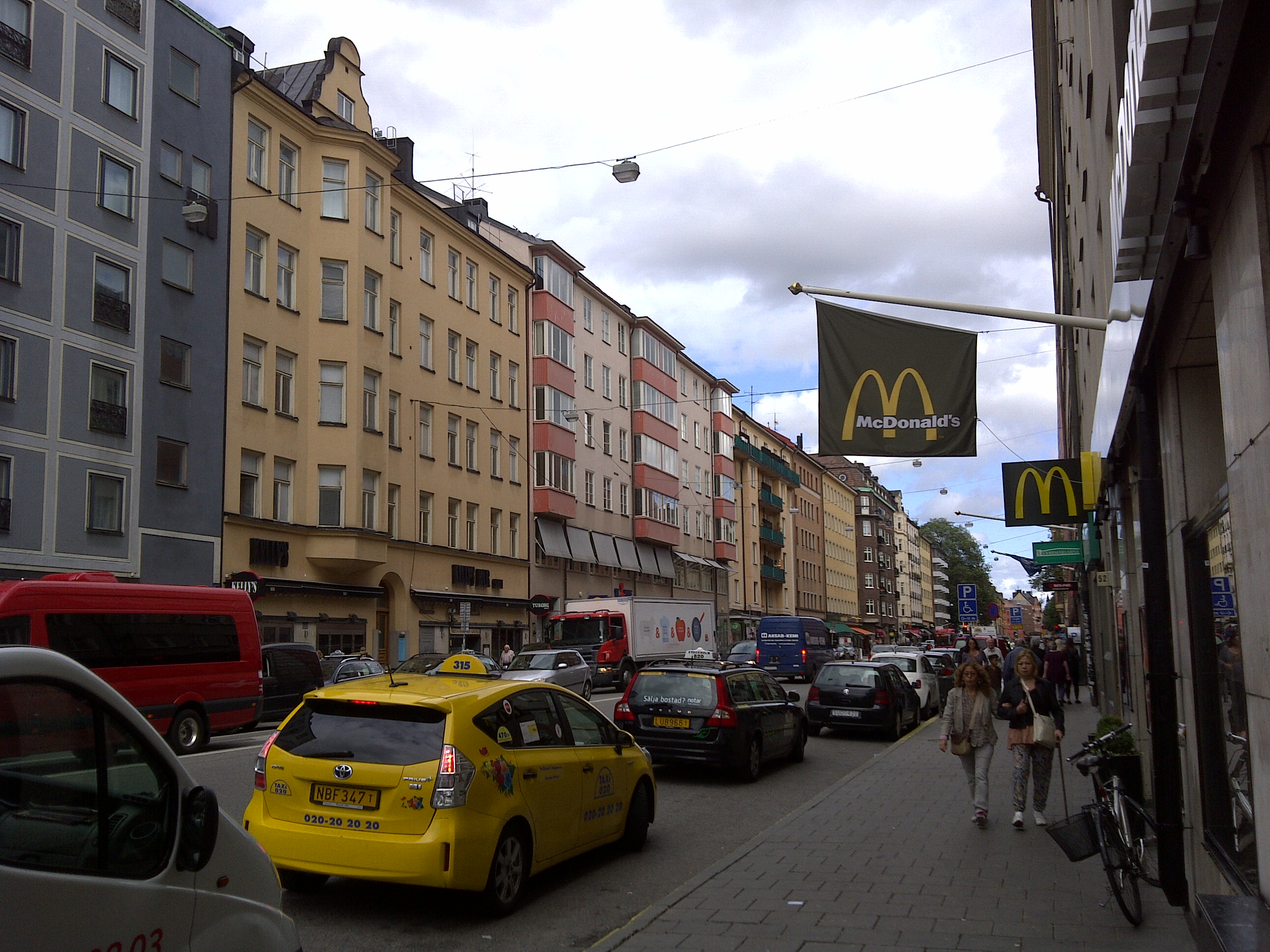
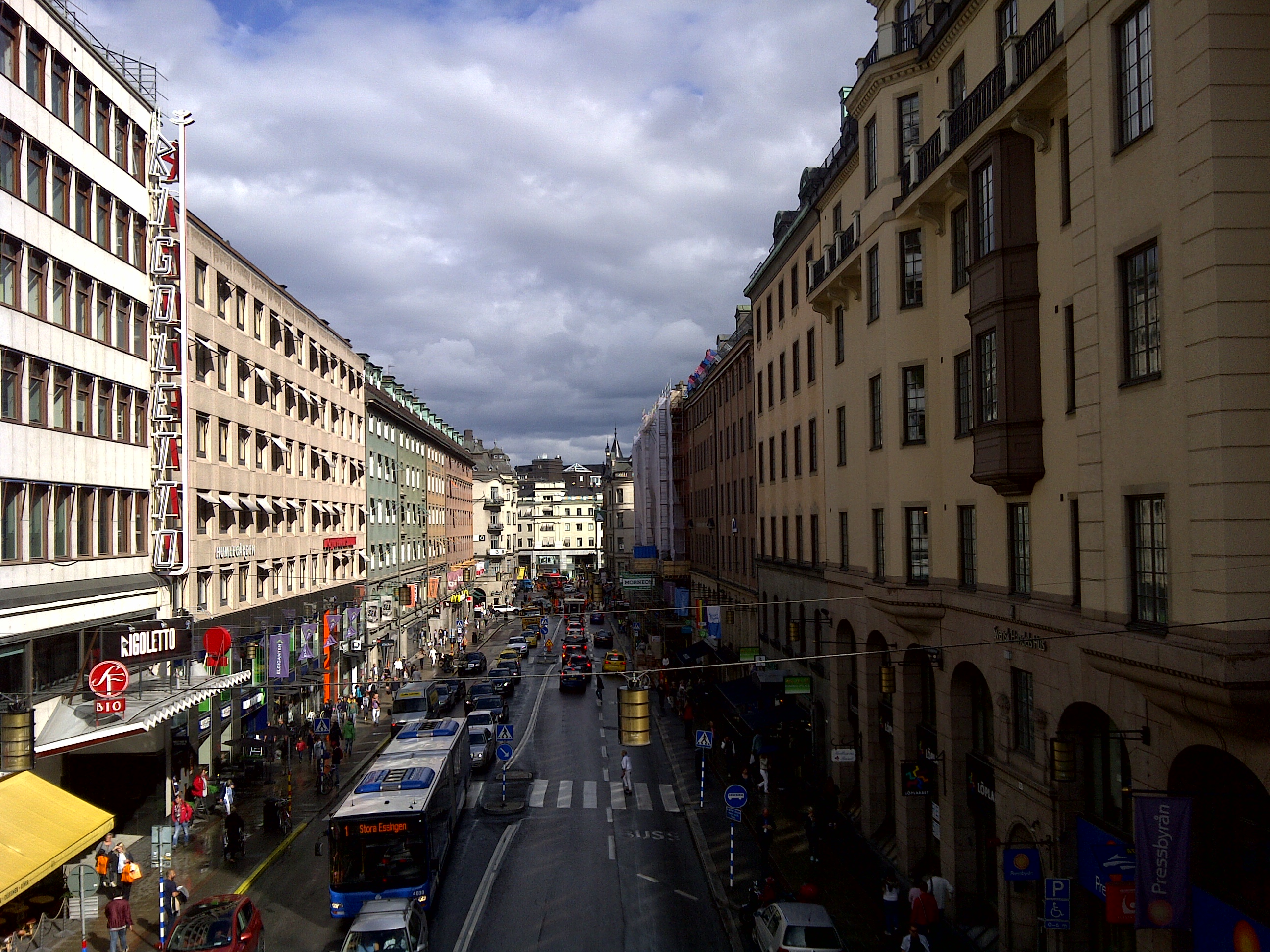