Category: Urban Transit
The Ultimate Authoritarian Anti-Urbanism
Cairo is a dense megacity, without the infrastructure such cities require for high living standards. The city proper, according to Wikipedia, has 10 million people, living at a density approaching 20,000 per km^2, and the metro area has 20 million. With a subway system fit for a city a tenth its size, Cairo is heavily motorized for its income level, congested, and polluted. Despite high construction costs, urgent investment in public transportation is required. Ignoring this need, the current military government has just announced plans to build a new capital outside the city, eventually to house 7 million people, with all the public monuments of a planned city, at a cost of $300 billion (exchange rate dollars, not PPP), about the same as Egypt’s annual GDP. The first phase alone will be $45 billion.
Cairo itself is already suffering from neglect and disinvestment. There are 2 million cars in the city. This is enough to cause so much traffic congestion it costs Egypt 4% of its GDP. Cairo’s air pollution is legendary: pollution levels are akin to smoking a pack of cigarettes per day. At least as of 1997, lead pollution caused by cars using leaded gasoline reduced Cairene children’s IQ by 4 points. The poor transportation options have led to a housing crunch, forcing half a million people to live in a historic necropolis as squatters.
The Cairo Metro would be a solution to these problems to a large extent, but is very small relative to Cairo’s size: it has 3 lines, totaling 78 route-km. Other cities of comparable size have many hundreds of route-km of urban rail, with a handful of exceptions infamous for their sprawl (such as Los Angeles) or pollution (such as Sao Paulo). Despite its small size, the Cairo Metro gets about 1.6 billion passengers per year, by far the highest number of passengers per route-km in the world, nearly twice as high as on the legendarily overcrowded Tokyo subway. Cairo has high construction costs, but in exchange rate dollars they only amount to about $130 million per km; a fully underground expansion of the subway to 400 km, somewhat more than the length of New York’s subway lines and less than that of Beijing and Shanghai’s, would cost about $40 billion, less than the cost of the new capital’s first phase alone. This is on top of all other possible infrastructure investments Egypt should consider: sanitation, sewage, water treatment, electrification, hospitals, schools, the Suez Canal. I bring up the Metro since so many of Cairo’s pressing problems would be substantially reduced if it had the capacity to transport a large share of the city’s population.
The problem is that the Egyptian government’s first priority is not to serve the needs of the Egyptian population. It is an authoritarian military government; it is not accountable to the broad public. I bring this up, because it’s a necessary check on things I have said in the past, attacking local American governance as authoritarian. Andrew Cuomo and Chris Christie have the power to overrule useful spending bills and cause traffic jams in cities run by political opponents. Abdel Fattah al-Sisi has the power to jail political opponents without trial, and execute them by the hundreds after show trials.
Autocrats love planned cities, for two reasons. First, planned cities are monuments to their greatness, lasting long into the future. The people the autocrats trample will be forgotten. Tourists visit the Taj Mahal, and not museums commemorating the churches and temples Shah Jahan destroyed. They visit the Great Wall of China, and not any commemoration of the million-odd people who died in its construction. They visit the Old City of Jerusalem, while nobody commemorates any of the locals Herod taxed to build its monuments – even Judaism only commemorates the destruction of the Temple and the beginning of the Diaspora, generations later. Autocrats know this. Even in antiquity, they knew monuments would make them more famous. And even in modern democratic regimes, politicians like signature initiatives that have their names on them; going back to Andrew Cuomo, his proposed Queens convention center is a typical example. But Cuomo still faces some democratic checks and balances. Sisi does not.
And second, planned cities can be built in ways that enhance social control. City Metric compares the new planned capital with Naypyidaw, Burma’s capital, built in the era of military rule to replace Yangon. Purpose-built capitals can be (and are) built around the needs of the national elite, keeping the poor out of sight. They have street and building design plans that make it easy to bring in the military to quell riots: wide streets, buildings that do not touch, no central square where protests could happen. They also disallow squatters, without going through the difficult and controversial move of evicting squatters from the preexisting city. One rhetorical question I have seen on Twitter is, where will this city’s Tahrir be? An article on Cairobserver doesn’t make this exact argument, but does note that this plan disinvests in what will still remain Egypt’s largest city, and could only come about as a result of Egypt’s complete lack of democracy.
One of the bigger influences on my views of democracy is Brad DeLong and Andrei Shleifer’s paper from 1993, Princes and Merchants. I do not fully agree with the point they make, but one of the key components of it, on the spending priorities of an absolute ruler, is crucial to understanding the benefits of democracy. Per DeLong and Shleifer, absolutism chokes economic growth, since the absolute ruler will overtax the economy to maximize revenue. One may ask if actually, hereditary rulers would want to stimulate more economic growth in order to bequeath a stronger kingdom to their heirs. DeLong and Shleifer answer that no: even with clear rules of inheritance, succession wars are so common that kings have to constantly be on the guard against rebellion to make sure their heirs get to inherit anything.
For Sisi, it is perfectly rational to spend so much money building a capital city that would make an uprising against him less likely. The money is not going to come from his pocket, but from the pockets of people he need not care about too much – the Egyptian people. The personal benefits to Sisi are invaluable: Sisi’s two predecessors, Mohamed Morsi and Hosni Mubarak, were both overthrown and immediately charged with crimes, for which they were guilty (under Sisi’s influence, Mubarak was exonerated from most). Why not remove himself and the apparatus of the Egyptian state from the city where they were overthrown?
When I talk of infrastructure democracy in democratic first-world countries, I complain about (much) smaller versions of this exercise. One could reason with a democratic Egyptian government that there are better uses of the money in Cairo itself. One cannot reason this way with a military government. The same is true of the soft authoritarianism found in governments with a democratic deficit, from the European Commission to local American governments. Their power is ultimately limited by other layers of government, which are more transparent, and they are incapable of killing off political opponents, but they still do not have to listen to the people they impact, leading to decisions that are at times obviously ridiculous. Egypt’s new capital is this autocracy, taken to its logical end. A dictator, of the kind who the infrastructurists might praise as someone who can cut through the red tape and gets things done, is spending the country’s annual GDP on a plan to disinvest in the capital and build a monument to himself and his regime from scratch.
What Happened to the RPA?
Last month, New York’s Regional Plan Association published a report, Overlooked Boroughs, proposing various transit improvements in New York outside the Manhattan core to complement the existing Manhattan-centric subway network. I’ve been thinking for a while what to say about the report. I don’t want to mock too much, since the RPA clearly tries to improve things. But the report falls short in every way, and plays into fads about buses. The one point of light is a brief mention of subways under Utica and Nostrand Avenues, but it is vague and doesn’t even make any of the maps the RPA is producing for additional rail and bus service. Even the RPA’s positive past contribution to the region’s transit proposals, Triboro RX, is replaced by the inferior Crossboro system. All this is on top of wooden analysis of preexisting transportation options.
The Analysis
The technical report talks about low transit usage for travel within the Outer Boroughs, which for the study’s purposes include Upper Manhattan. Figure 3 on page 7 breaks down mode choice as transit versus other modes. This works in Queens, but in Upper Manhattan and the South Bronx, car ownership rates are so low that local transit is competing with walking (and biking). In the Bronx in general, the mode share for borough-internal commutes is 40% transit and 36% car; in Brooklyn, the corresponding numbers are 42% and 32%. Eyeballing figure 3, Upper Manhattan’s transit share looks like 35%, but the car share is almost certainly much lower, given very low car ownership. This means there’s a huge volume of non-mechanized transportation in those regions.
The study does mention expanding bike infrastructure, on pp. 50-51, with an emphasis on bike share. However, its conclusion is directly at odds with the fact that non-mechanized transportation is quite popular in Upper Manhattan, the Bronx, and Brooklyn. It calls for incremental enlargement of the current system’s coverage, which consists of Manhattan south of 59th Street and the innermost parts of Brooklyn. It specifically warns against rapid expansion, “so as not to spread the program too thin,” and says the next areas for coverage should be the bridge landings in Brooklyn and Queens and the Upper East and West Sides. Inexplicably, low-income Bedford-Stuyvesant, which is adjacent to the current coverage area, is explicitly listed as a future phase and not a current priority.
A better proposal would call for rapid expansion of bike share and bike lanes; this costs money, but so does transit. Moreover, since the neighborhoods that would gain the most are low-income, the city should give some thought to how to make its bike share system easier to use for low-income residents. The current system requires a debit or credit card and puts a $101 security hold per pass. A city-subsidized system allowing qualified low-income residents to ride without a security hold is required; for example, the city could allow EBT cards to be used in lieu of a security hold, even if their holders then need to put in cash or a MetroCard to pay, in case the federal government disallows using the cards for biking and not just food stamps.
Then, a few pages after the analysis of intra-borough commutes, the report makes another mistake: on table 2, it lists mode shares for commutes between city boroughs and suburban counties, as well as likely transit options. Where commuter rail exists, it lists it as an option: thus, the Manhattan, Queens, or Brooklyn to Essex County rows list “subway to New Jersey Transit” as an option, despite the fact that New Jersey Transit is expensive and infrequent in the reverse-peak direction. Most likely, transit commuters from New York to Essex County work in or near Downtown Newark and take PATH, or at the airport and take a bus.
Now, the report does talk about commuter rail’s deficiency in attracting urban riders, both in the discussion surrounding tables 2 and 3 and in the proposal to improve commuter rail on pp. 49-50. But it says little about frequency for reverse commuting. Even when it does acknowledge the LIRR’s one-way peak service, it pulls its punches and only says it “recommends this project” (three-tracking the LIRR Main Line); proposing to instead do away with peak express service in order to permit reverse-peak service on the other track – as is practiced on the two-track segments of the Chuo Line – is beyond its scope. The punch-pulling is significant; as we will see over and over, the report repeatedly lets itself be defined by current practices and low-level current proposals.
Finally, the analysis of buses leaves something to be desired. The report talks at length about issues regarding span, frequency, and speed, on the list of nine characteristics that determine the attractiveness of transit. There’s no attempt to look systematically at what the busiest bus corridors in the city are. At some places, the corridors proposed match those of busy bus routes, for example the main crosstown routes in Brooklyn, the B35 and B6. At others, they neglect them entirely: as Alexander Rapp noted in comments recently, Grand Concourse, hosting the Bx1/2, is one of the busiest bus corridors in the city, even though it parallels the subway – it’s busier than Nostrand, which is now a Select Bus Service (SBS) route. The third busiest Bronx route, the Bx19, running on Southern to 145th in Manhattan, is also neglected.
We Just Call It “The Bus”
I think it’s Zoltána who said that what Americans call bus rapid transit, Londoners call “the bus.” As she noted in the past, three-door buses with all-door boarding are ubiquitous in Italy. German-speaking cities tend toward all-door boarding as well, as does Paris, but the buses usually have just two doors. All of this is years-old discussion, here and on related blogs such as Human Transit.
The significance of this is that it throws a wrench in any and all attempts to plan surface transit in New York around SBS, which is a bundle of features: enforced off-board fare payment, longer stop spacing, dedicated (but not physically separated) bus lanes. Vancouver engages in similar bundling with the B-Lines, but at least gets it right by not enforcing off-board fare payment: there are no machines printing tickets at any B-Line bus stop, but instead passengers can pay the driver at the front, or board from any door if they have a monthly pass or a transfer slip, which most do. But even Vancouver makes a mistake by requiring everyone to board from the front and pay the driver on all but a handful of bus lines. Vancouver, at least, establishes B-Line routes to mark where it considers building SkyTrain extensions in the future. In New York, it’s not about subway extensions; the planners really do think these features are special, and should be combined.
The RPA could have pushed for citywide off-board fare collection. Instead, it chose to smother any such push:
Set up off-vehicle fare payment using a proof of payment system. Passengers will not only board faster, but they will also be able to board using either front or back doors. However, the high cost of this option makes it impractical for system-wide implementation. Alternatively, the MTA should shift to touch or vicinity passes, the successor to the MetroCard, which is fast becoming obsolete.
First, the invocation of high cost in any plan that includes subway extensions, as this report does, is laughable. One-word replies to this point include any city where all buses already use proof of payment (POP), such as Paris, Berlin, Zurich, or Singapore. This is especially true now that the front end of smartcard technology is so cheap that there are top-up consumer items sold for $30. The cost of putting a card reader at every bus stop and at every bus door is, in 2015, trivial; what is not trivial is the cost of paying drivers to idle while bus riders are dipping their MetroCards at the front one by one.
If we accept citywide POP and bus stop consolidation – again looking at practices in Europe (and in Singapore), bus stops here are spaced every 400 meters and not 200-250 as in the US – then the rationale for SBS breaks down completely. All that’s left is corridors that require bus lanes, and those do not need to be continuous, as a bus can run partly on dedicated lanes and partly in mixed traffic.
Planning for the best corridors for specially upgraded surface transit requires thinking in terms of key bus corridors; the report does this because it assumes SBS is special, and the discussion with Alexander Rapp about Grand Concourse was about light rail. But if this is really just about bus lanes, then planning should be in terms of street segments. Bus lanes are required whenever there are busy buses on congested streets, and feasible when the streets are wide enough to permit car lanes and parking lanes in addition to the bus lanes. The importance of congestion means that a citywide bus lane map would be much more Manhattan-centric: potentially all Manhattan avenues and most two-way streets should have bus lanes since Manhattan traffic is so slow, even if there are key corridors elsewhere in the city with higher ridership.
At this point it’s useful to step back and think about relative advantages of surface transit (in this case buses) and rapid transit. Surface transit will always be slower, more expensive to operate, and far cheaper to deploy than rapid transit. This is why bus maps look like dense grids or meshes in every major city whereas subway maps only do in a small number of megacities.
The upshot is that there’s less need to force buses into a few key corridors. If New York were to build a subway or even light rail on a corridor, it would have to choose the routing in a way that would replace multiple parallel buses. For example, light rail on Tremont would replace both the Bx40/42 and the Bx36, which run on or parallel to Tremont in different parts of the Bronx. There’s no need to do that with bus-based transit: the Bx40/42 and the Bx36 can stay where they are. Route consolidation is only beneficial insofar as it boosts frequency, which means it’s required on minor routes but optional on major ones – this is why there’s a bus on every Manhattan avenue except Park, with no consolidation of the various one-way avenue pairs. The Bx40/42 runs every 10 minutes in the midday off-peak, and the Bx36 runs every 7-8 minutes, so there’s no need for a combined corridor.
Another key difference, ignored in the report, is that surface transit needs to run on straight, continuous streets whenever possible. Turns slow the bus down much more than they slow the subway (although they do increase the subway’s construction costs, since the subway would need to go under private property). This is partly because the bus is already slower, so the extra travel distance is more onerous, and partly because turning from one street to another requires red-light cycles that may not be easily eliminated via signal priority.
One upshot of this is that the report’s proposed bus map has some routes that are completely insane. Figure 14, on page 40, has two proposed new SBS routes in the Bronx: one paralleling the Bx36 and Bx40/42 in a circuitous manner, and going north-south in the East Bronx with several jogs and turns larger than 180 degrees. Nobody needs such circuitous routes.
Another upshot is the situation in Brooklyn. Brooklyn has five of the city’s top ten routes: the crosstown B35 and B6, and the radial B41 (Flatbush), B44 (Nostrand), and B46 (Utica). The latter three follow their streets nearly the entire way. The first two do not, as Brooklyn does not have continuously important crosstown arterial streets the way it has Flatbush, Nostrand, and Utica. Now, to be fair, the B6 is as fast as the three radials, all averaging 11 km/h on local buses and 12-13 on limited ones, but the B35 is much slower, 8 km/h local and 9 km/h limited; all average speeds are computed departing eastbound or northbound at noon. Between this and the B6’s somewhat zigzaggy route, the circumferentials are slowed more than the radials, which means rapid transit becomes more useful.
Enter Triboro RX, which appears in modified form (see below) in the report. Although it doesn’t closely parallel the B35 or B6, it provides a similar kind of service, and could poach significant ridership from both. This means that the introduction of rapid transit service there would make it less important to upgrade the B35 and B6 beyond the upgrades all other buses receive; conversely, such service would get much more ridership than we see today on buses, since it would offer such a large speed benefit. Of course the same is true of subway extension on Nostrand and Utica, but the rail bias over the existing 12-13 km/h options is a bit less than over a 9 km/h option; it’s only the easy tie-in to the 2, 3, 4, and 5 trains and the very high ridership of three closely parallel bus routes that make two subway lines pencil out.
Unfortunately, there’s no attempt at combined planning in the report. There’s no attempt to tie upgraded bus routes in Brooklyn and Queens to new transfer points created by Triboro. At the city’s other end, in the Bronx, Second Avenue Subway Phase 2 would make an East 125th Street terminus desirable for some Bronx buses; this is again not shown. Figure 14 on page 40 doesn’t show subway extensions, and figure 15 on page 44 doesn’t show SBS routes.
Finally, one notable inclusion is that of North Shore Branch SBS. Everything I could say about this I said three and a half years ago; it’s a terrible plan, and the fact that the RPA is going through with it instead of explaining why a second Staten Island Railway line would be better speaks volumes to how little the RPA is willing to come up with its own ideas instead of following whatever fads the city and MTA engage in.
Rail: Even When It’s Right, It’s Wrong
The report’s proposals for subway and commuter rail expansion have good kernels, but manage to make big mistakes on top of them, producing projects of limited transportation value. Here the RPA’s mistake is less overrelying on bad government planning (there is none as far as rail is concerned) and more overrelying on its own hype and that of similar organizations.
The plan for Second Avenue Subway is still in place. However, one key proposal regarding phasing worries me:
There is a strong argument to move quickly to build the north segment first as far as 116th Street, which would be relatively inexpensive since much of the tunnel is in place from earlier work, leaving the more expensive last piece to 125th Street for later. This report supports this argument.
Although in East Harlem, 116th Street is the key throughfare, a connection to 125th Street is crucial, for the transfer to Metro-North and the 4, 5, and 6 trains. It’s not even too much more expensive than a Phase 1.5 to 116th Street, since the 106th and 116th Street stations would still need to be dug, and the stations are the dominant part of Second Avenue Subway’s cost, three quarters of Phase 1 if I remember correctly.
Moreover, the report suggests various tie-ins, all on page 43: going west across 125th, going north into the Bronx, going south to Brooklyn via a new tunnel and taking over the Atlantic Branch of the LIRR. The first one would be golden, but isn’t even depicted on the associated map, figure 15 on page 44. As with the Nostrand and Utica subways discussed on the same page, the best ideas in the report are presented as afterthoughts and not depicted on any map. The Bronx extensions are harmless, but the routes shown on figure 15 are at times circuitous. The Atlantic Branch plan, fortunately not shown either, is the worst: the Atlantic Branch should be part of a modernized commuter rail plan. Despite the fact that the report does talk about commuter rail upgrades, it still considers cannibalizing a key route for a Second Avenue Subway extension.
The second key piece of rail infrastructure proposed, Triboro RX, is the RPA’s key contribution, dating back to 1996. Michael Frumin worked on this project and, together with Jeff Zupan, one of this report’s two authors, estimated its ridership at 76,000 commuters, each taking a roundtrip per weekday, for about 150,000 weekday boardings. Unfortunately, this report scraps many of the useful features of Triboro, replacing the line with Penn Design’s inferior Crossboro, which runs alongside the Northeast Corridor in the Bronx instead of completing the semicircle around Manhattan.
Moreover, for reasons I do not understand, the report widens the interstations on Triboro. The original plan called for a station every 800 meters, excluding the Hell Gate Bridge; including it, there would be about a station every kilometer. The current version of the route has a station every 1.8 km; even excluding the Bronx and Hell Gate portions, this is a station every 1.6 km. Broadway Junction, a key transfer point with connections to the A, C, and J, is deleted; trains run nonstop from New Utrecht to the Brooklyn Army Terminal; successive spokes in Brooklyn get no stations between them, even when the distance between the radial lines is such that most subway networks would put in a station in the middle.
Finally, commuter rail modernization falls flat. The RPA correctly calls for lower fares and higher off-peak frequencies – but then fails to follow through with demanding reductions in marginal operating costs. A discussion of high off-peak frequency and subway-competitive fares is a waste of time if each train is staffed with five conductors. A more reasonable number of conductors, zero, is required for this to financially pencil out.
But even if we ignore the costs, the plan does not look like a plan with modernized commuter rail. There are no infill stations proposed. High frequencies and mode-neutral fares would make Astoria a desirable commuter rail stop; but the stations mentioned on pp. 49-50 for Penn Station Access service are only the ones currently proposed in the Bronx, omitting Astoria. Similarly, despite wild plans, not depicted on maps, to construct a commuter rail branch on Utica, there’s no mention of simply adding a Utica stop to Atlantic Branch trains. Nobody is going to use Utica or Astoria for today’s fares or on today’s schedules, but frequent, cheap commuter rail service to these areas would be very popular.
All of the ideas proposed for rail are good, in principle. I’m glad that Second Avenue Subway is receiving priority, that Triboro is on this map, and that there’s talk of commuter rail modernization. But every when the RPA gets it right, it wrecks things with bad details about phasing, station placement, and lack of consideration of what commuter rail modernization would do to demand patterns.
Where are the Forward-Thinking Proposals?
The report simply cobbles together various proposals by organizations and politicians, without trying to turn them into a coherent whole: some bus upgrades here, some subway and commuter rail expansions there, no real attempt to even make the various modes work together. Even within each tranche, the report often rehashes current city plans, no matter how inappropriate.
Is the RPA thinking forward here? I don’t see any evidence of forward thought in the report. Where Paris is beginning construction on 200 kilometers of driverless rapid transit, mostly underground, the RPA is proposing 10 km of subway in future Second Avenue Subway phases and 40 km of rapid transit on existing right-of-way in Triboro RX. If New York could build subways at Paris’s prices, about $250 million per kilometer, Ile-de-France’s budget for Grand Paris Express, about $35 billion, would build the entirety of Second Avenue Subway eleven times over. There would be money for multiple radial and crosstown subway extensions and commuter rail tunnels (at Parisian costs, my commuter rail through-running tunnels would together be $20 billion or somewhat less); bus upgrades, done right, would show as a rounding error in streetscaping, and actually save money since higher speeds would reduce operating costs.
The Third Regional Plan did talk about things that other people were not proposing at the time. It had more Second Avenue Subway tie-ins, for one. Here all the RPA is doing is slapping its logo on a bad bus upgrade plan and reminding people that there’s a Second Avenue Subway project waiting to be finished. What happened to the RPA?
Ferries
Last week, Bill de Blasio proposed a citywide ferry system in his otherwise perfectly boilerplate State of the City speech. Ferries, as Ben Kabak notes, are a tried and failed solution in New York, with a $30 per passenger subsidy on the ferry to the Rockaways, one of the neighborhoods mentioned in de Blasio’s speech. At the same time, some ferry routes do attract large numbers of passengers, including the Staten Island Ferry and SeaBus; in addition, MBTA Boat attracts fewer passengers than SeaBus, but achieves better cost recovery than the MBTA’s land transportation services. The purpose of this post is to explain which urban geographies could be well-served by ferries, and why New York could not.
Until the invention of the railroad, the fastest, cheapest, and most reliable form of transportation was the boat. Inland transportation of goods was by canal whenever possible. Overland transportation was so expensive that, as noted by Andrew Odlyzko, the cost of coal would double twelve miles away from the mine (see p. 14). As a result, cities were founded on shorelines and in river estuaries, and shrank if their rivers silted.
Railroads inverted this equation. Even in the 1830s, trains achieved higher speeds than ferries do today: the London and Birmingham averaged 31 km/h at opening, whereas SeaBus, which uses fast catamarans, averages at most 20 km/h. They could climb grades without resorting to locks and derailed much less often than boats sank; and, with the world still in the tail end of the Little Ice Age, the railroads did not freeze in winter. In this situation, a seaside location is no longer an advantage. At coastal locations, railroads have to cross more rivers, as did roads before; the current route of the Northeast Corridor in Connecticut was not the first but the third rail connection to be built between New York and Boston, after the Long Island Railroad (with ferry connections at both ends) and the inland Hartford and New Haven Railroad route.
The 19th century was a period of fast population growth in the industrialized world, especially the US, and fast urbanization. The industrial cities were then sited based on the optimal locations of a railroad network and not that of a shipping network. Birmingham and Manchester were already the largest cities in the UK outside of London, but the first railroad was, not coincidentally, built precisely to give Manchester port access without relying on the Manchester Ship Canal. In the US, we can see this in action, especially in New England: Boston has always been New England’s largest city, but many other early-settled cities – Salem, Newport, Plymouth, Provincetown, Portsmouth – declined, and now New England’s second cities include not just coastal New Haven and Providence but also inland Hartford, Worcester, and Nashua-Manchester.
In some areas of Long Island and New England, we can see towns with dual centers: an older coastal center, and a newer inland center, near the train station or a highway interchange. As Long Island had extensive suburban growth in the postwar era, the inland centers there are usually the larger ones, whereas in Massachusetts and Rhode Island, the coastal centers are usually larger.
Boston’s ferries serve these coastal centers. The Greenbush Line is locally infamous for its low ridership, about 3,000 per weekday in each direction. And yet, the ferries serving Hingham are fairly well-patronized: about 3,500 weekday passengers in both directions. (Both figures are from the 2014 Blue Book.) Now, the trains still carry nearly twice as many passengers as the ferries, but, relatively speaking, the ferries are doing quite well, since that part of the South Shore was settled before the railroad came, so the ferry serves passengers better than the trains do.
The other issue is which mode of transportation offers the most direct route. On the South Shore, the ferries go in a straighter line than the trains, which have to detour to remain on land. The Staten Island Ferry goes in a straight line, whereas roads and trains take big detours, especially for passengers leaving from St. George and not from near the bridges to Brooklyn and New Jersey. SeaBus, likewise, takes a direct route.
The significant fact for the Staten Island Ferry and SeaBus is that there economic centers of Staten Island and North Vancouver are right next to the ferry docks, coming from the fact that those areas were settled as suburban regions connected to the center by ferry. Because constructing a road or rail link across the New York Harbor or Burrard Inlet is difficult, those ferries were never replaced by fixed links; this is in contrast with Jersey City, which was also connected to New York by multiple ferry lines, but had enough demand a hundred years ago to fill the Hudson Tubes and later the Holland Tunnel with commuters.
None of these histories and geographies applies to the routes proposed by de Blasio and other ferry supporters. A Rockaway ferry has to detour around all of Brooklyn to reach Manhattan. The various waterfront ferries between Manhattan and Queens don’t really serve neighborhood centers, which are located around subway stations. Subway stations, like railroads, dislike coastal locations, not because of construction difficulties but because half their walk sheds would be underwater. Even Red Hook, which is cut off from the rest of the city by the Brooklyn-Queens Expressway and has no subway service, is not centered around the waterfront: the projects are several blocks inland, and Ikea Dock is facing the wrong way, south instead of west.
New York’s commercial centers, likewise, are inland. Why would a Midtown office developer waste any time building a skyscraper on the East River when the easternmost subway stations in Midtown are at Lexington Avenue? Thus the high-rise towers that line First Avenue are more residential than commercial, making them poor candidates for ferry connections. Lower Manhattan is better-connected to the water, but it is served by a large number of subway lines in all directions, none of which is at capacity since Midtown is the bigger office cluster. It’s also far from the waterfront condo clusters de Blasio wants to serve with ferries.
Even service between Staten Island and Manhattan shouldn’t be a ferry. A rail tunnel would offer a large improvement in trip times: about 8 minutes or even less, compared with 25 by ferry, and one to two transfers less than today. The question is entirely whether the costs could be contained enough to be in line with a realistic demand projection. Of course this is best realized as part of a regionwide commuter rail modernization plan, but even without such a plan, a connection to the 1 train would substantially reduce Staten Island’s commute time, which, at least last decade, was the longest of all US counties.
And this is an origin-destination pair that, given current infrastructure, is actually well-served by ferry, unlike the routes that de Blasio proposed. Ben tried to propose a better way of running ferries in New York, but with no real anchors to connect to, Ben’s proposal is a polite way of what I would phrase as “just don’t.”
Unlike Cuomo, de Blasio is not inherently hostile to public transit. However, he does not particularly care about transit, either. In this view, what he says about ferries is of limited consequence; the amounts of money in question are trivial. He’s not like Bloomberg, who directed $2 billion of city money to the 7 extension ahead of more deserving subway investments. Perhaps it’s wiser to focus on his plan to deck over Sunnyside Yards, or, more specifically, his invocation of massive projects including Stuyvesant Town, Coop City, and Starrett City – precisely the models that a Sunnyside decking should avoid.
However, there’s a good reason to focus on this, unimportant as it is. Cuomo’s failings are characteristic of an autocrat who is hostile to transit. De Blasio’s are characteristic of an autocrat who is indifferent. Although there is a long-term transit plan in New York, centered around completing Second Avenue Subway, this is not what de Blasio talked about, at all. Instead, he went for projects that can be done during his first term: off-board fare collection on a few more bus routes (“Select Bus Service,” complete with the pretense that they are bus rapid transit), and ferries. He won’t just follow an agenda set by others a long time ago: he has to remind people he exists on this issue as on his signature issues, but, as he doesn’t actually care about it, he will propose distractions that would at best do little (Select Bus Service) and at worst would be complete wastes of money (the ferries).
In a democracy, good transit advocates can push themselves into key positions at the ministry of transport, or its equivalent, such as a parliamentary committee on transportation (including the Congressional one, even). The same is true for people who care about other aspects of government spending and policy: housing, health care, education, defense, social welfare, policing. In an autocracy, such as the strong mayor system, it boils down to asking the autocrat to care and to take the right position. But the autocrat is just one person, and cannot pay equal attention to everything. Hence, ferries and Select Bus Service, in lieu of real transit investment.
The Wrong Kind of Branching
Transit lines branch. Core routes have more demand than outlying ones, so naturally trains and buses run on trunk lines in the core and then branch farther out, to match frequency to demand. I gave an overview of this years ago. This is both normal across nearly all significant transit systems, and good practice. In this post, I’d like to focus on the opposite kind of branching, which I am going to call reverse branching, when one outlying line splits into two core routes. This is much less common, but exists in multiple cities, and leads to problems including restrictions on capacity and disappointing ridership. Cities should avoid building new lines that reverse branch, and in one famous existing case, London’s Northern line, the city is working on changing the situation by building a new outlying branch.
London’s Northern line, as can be seen on the Underground map, has three branches to the north and two in the center, but just one to the south. The highest ridership demand is in the center, but because both branches feed into just one southern branch, there is less than full capacity on the central branches, about 20 trains per hour each, compared with 30 tph on the southern branch and 33 tph on the Victoria and Jubilee lines. As a result, Transport for London has made recurrent plans to split the line for good: one central branch (through the City of London) using the existing southern branch and two of the northern ones, and one (through Charing Cross) using one northern branch and terminating at Kennington, the junction with the southern branch. An under-construction extension of the line from Kennington to Battersea can then be tied to the Charing Cross branch. There is some NIMBY opposition from a member of Parliament representing a constituency on one of the northern branches, who would like her constituents to have one-seat rides to both branches, but most likely, Transport for London’s need for capacity will make the split inevitable once the Battersea extension opens, ending the reverse branching practice.
In New York, routes branch and recombine, and thus it is common to have trains of different colors (which only denote Manhattan trunks) running together on a branch in Brooklyn, Queens, or the Bronx. The single busiest entry point into the Manhattan core is via 53rd Street Tunnel (connecting to Queens Boulevard), technically a branch since it runs trains connecting to both the Eighth and Sixth Avenue Lines. This, again, causes capacity problems. It’s not so bad on the numbered lines, where four trunk tracks (the Manhattan express trunks, carrying the 2/3 and 4/5) recombine in a different way to four tracks in Brooklyn (pairing the 2/5), but the lettered lines’ reverse branching in Uptown Manhattan and Queens initially forced eight trunk tracks (the Sixth and Eighth Avenue services, the B/D/F and A/C/E) to converge to six branch tracks (the two Queens Boulevard express tracks via 53rd, and the four Central Park West tracks). New subway connections have replaced this situation with twelve trunk tracks (including the Broadway Line’s N/Q/R) splitting to ten, spreading the problem around but not dealing with the fundamental restriction on capacity. The under-construction Second Avenue Subway will connect to the Broadway Line and run Q trains, raising the number of lettered tracks Uptown and in Queens to twelve, but this will not be enough to disentangle the tracks and provide full capacity on each core track; see below for proposed examples.
In Delhi, the Green Line splits into short branches, to provide transfers to two different Metro trunk lines. As seen on the system map, the Green Line does not enter central Delhi, and the current setup allows passengers to travel to central Delhi via two different routes. However, the Phase 4 extension plan extends the one branch to go out of the city in a V-shaped direction (the light green Kirti Nagar-Dwarka Section 28 line on this map), and has an extension that may connect to the other branch (Inderlok-Indraprastha, colored ocher on the map) to connect it to central Delhi, which may cause a serious mismatch in demand on the outlying common segment.
Finally, in Tokyo, subway lines reverse branch in two locations. The Namboku and Mita Lines share their southernmost three stations and the tracks in between. Although most Tokyo subway lines, including Namboku and Mita, run through to commuter lines, which provide the normal kind of branching, the Mita and Namboku Lines only do so either to the north or via the shared segment, as seen on this map, constraining capacity. They run only 12 peak tph each, and have low ridership by Tokyo subway standards. The Fukutoshin and Yurakucho Lines are in a similar situation, but the Fukutoshin Line does run through to a commuter line, the Tobu Tojo Line, without going through the shared segment (it is not depicted on the map, which is a few years out of date). The Fukutoshin Line has low ridership (see last page here), but the Yurakucho Line does not.
In all examples I’ve listed so far, the two core branches serve very central areas (as in London, New York, and Tokyo), or neither of them does (as in Delhi). Tokyo is somewhat of an exception, since the Yurakucho and Mita Lines serve Central Tokyo and the Fukutoshin and Namboku Lines serve secondary centers, but those secondary centers are very dense themselves; the Mita and Namboku Lines in particular are quite close in ridership. I am more wary of proposals to split an outlying line in the core that have one branch serving the CBD and one branch avoiding it, as in Delhi, assuming I understand the proposal correctly.
Also of note, all the examples I’ve listed involve subways. This is because conventional branching, with a core trunk splitting into multiple outlying branches, is more limited on urban rail than on both buses and regional rail. Most subway lines do not have more than two branches feeding into a trunk. In New York, not counting the split in the A, which is inherited from the LIRR, there is exactly one place where three subway routes share tracks: the N, Q, and R from Manhattan to Queens. In Stockholm, with its highly branched subway network, only one line, in one direction, splits into three. This is because even a split into three branches requires limiting off-peak frequency on the branches to less than a train every ten minutes, which is undesirable in large subway systems. The result is that reverse branching can easily create a situation in which there are more tracks in the core than in the outlying areas, as it does in all four cities surveyed above, restricting capacity on each core track.
In contrast, regional rail tends to operate at lower frequency on the branches, and this permits conventional branching with more than two branches per trunk. In addition, there are often turnback facilities at through-stations, and substantial four-track segments on otherwise two-track lines. The result is that reverse branching is possible without any constraint on core track capacity. The Berlin S-Bahn is highly branched in both the conventional and reverse senses. The RER E is being extended to the west, including a takeover of an RER A branch. And the Tokyo commuter rail network has extensive reverse branching, coming from through-service between commuter lines and subway lines but also from the Shonan-Shinjuku Line’s split from the Tokaido and Tohoku commuter lines. In none of these cases is there a significant restriction on core capacity, simply because there’s enough slack in the branches that they can’t fill to track capacity unless the core has filled as well.
In the US, I am familiar with three proposals for new subway lines that involve reverse splits, in Boston, Washington, and New York.
In Boston, the proposal actually involves commuter rail rather than the subway: the Worcester Line would use the Grand Junction Railroad to go through Cambridge to reach North Station, bypassing South Station. See map on page 38 of the statewide transportation capital budget proposal. This would not reduce capacity, since the Worcester Line is nowhere near exhausting the capacity of a two-track railroad, and moreover, the Grand Junction line would terminate at West Station within Boston proper, where there’s a railyard. However, this is still bad transit, for other reasons. West Station serves a residential neighborhood, without enough density to justify a fork toward both North Station and South Station. On top of that, since North Station lies outside the Boston CBD, the proposal is essentially a mixture of a radial and a circumferential line, with all the problems that would bring – and despite running as a circumferential line through Cambridge, there is no transfer planned with the Red Line, although the Grand Junction passes close to the Kendall/MIT station.
It would be better to bag all plans to use the Grand Junction until such time that the state builds the North-South Rail Link, connecting North Station with South Station. Then, the Grand Junction would make an almost perfect alignment for a circular line, with its eastern leg connecting North and South Stations and its western end going through Cambridge, making several stops, including a transfer to Kendall/MIT. This would require high investment – besides being a single-track at-grade line, the Grand Junction would require a new junction to connect to the Worcester Line to go east toward South Station, whereas today it only connects to the west, toward Allston and Brighton – but still a fraction of the cost of the North-South Rail Link, which is getting some serious political support, including from former governors Michael Dukakis and William Weld.
In Washington, there already is some reverse branching: the Yellow and Blue Lines share tracks in Virginia, but run on two different trunk lines in Washington proper, each shared with other lines, so four central tracks become four tracks in Virginia. But now with the opening of the Silver Line, raising the number of Virginia tracks to six, WMATA would like to separate the Blue Line from the Orange Line, which it shares tracks with in Washington, in order to provide six tracks across the District as well. This can only lead to awkward service patterns and wasted core capacity, as Matt Johnson demonstrates on Greater Greater Washington: because the Orange and Silver Line will keep interlining under any plan, reckoned from their split east there are only four tracks in Virginia and not six. Moreover, the Yellow Line interlines with the Green Line in the District, which means that even if it’s separated from the Blue Line, it could not run at full capacity.
Washington built itself into a corner with its Metro route decisions. There’s no corridor in the city that really needs a subway line; unlike New York, Los Angeles, and San Francisco, Washington has no corridor with so much bus ridership that it should be a subway line. A fourth subway line would be useful for service to Georgetown, but that’s about it. So decisions about a fourth line in the District should be based on the capacity needs of the branches, not those of the core. On a list of possible changes that WMATA looked at, Greater Greater Washington included a separated Silver Line, including separation up to the junction with the Orange Line so that they share no tracks. I’ll add that if WMATA wants to go down that route, then it should give the Orange Line its own route through the District and keep the Silver and Blue Lines together; this is because the Orange Line is the busiest of the three, so that it should be the least branched, in this case not branched at all whereas the other two do branch.
Finally, New York. Second Avenue Subway is going to change the nature of the reverse branching used by the lettered lines, for the better. Because the plan for Phases 1 and 2 is to run only the Q train, the city will finally have matching numbers of lettered tracks in and north and east of the Manhattan core: twelve tracks in the core, and twelve in Uptown Manhattan and Queens. Unfortunately, it is impossible to match service, because that would sever too many connections. Second Avenue Subway only connects to the Broadway express line, so to match service there couldn’t be any other service using the Broadway express.
Recall the London NIMBYism mentioned at the beginning of this post: that was about a service change that would give commuters a cross-platform (see comment with diagram) transfer between their branch of the Northern Line and the central segment of the other branch. In New York, the transfers in western Queens involve a lot of walking between platforms, if they even exist. Then all the Broadway locals (the N/R) would go to Queens through 60th Street Tunnel, and thence to the Astoria Line, severing the connection to the Queens Boulevard Line. The Queens Boulevard Line has two ways into Manhattan: 53rd Street, which connects to both Eighth and Sixth Avenues, and 63rd Street, which connects only to Sixth Avenue. Moreover, either all F trains (through 63rd) have to run express in Queens and all E trains local, or the reverse; mixing and matching would produce at-grade conflict at the junction, as seen on the Queens 1 track map on nycsubway.org. The transfer between the E and F would be located at 74th Street in Queens, several kilometers east of the split, which is located just to the east of the westernmost express/local station, Queens Plaza. Neither the E nor the F would have a transfer to the N/R near their respective intersection points. The Q would not have a transfer to the E (it would have one to the F, though). This puts many commuters in an impossible situation and the capacity gains from it are frankly not enough to be worth it.
Instead, the capacity gains would be limited to running some more express trains on the Broadway Line. Before the service cuts in 2010, the N ran express on the Broadway Line, the Q terminated at 57th Street at the north end of Midtown, and a fourth Broadway route, the W, ran local and served the Astoria Line. Once the Q is extended up Second Avenue, the restored W could beef up Broadway Line service. Second Avenue would only get a branch despite its high ridership, but it’s still only a segment of a line.
Then there are Phases 3 and 4 of Second Avenue Subway, serving Midtown and the Lower East Side, where the Q runs on Broadway. The official plan introduces another reverse branching: a new route, the T, is planned to run the entire length of Second Avenue: see map here. When both phases are complete, there will be fourteen lettered tracks in Midtown but only twelve Uptown and in Queens.
To resolve this, the MTA should activate a connection that is included in the Second Avenue Subway plan as a non-revenue connection: a connection from Second Avenue south of the Q/T split at 63rd Street to 63rd Street Tunnel; currently, 63rd Street is the least used connection from Manhattan to Queens, since the reverse branching limits capacity and 63rd Street is the least useful connection since it enters Manhattan north of Midtown. This implies there should be a Queens Boulevard-Second Avenue service, which I will call the U, one letter next to the T. The Queens Boulevard express tracks are filled to capacity and the local ones are not, so the T should run local, cutting the frequencies on the existing local R and M trains a bit to make room. It would still leave New York with twelve Uptown and Queens tracks diverging to fourteen Midtown tracks, but it would distribute the load better, in the same way the present system distributes the load better than the 1930s-era reverse branching from six to eight tracks did.
New York is in a somewhat special case, in that its subway system is based on heavy branching and reverse branching, and moreover it’s historically based on three different systems, with poor transfers between them. Fully untangling the lines after Second Avenue Subway’s Phases 1 and 2 are built is not possible because there are no transfers between the lines that would result, and the station placement is such that any new transfers would involve long walks between platforms.
Other cities, especially cities planning new systems from scratch, should not emulate this feature, and should instead design all lines to either not branch at all or only branch conventionally. A system designed from the ground up could have cross-platform transfers between lines, and even make sure they’re timed, reducing the cost to passengers of having to transfer in lieu of using a reverse branch. It could be coherent, in the sense of making it easy for an unfamiliar passenger to understand how to get from each station to each other station. And it could be built for maximum capacity in the most crowded segments, where it matters the most.
Authoritarian Leaders and Agenda Setting
On Tuesday, Andrew Cuomo proposed a new signature initiative: a $450 million AirTrain to LaGuardia, connecting to the Mets’ stadium on both the 7 train and the LIRR. The proposal has practically no merit even as an airport connector: Ben Kabak and Yonah Freemark both note, with helpful graphics, that the connection is so circuitous it’d be slower than the existing bus-subway options to nearly every destination, including everywhere in Manhattan. Capital New York notes that in general, transit activist reactions to the plan were cold, precisely because it’s such bad transit.
The interesting aspect of this is about the counter-criticism, and the discussion it led to. (In contrast, Cuomo’s general hostility to transit and intercity rail is not news, and it’s unlikely someone with such a history could come up with cost-effective transit plans.) The main reaction to the criticism is not “where would you spend $450 million instead?”. That question has a few answers, all of which are boring: the general MTA capital plan, or, if the money is to go to expansion, Second Avenue Subway Phase 2, the next item on the city’s transit agenda now that Phase 1 is nearing completion.
Instead, the main reaction is “how would you connect to LaGuardia instead?”. That question, too, has a definite answer, which Ben talked about in his post, and which I pointed out in my post about airport connectors last year: an extension of the N to the east, with several stops (for example, at Steinway and Hazen) to serve more of Astoria and not just airport riders. The N takes a direct route to Manhattan, passing through or next to the top areas for LaGuardia passengers, as seen in the second map here. But even that is the wrong question. There are probably more cost-effective subway extensions in New York, having nothing to do with LaGuardia; I have to say probably, since at no point has the MTA proposed large enough a slate of possible extensions that we can compare projected costs per rider and say “this is the best.” There might even be better ways to extend the N eastward than to LaGuardia: an elevated line over Ditmars, a short segment of the Grand Central Parkway, and Astoria Boulevard would serve East Elmhurst, a dense, transit-deprived section of Queens, and would probably produce higher ridership than a swerve from the GCP to the airport.
Such is the power of a governor who’s accountable to nobody: he proposes a scheme, and even the criticism is on the governor’s own terms of providing service to LaGuardia. Yonah compares travel times to various destinations on various alignments for connecting LaGuardia to the subway. Nate Silver’s response has an infographic with travel times from the airport to city hall in various American cities – an infographic that is of little use to New York, where the main destination is far north of city hall, but is well within the general topic of LaGuardia’s airport connections. Even I, cognizant of this agenda-setting power, have to at least mention an alternative LaGuardia connector, knowing readers will want a plan.
The cheeky response to this is that in a democracy, this wouldn’t happen. Now, the US is a democracy. Cuomo has to stand for election every four years. The worst infrastructure disasters tend to be in countries that are authoritarian through and through: Russia’s elevated winter Olympics costs in Sochi and Qatar’s human rights abuses in the World Cup preparations are the two biggest recent examples. But democracies with insufficient checks on political power are susceptible to this as well. This is common in the third world, where corruption is more common – hence the abuses of the World Cup last summer, in a solidly democratic country – but can also happen in developed countries with democratic deficits.
Usually, the phrase democratic deficit refers to the EU, and by analogy other supranational organizations. But in the US, it’s a useful framework for thinking of local and state governments. Rick Scott, Scott Walker, and John Kasich needed nobody’s approval to reject federal funding for intercity rail. Chris Christie did not need anyone’s approval to cancel ARC, or to cause traffic jams in retribution against a mayor who refused to endorse him; in a recent article in New York YIMBY, defending the cancellation of ARC as originally proposed, I made sure to take multiple barbs at Christie, just to avoid playing into the agenda of canceling ARC to posture about government waste while diverting rail money to the New Jersey Turnpike.
Cuomo’s power is if anything even greater: the New York state government works by a three men in a room model, in which the governor, the speaker of the State Assembly (just indicted for corruption), and the majority leader in the State Senate (currently relatively powerless and dependent on Cuomo) wield all practical power. In such a system, Cuomo does not have the power to shoot protesters, thankfully, but does have the power to propose megaprojects that glorify him, without a broad discussion with stakeholders, in which the MTA’s long-term expansion plans and cost-benefit ratios would come into play.
Last year, in writing about elite infrastructure projects that are not about meeting a service need, I noted that talking about such projects in terms of cost-effectiveness is moot, because they were never intended to be about benefiting the wider public. We could discuss where to spend money on transit in New York in the way that would benefit the largest number of riders. We could even discuss what the optimal way of connecting to LaGuardia is, before comparing the best connection with non-airport projects to see where it should lie on the list of future expansions. But it would be pointless, because Cuomo is not interested in spending money on benefiting the largest number of riders; he frankly does not care about transit riders. When the time came to support transit riders, for example in signing a lockbox bill guaranteeing that money the state government had promised the MTA would indeed go to the MTA, he vetoed the bill instead.
In such a climate, as soon as we talk about tweaks to Cuomo’s plan, Cuomo’s already won; whatever happens, he will reap the credit, and use it to buy political capital to keep building unnecessary megaprojects. Even trying to make the best of a bad situation by making the airport connector better is of little use, since Cuomo will support the plan that maximizes his political capital and not the one that maximizes transit usage even within such constraints as “must serve LaGuardia.”
This is evident in his response to criticism among transit activists. After listing the many pundits and activists who oppose the plan, Capital New York included a response from the governor’s office, which said, in so many words, “our plan is better because it doesn’t go through populated neighborhoods, where there would be NIMBYs.” What those of us who want good transit view as a feature – connecting to underserved neighborhoods and not just to the airport – Cuomo regards as a bug. A plan that included additional stops in Astoria might well attract community support, while still offering much faster trip times to Manhattan because of the direct route, but would rely on non-airport ridership, which Cuomo doesn’t care about, to keep the cost per rider reasonable.
Because of this disconnect between what would work for transit users and what would work for Cuomo, the only reasonable answer to the plan is a simple no, which should be said as sharply as possible. No working with the proposal: it’s terrible, a true stone soup. No tweaks: Cuomo wouldn’t want any ingredients that would improve the soup, and would insist on keeping the stone in anyway. (He doesn’t have to eat it, he doesn’t use transit either way.) And, within the parameters of a transit conversation in which people are desperate to see expansions, no discussion that validates Cuomo’s original plan.
Update 7/28: in a joint announcement with Joe Biden, Cuomo has just announced $4 billion in airport improvements at LaGuardia, bundling the rail connector into the larger projects. I have nothing to add that I didn’t already cover in this post and in my older post about elite infrastructure investments.
Mixing Circumferential and Radial Transit
Nearly all rapid transit lines belong to one of two categories: radial lines (a large majority), which connect city center with outlying neighborhoods or suburbs; and circumferential lines (a minority), which go around city center and often serve secondary centers and usually intersect all or nearly all radial lines perpendicularly, such as Paris’s Lines 2 and 6, Moscow’s Circle Line, Seoul’s Line 2, New York’s G train, and Shanghai’s Line 4. In this post, I’m going to discuss an uncommon third category, that of lines that combine circumferential and radial functions: they go toward city center, like a radial line, but then change direction and become circumferential. The G train in New York was like this until 2001, and Line 3 in Shanghai is like this today. This is apropos a proposal by a team Penn Design graduate students to build a variant of Triboro RX in New York that combines Triboro’s circumferential orientation with a radial commuter line. I believe such mixed lines are a recipe for low ridership and strained transfer points, and the Penn Design proposal is inferior to the original Triboro proposal.
First, some details about the mixed lines in question. The example most accessible to most readers is the historical G train in New York. When it first opened in the 1930s as part of the IND, it was designed to both connect Brooklyn and Queens without going through Manhattan and provide local service along radial lines, running alongside express trains that would serve Manhattan. Thus the northern half of the G ran under Queens Boulevard as a local, while the E and F trains provided express service and went to Manhattan. From the start, this arrangement was unstable. Demand for service to Manhattan was much greater than to Brooklyn, so people riding the G inbound changed to the E or F at the first express station after the one they boarded. With overcrowded express trains and undercrowded local ones, the Transit Authority was compelled to build a track connection in 1955 to add a Manhattan-bound local service, and to build a second track connection in 2001 to add another Manhattan-bound local train and remove the G from Queens Boulevard entirely.
In Shanghai, Line 3 was built as an (almost) entirely above-ground line, interlined for part of the way with the circular Line 4. The northern half of Line 3 is radial, running parallel to the overcrowded Line 1. However, where Line 1 enters the traditional center and serves People’s Square, Line 3 swerves west to go around it (missing Lujiazui, the new high-rise CBD to the east of People’s Square), interlining with Line 4, and leaving the loop southward to intersect Line 1 again at Shanghai South Railway Station. Its ridership disappoints not only by the standards of Line 1, but also by those of Line 4: 642,000 on 2014/4/30, the system’s busiest day, compared with 1,384,000 on Line 1 and 907,000 on Line 4. Line 6, which likewise combines a radial function at its northern end with a circumferential one at its center, serving Century Avenue but not Lujiazui or People’s Square, has even lower ridership, 376,000, although this is several times the original projection.
There’s a discussion on Human Transit, in which consensus is that the best circumferential lines connect secondary activity nodes that generate trips in their own right. Now, the G train connects Downtown Brooklyn (the largest business district in New York outside Manhattan) with Long Island City (one of the business districts of Queens), but it lacks the other positive feature of circumferential lines: transfers to the radial lines, to allow one-transfer trips from anywhere to those secondary nodes. The G has good transfers only to other IND lines, and at the Queens end, its transfer to the Queens Boulevard trains was cut in 2001 since, for operational reasons, it was cut not to its old junction with the E and F (Queens Plaza) but one station short (Court Square). Other G transfers are very recent and require a considerable amount of walking.
In contrast to the underperforming G, circumferential lines that both connect important activity nodes and have plenty of radial transfers are backbones of their cities’ transit systems. Shanghai’s Line 4 is fairly busy as noted above. Seoul’s Line 2 is according to a forum post the busiest in the system. Paris’s Lines 2 and 6 are only about average in ridership but combined would be the second busiest after Line 1 (and per route-km are third and fourth, only behind Lines 1 and 4, but are only narrowly ahead of many other lines). The juxtaposition of Shanghai’s Lines 3 and 4 in particular suggests that subway lines shouldn’t try to mix radial and circumferential functions.
Let us go back to the impetus for the post, Triboro RX. The proposal is to largely use existing freight rail lines, all of which are lightly used and could be turned over to the subway, to provide a semicircular line connecting nodes of activity in the Bronx, Queens, and Brooklyn. Because of the focus on using an existing right-of-way to reduce costs, the line misses the most important nodes in Brooklyn and Queens, which are served by the G in any case. However, it passes within half a kilometer of the Hub in the Bronx and, via a short greenfield tunnel, connects to Yankee Stadium, the Bronx’s busiest subway station; it also connects to Brooklyn College and 74th Street/Broadway in Queens, both busy stations if not as central as Downtown Brooklyn or Long Island City. Moreover, it provides direct Bronx-Queens service, which in the existing system requires circuitous routes through Manhattan with difficult transfers, and has reasonable transfers to nearly all subway lines. At the end, the lack of service to Downtown Brooklyn ensures it cannot be a very well-patronized line, but as the right-of-way is almost entirely in place, its cost per rider could be quite low.
In contrast, the Penn Design proposal, called Crossboro, severs the connection to the Hub and Yankee Stadium, and replaces it with service along the Northeast Corridor to Coop City, making sparse stops, at the same locations Metro-North plans to for Penn Station Access; this is 4 stops in 10 km in the Bronx, compared with stops spaced roughly every 800 meters in Queens and Brooklyn, as in the original proposal. The trains would be certified for mainline operation, on the model of the London Overground, rather than segregated from mainline traffic.
The problem with the Crossboro idea is essentially the same as that of the G train until 2001. Most riders at the four Bronx stops are interested in getting to Manhattan, and not to the neighborhoods served by Crossboro, so they’d look for transfer opportunities. The only such opportunity in the Bronx is at Hunts Point, to the 6, which unlike the E and F on Queens Boulevard runs local and provides slow service to Manhattan. With the extra transfer, there is no advantage to Bronx riders over continuing to walk or take the bus to the 2, 5, and 6 trains to Manhattan. Moreover, because of the poor transfers within the Bronx, it’s impossible to use the line to connect from Queens to anywhere in the western half of the Bronx, including Yankee Stadium and the Hub: there’s a connection only to the 6, and none to the 2, 4, 5, or B/D, or to Metro-North.
The principle in action here is that, especially when there are no compelling destinations, it’s critical to make sure the line provides connectivity between large regions. This means connecting to all or almost all radial lines in a region well-served by radial subways but poorly served by preexisting circumferential ones. Not including the 1, which no proposal connects to, the Bronx has five subway lines, all providing radial service to Manhattan; it is a feature of Triboro that it connects to all five (though the connection to the 2/5 requires a long walk), ensuring that people from nearly everywhere in the Bronx can use the line to get to its destinations in Queens and Brooklyn with one transfer. To get from anywhere to anywhere would require two transfers, but to get from a random station in the Bronx to one in Queens or Brooklyn often already requires two transfers, usually at busy Manhattan stations that are out of the way for the crosstown traveler.
Mixing radial and circumferential service interferes with this principle, since the radial component has to come at the expense of completing the circle (or semicircle in a geographically-constrained city like New York). Thus, it’s harder to use the line to get to a large enough variety of points of interest to make up for the fact that it misses the city’s most important destinations. Of course, such a line is also wanting as a radial line, since it misses the center. Thus, ridership underperforms, and the line usually fails to achieve its stated purpose.
Quick Note: High Third-World Construction Cost Examples
Dhaka, the world’s poorest megacity (at least until Kinshasa crosses 10 million and qualifies as a megacity), is building a metro system. Using Japanese financing and Indian consultants, it is planning to build a multi-line system, and getting bids for the first line. This line is going to be elevated, and 20-21 kilometers long; construction costs are 220 billion takas, which is $2.8 billion in exchange rate terms and about $8.5 billion in PPP terms.based on the 2013 conversion factor here. This is a bit more than $400 million per kilometer, which is high for a fully underground line, let alone an elevated line.
Jakarta, which is much richer, but still third-world (Indonesia is slightly poorer than China, as of 2014), is building a metro as well. Its first line’s first phase is mixed underground and above-ground: 15.7 kilometers, of which 9.2 are underground. The cost is $1.4 billion, or about $4.2 billion after PPP conversion, giving $266 million per km, still on the high side for a 59% underground line, but nothing as extreme as in Dhaka.
It’s a reminder that poor countries aren’t just low-cost. Things usually are cheaper in the third world, but by a much smaller factor than the income difference. Bangladesh’s GDP per capita, before any PPP conversion, is about $1,000. It is cheaper than the US and Europe, but not by a factor of forty or fifty, but by a factor of about three. Three is an average – imported electronics cost about the same in exchange rate terms everywhere, whereas rent is much more sensitive to local wages – but, for rapid transit construction cost, the average turns out to level the entire difference between the first and third worlds. Some countries, like China, are still a bit cheaper than Europe, while others, like Bangladesh, overshoot.
What is the MTA Reinventing, Anyway?
In the last few years New York’s MTA has gone through multiple cycles in which a new head talks of far-reaching reform, while only small incremental steps are taken. The latest is the MTA Transportation Reinvention Commission, which has just released a report detailing all the way the MTA could move forward. Capital New York has covered it and hosts the report in three parts. Despite the florid rhetoric of reinvention, the proposals contained in the report are small-scale, such as reducing waste heat in the tunnels and at the stations on PDF-pp. 43-44 of the first part. At first glance they seem interesting; they are also very far from the reinvention the MTA both needs and claims to be engaging in.
Construction costs are not addressed in the report. On PDF-p. 53 of the first part, it talks about the far-reaching suburban Grand Paris Express project for providing suburb-to-suburb rapid transit. It says nothing of the fact that this 200-km project is scheduled to cost about 27 billion euros in what appears to be today’s money, which is not much more than $150 million per km, about a tenth as much as New York’s subway construction. (Grand Paris Express is either mostly or fully underground, I am not sure.) The worst problem for transit in the New York area is that its construction costs are an order of magnitude too high, but this is not addressed in the report.
Instead of tackling this question, the report prefers to dwell on how to raise money. As is increasingly common in American cities, it proposes creative funding streams, on the last page of the first part and the first six pages of the second part: congestion pricing, cap-and-trade, parking fees, a development fund, value capture. With the exception of congestion pricing, an externality tax for which it makes sense for revenues to go to mitigation of congestion via alternative transportation, all of these suffer from the same problem: they are opaque and narrowly targeted, which turns them into slush funds for power brokers. It’s the same problem as the use of cap-and-trade in California.
One of the most fundamental inventions of modern government is the broad-based tax, on income or consumption. Premodern governments funded themselves out of tariffs and dedicated taxes on specific activities (as do third-world governments today), and this created a lot of economic distortion, since not all activities were equally taxed, and politically powerful actors could influence the system to not tax them. The transparent broad-based tax, deeded to general revenue through a democratic process, has to be spent efficiently, because there are many government departments that are looking for more money and have to argue why they should get it. Moreover, the tax affects nearly all voters, so that cutting the tax is another option the spending programs must compete with. The dedicated fund does neither. If the broad-based tax is the equivalent of market competition, a system of dedicated funds for various government programs is the equivalent of a cartel that divides the market into zones, with each cartel member enjoying a local monopoly. In this way there’s a difference between the hodgepodge of taxes the MTA levies and wants to levy and Ile-de-France’s dedicated 1.4-2.6% payroll tax: the payroll tax directly affects all Francilien workers and employers, and were it wasted, a right-wing liberal politician could win accolades by proposing to cut it, the way New York Republicans are attacking the smaller payroll tax used to fund the MTA.
The proposals of where to spend the money to be raised so opaquely are problematic as well. There is a set of reforms, based on best practices in Continental Europe and Japan, that every urban transit system in the first world should pursue, including in their original countries, where often only some of those aspects happen. These include proof-of-payment fare collection on buses, commuter trains, and all but the busiest subway systems; all-door boarding on buses; mode-neutral fares with free transfers; signal priority and bus lanes on all major bus routes, with physically separated lanes in the most congested parts; a coherent frequent bus network, and high off-peak frequency on all trains; and through-service on commuter rail lines that can be joined to create a coherent S-Bahn or RER system. As far as I can tell, the report ignores all of these, with the exception of the vague sentence, “outfitting local bus routes with SBS features,” which features are unspecified. Instead, new buzzwords like resiliency and redundancy appear throughout the report. Redundancy in particular is a substitute for reliability: the world’s busiest train lines are generally not redundant: if they have parallel alternatives those are relief lines or slower options, and a shutdown would result in a major disruption. Amtrak, too, looks for redundancy, even as the busiest intercity rail line in the world, the Tokaido Shinkansen, has no redundancy, and is only about to get some in the next few decades as JR Central builds the Chuo Shinkansen for relief and for higher speeds.
The only foreigners on the Commission are British, Canadian, and Colombian, which may have something to do with the indifference to best industry practices. Bogota is famous for its BRT system, leveraging its wide roads and low labor costs, and Canada and to a lesser extent the UK have the same problems as the US in terms of best industry practices. Swiss, French, German, Japanese, Spanish, and Korean members might have known better, and might also have been useful in understanding where exactly the cost problems of the US in general and New York in particular come from.
The final major problem with the report, in addition to the indifference to cost, the proposal for reactionary funding sources, and the ignorance of best industry practices, is the continued emphasis on a state of good repair. While a logical goal in the 1980s and 90s, when the MTA was coming off of decades of deferred maintenance, the continued pursuit of the maintenance backlog today raises questions of whether maintenance has been deferred more recently, and whether it is still deferred. More oversight of the MTA is needed, for which the best idea I can think of is changing the cycles of maintenance capital funding from five years, like the rest of the capital plan, to one year. Long-term investment should still be funded over the long term, but maintenance should be funded more regularly, and the backlog should be clarified each year, so that the public can see how each year the backlog is steadily filled while normal replacement continues. This makes it more difficult for MTA chiefs to propose a bold program, fund it by skimping on maintenance, and leave for their next job before the ruse is discovered.
I tag this post under both good categories (“good transit” and “good/interesting studies”) and bad ones (“incompetence” and “shoddy studies”) because there are a lot of good ideas in the report. But none of them rises to the level of reinvention, and even collectively, they represent incremental improvement, of the sort I’d expect of a city with a vigorous capital investment program and industry practices near the world’s cutting edge. New York has neither, and right now it needs to imitate the best performers first.
Toward a Tel Aviv S-Bahn
I have been thinking of alternatives to the current plan for a Tel Aviv Subway for several years now; last year I expounded on some principles for a better plan. As I mentioned last year, Tel Aviv’s subway system should be shaped roughly like the letter E, with a single north-south spine paralleling the rail mainline and three east-west lines intersecting the mainline at the city’s three main train stations. Today I would like to give more details about this system, with special focus on commuter rail. While thinking of how to create an optimal system serving the region’s secondary centers, I came upon an important principle used on the Paris RER and the Zurich S-Bahn, which past posts (including my own) on the subject downplayed in favor of city-center tunnels: namely, it is often correct to deviate from legacy alignments for a few kilometers in order to better serve a secondary center, even if it requires some greenfield tunneling.
Before I go on, I will note that this plan is intended to be politically neutral, in the sense of serving the dense primary and secondary urban centers of Gush Dan regardless of ethnicity, and with only weak regard for income. In my view, if there are anti-government riots in response to police shooting of a young minority, this is not a reason to deny service to the area; on the contrary, denial of social services is what creates the social alienation that contributes to rioting. But more than this, this plan assumes everyone travels to the same destinations, a reasonable approximation in a country with the level of social integration of the US or a monolingual European country, but a problematic one in Israel.
About 18% of Israel’s population is Arab, and another 12% is ultra-Orthodox; both groups are highly segregated, and have their own job centers. On 972Mag’s Hebrew-language sister site, Noam Sheizaf reports that MK Hanin Zoabi (the Knesset’s sole Arab woman), best-known for her incendiary rhetoric against the IDF, criticized the state’s emphasis on developing fast transportation to Tel Aviv on the grounds that Arabs, especially Arab women, typically work close to home. Incomes are much lower than those of mainline Jews as well: I have no ultra-Orthodox data, but making mild assumptions on income distribution within each decile from Central Bureau of Statistics data, per capita income from work is about $6,000 per year for Arabs, a bit higher than Romania excluding Bucharest, and $16,500 for Jews, a bit higher than Greece or Southern Italy. The best American analogy I can think of is the development of dedicated buses for Chinese immigrants in New York City proper and ultra-Orthodox Jews in the New York area, as both groups are very poor and have different centers bypassing Midtown and Lower Manhattan.
With this deliberate decision to ignore ethnic composition in mind, my plan is to build an E-shaped subway system, with the E’s southern leg turning north at its western end to provide a second north-south line in Central Tel Aviv. Here is a link to the map I currently think works the best. The brown lines are an electrified commuter rail system running at very high frequency between Tel Aviv HaHagana and Exhibition Center (currently called Tel Aviv University, though the station is quite far from the center of campus). Observe that the lines deviate from the current network in a few places:
* The circumferential service running along the Eastern Line loops to serve Elad better.
* There is a new branch into Kafr Qassem, passing much closer to Rosh HaAyin’s built-up area than the current Rosh HaAyin North station does.
* The Kfar Saba branch is completely redone. There are plans to connect it to the Coastal Railway concurrently with building a freeway along the same alignment, going due west from its current terminus alongside Route 531. The freeway should be scrapped – Israel is building too many of them, and insists of bundling every transit project with a freeway (even the currently proposed Red Line is planned to come together with a freeway tunnel through an alignment near Jaffa Road in South Tel Aviv, forcing the line to go deeper and raising its costs). Moreover, the connection west of Kfar Saba should be more direct. Conversely, east of Kfar Saba there is a right-of-way that can be used to send trains up to Tira, and perhaps farther into the Triangle, into Tayibe or Qalansawe.
* There is a new branch to Glilot and Herzliya Pituah, an edge city located a bit too far from the Herzliya train station to be a comfortable walk, especially along the wide, pedestrian-hostile access road.
* The line enters Netanya along a new alignment, with a short tunnel; the current Netanya station is at the edge of the built-up area.
* There is a reactivated branch serving Tsrifin.
* The route through Rishon LeZion avoids the current plans to connect Rishonim Station (Kiryat Simha on my map, to avoid confusing with Ramat HaSharon Rishonim) to the Ashdod Branch via Route 431, avoiding the Rishon LeZion built-up area. Rishon is a sprawling suburb, but has more than 200,000 people, and secondary centers; it is better to spend a bit more money, tunneling under the center of the city and going above-ground to its west to serve the College of Management Academic Studies, Israel’s largest independent (i.e. non-university) college.
These short tunnels are in line with construction in European cities: the Paris RER’s centerpiece is the connecting tunnels in central Paris, but as seen on this map, which includes chronology, the Charles-de-Gaulle branch opened in 1976, shortly before the RER B it connects to, and the Disneyland branch opened in 1977, concurrently with the RER A. The Zurich S-Bahn includes short greenfield tunnels to access the airport from both directions. The Stockholm commuter rail system includes a tunneled loop serving Arlanda, which was built for the Arlanda Express and then extended and used by the regular commuter trains. Usually these new tunnels serve airports or other new centers such as Disneyland, since the old secondary centers already have legacy lines, but in Israel, most towns’ train stations are located at the edge of the built-up area rather than in the center, and in the larger secondary cities, this justifies some additional tunneling.
On the same principle, the Jabotinsky subway line, which is otherwise elevated outside the Tel Aviv core, tunnels to reach central Petah Tikva, in lieu of the current plan to skirt the center of the city and go in tram mode to Petah Tikva Central Bus Station.
I expect most ridership, and by far most of the cost, to come from the subway lines, colored red, green, blue, and yellow; I call them subways, but out of the system’s 60 km, 27 are above ground and only 33 are underground, mainly in Tel Aviv proper and in the parts of Ramat Gan and Givatayim that do not have wide roads for a right-of-way. I chose names for political reasons: the north-south line is called the Jaffa Line since it passes through Jaffa, a low-income left-wing Arab area; the northern leg of the E is called the Jabotinsky Line since it runs largely along streets named after Zeev Jabotinsky, founder of Revisionist (right-wing) Zionism; the central leg of the E is called HaShalom Line since it intersects the mainline at HaShalom train station, and the peace process (shalom in Hebrew) is a cornerstone of the Zionist left; and the southern leg of the E is called HaTikva Line since it passes through HaTikva, a low-income right-wing Mizrahi neighborhood. I tried to steer clear of politics in the route choice: only the choice of names, constrained by the need to refer to features of the lines, is political.
In the remainder of the post, I will deal with possible objections to the proposal, and with various doubts and drawbacks.
1. Probably the biggest objection I expect is that the system skirts the proposed Tel Aviv CBD, which is District 6 on this map. Unlike the current plan, there are no tunnels under Namir Road, but rather the tunnels are farther west, in the city’s traditional center. This is deliberate. I do not have bus traffic data, but I do have frequency data for the most frequent buses, expressed in daily departures in both directions. It is in Hebrew on the Israeli Bike-to-Bus Rider blog; the key is that a gold medal denotes at least 4 buses per hour, a bronze one denotes at least 3, a silver one denotes at least 3 and at least 4 at and on the shoulders of the peak, and a V on the left column denotes at least 6 at rush hour. The bus route numbers are on the second column from the right. See also this frequent bus map to match route numbers to streets.
While I criticized the use of bus corridors for subway planning last year, noting that buses serve the wider Jerusalem Boulevard through Jaffa and not the narrower but more centrally-located Yefet Street, the map provides a rough guide to which regions and which directions of travel have the most demand. North-south travel along Ben Yehuda, Dizengoff, and Ibn Gabirol Streets and Namir Road is very popular. Ben Yehuda’s routes 4, 104, and 204, which HaTikva Line roughly parallels, have 642 buses per day. Dizengoff’s routes 5, 39, 72, 129, 172, and 239 have 1,071. Route 9, which runs along Ben Yehuda and Dizengoff in a one-way pair, has 162. Ibn Gabirol’s routes 24, 25, 125, 126, 189, and 289 have 986. And Namir Road’s routes 1, 40, 42, 51, 60, 71, 160, 171, 240, and 271 have 1,726. Despite the large number of buses on Namir, these buses closely parallel mainline rail, and moreover, there are 65% more buses on Ibn Gabirol and points west.
2. My plan ignores many active plans made by the state. This is on purpose: until such projects as combined freeway-rail lines are built, they should be opposed, since the road construction will ensure connectivity by road will be faster than by rail, frustrating any attempt to maintain a high public transit mode share. To my understanding, the most expensive portions of the planned subway, namely the underground parts, have not been built, and on the contrary there are constant schedule and budget slips; the current timetable calls for the completion of the Red Line in 2023, and the budget has slipped from 10.7 to 14 to 17 billion shekels; this is $200 million/km, accounting for PPP but not future inflation (if Israel holds to 2% inflation, it will be about $180 million/km), for a line that’s only 43% underground.
3. Four-tracking the mainline rail route through Tel Aviv is going to be expensive, since it requires building over or rerouting the Ayalon River. In the long run, rail growth makes such construction necessary: Israel’s economic geography forces all travel between the north and the south to go through or right next to Tel Aviv, which means potential travel demand is higher than through Stockholm, which is currently four-tracking its main route through T-Centralen to provide for both additional commuter rail and intercity rail service.
In the short run, there are two ways to cut initial costs. First, it may be the case that there is room for four tracks along the Ayalon right-of-way, as long as only two are served by station platforms. If that is true, then HaShalom should be reconfigured as a local station, with two nonstop tracks, while all trains should continue to stop at Tel Aviv Center and HaHagana, both of which already have more than 4 tracks. While HaShalom is Israel’s second busiest train station (see file here, shared by a forum member back in 2008: the leftmost column is total daily entries and exits), high-frequency local commuter rail service connecting it with Tel Aviv Center and HaHagana is an acceptable substitute if it saves a lot of money.
And second, Israel Railways runs very inefficiently, partly because of single-tracking and partly because of the use of slow-accelerating diesel locomotives. Peak traffic on the two-track mainline, excluding the third track (which is run as a captive single-track commuter line), is still in the single digits of trains per hour. While my plan calls for 10-minute peak frequencies on each of 5 branches, I believe that for a long while, several branches could make do with 20 minutes; with high-capacity signaling, and the use of the third track for emergencies if a train is late, 30 trains per hour are possible, permitting space for commuter trains as well as the four hourly intercity trains to Haifa, two to Beer Sheva, and future trains to Jerusalem.
4. Too much service to the north. The way the map is presented, without extra proposed extensions, the best-served part is District 6, which has almost no residential population: counting transfer stations twice and jurisdiction-boundary stations as belonging half to each jurisdiction, it has 1.5 stations for 4,600 residents, or 1 per 3,000. But the second best is District 3, the Old North, and even Herzliya is better-served than District 8, South Tel Aviv. It’s an unfortunate fact that Herzliya’s train station is located on a pedestrian-hostile road, between the two centers of Herzliya and Herzliya Pituah and beyond walking distance to both, requiring considerable additional construction; but it’s also possible to either eliminate the Herzliya Pituah commuter rail branch or cut the Jaffa Line to KKL Junction. The Old North needs this much service, because of the high demand for bus service along both Dizengoff/Ben Yehuda and Ibn Gabirol, as well as the presence of several major retail and entertainment centers, such as the Port, the Marina and waterfront hotels, and Dizengoff Center, making the neighborhood more than just residential.
5. Not enough service to the south, especially Holon. The official plan calls for building a second line going north-south from Tel Aviv University to Holon and Rishon LeZion, giving two north-south branches to the south (including the initial one to Bat Yam) versus one in my plan. I admit that the indirect service to Holon is problematic, but counter that the city is substantially less dense than Bat Yam, and moreover the east-west orientation of the Jaffa Line connects the two cities while giving Holon a transfer to a direct mainline rail connection to Tel Aviv. Rishon LeZion is completely cut from my subway plan, but gains a centrally-located commuter rail station.
South Tel Aviv has relatively little service, too, since the Jaffa Line and HaTikva Line have stops just outside it. The alternative I proposed within the map file, in which HaShalom Line is extended two more stops to Old Jaffa while the Jaffa Line is rerouted along the more southeasterly Shalma Road alignment, provides several more South Tel Aviv stations and makes Central Bus Station the Jaffa/HaTikva transfer point, at the cost of a detour that lengthens end-to-end trips as well as about 3 km of additional tunneling. In either case, the center of South Tel Aviv today is close enough to Central Bus Station to be serviceable, even if it’s only by one line rather than two.
6. Tight timed transfers. Unlike the simply-connected lines branching to the north, the lines to the south have multiple mergers, to be dealt with using timed transfers at Lod and Lod Junction. The plan is, using a 20-minute clockface schedule, to have Airport Branch trains leave 4 minutes before mainline Lod trains, be slowed down by the airport detour and the extra stops, and have a timed transfer with the Eastern Line at Lod Junction, which then has a timed transfer at Lod. This corresponds to a 4-minute slowdown as planned, but requires two successive transfers. I do not know to what extent this is robust, although given relatively low frequency per branch, I do not think it’s a trouble on a railroad with reliable trains and level boarding. Israel’s current diesel rolling stock is unreliable, but this can be fixed with EMUs, and there’s already level boarding.
7. Station locations. I tried keeping station spacing to one per kilometer, but ended up finding more good locations, so station spacing is slightly narrower. More fundamentally, at several spots, mainly east of Ayalon, I chose station locations based on destinations rather than street intersections. The tradeoff is that the destinations can provide better waiting spots than an intersection of two wide roads built for high car speeds, and by definition have something within walking distance, but street intersections make it easier to run connecting buses.
8. Quibbles on termini. These I am happy to be convinced about, including the eastern termini of HaTikva Line (on Twitter, Moshe Schorr proposes avoiding Kiryat Ono, and instead swerving southeast to serve Or Yehuda and Yehud), the southern terminus in Ashdod (it is possible for trains to enter the city on viaducts and serve it more centrally), and extensions or cutbacks to lines already mentioned.
9. Quibbles on routes. As with the termini, I am happy to make changes. These include the route through Ramat Aviv (the current map provides a stop on the south side of the Tel Aviv University campus, but it’s possible to instead take two sharp turns and serve Ramat Aviv Mall), and the routes of HaShalom and HaTikva lines through Ramat Gan and Givatayim, which could both be moved south. There are no compelling destinations west of the eastern anchors at Bar Ilan and the Bakum/Kiryat Ono and east of the neighborhoods abutting Ayalon such as HaTikva, which makes the routes more flexible.
The first two objections are the most fundamental, and the ones I feel the most strongly I am right again. The others are smaller changes, in descending order of importance, and do not conflict with the concept of an E-shaped rapid transit system supporting a single frequent S-Bahn spine.
Pedestrian Observations from Central Stockholm
I like Stockholm. There’s something reassuringly familiar about it, despite the language barrier, which I think comes from the fact that the Central Stockholm housing stock is of similar vintage as the residential parts of Manhattan. It even avoids New York’s most annoying (to me) architectural tic, the exposed brick. The buildings here are similar in style to the ones in New York (and more generally northern Europe), but most have smooth exterior, with enough variation of colors between buildings to make it interesting.
The streets here vary a lot in width, but outside the older sections of the city, they are never very narrow. In Gamla Stan (“the old town”), the medieval core of the city that is now a tourist ghetto, complete with stores selling Swedish flags or English-language books, there are some pedestrianized streets with single-digit building-to-building width. But in my part of the city – Roslagstull, near the outer end of what’s considered Central Stockholm – the street width ranges are almost identical to those of Manhattan. My street, Birger Jarlsgatan, is about 30 meters wide, while less important parallel streets are about 15 or 20. Like the rest of city center, it’s lined with almost uniformly mid-rise buildings, six to seven stories tall. See photos here, from Södermalm, and here, from Regeringsgatan, a street that for a portion of its length is elevated over intersecting streets.
A feature of Stockholm streets that I have not seen in other cities is that on-sidewalk bike lanes. While the overall sidewalk width on Birger Jarlsgatan is generous, the sidewalk is broken by the bike lane. The inner side of the bike lane is interrupted by trees, and the outer side by sidewalk cafes, and as a result, sometimes walking in the bike lane is unavoidable if one wishes to avoid walking in zigzags. In any case, cyclist traffic does not seem to be heavy; there is much more pedestrian traffic.
Crossing the street is rarely difficult. There are beg buttons at intersections, but the pedestrian light will turn green even without pressing them. The stoplight phasing is simple: most of Central Stockholm is on one of several grids, and even at intersections of two-way streets (one-way streets are uncommon, at least around Roslagstull), there are only two phases per stoplight cycle. Without grade-separated freeways in the city core, the worst streets for the pedestrians are the occasional freeway-like structure, or one of several excessively wide roads. I walk to work on one of those roads, Valhallavägen, and during the daytime, the cars’ noise and air pollution are uncomfortable unless I walk through the parking lots behind the street or the bus bay in its median.
The transit system is useful, though I almost never take it. This is a combination of very high fares (with my pay-per-ride smartcard, I pay 25 kronor per ride, about PPP$2.70) and a city core that’s small enough and pedestrian-friendly enough that I can get around most of it on foot. The pedestrian orientation of the streets matters: my apartment is 2.3 km from the CBD mall and 1.7 km from Stockholm University; but I will walk to the mall, whereas to get to and from a conference at SU, I didn’t walk on Roslagsvägen (which is almost a full freeway) but instead took the subway from my university, KTH, which is more centrally located within the city.
Of course, most people in the region don’t live in Central Stockholm, and for them the T-bana is a lifeline. Subway ridership here, excluding commuter rail, is about 900,000 per day (not weekday), not much lower than on the U-Bahns of much larger Berlin and Munich. As a curiosity, there are many light rail lines that connect outlying suburbs to a T-bana station, requiring a transfer to get to the CBD; the busiest, Roslagsbanan, is a narrow-gauge commuter rail system terminating next to KTH, with one T-bana branch, the T14, running parallel to it for a few stops before terminating. This is in addition to a mainline commuter rail system, with 267,000 daily passengers; this ratio of about one commuter rail rider to three subway riders is higher than anything most (see first two comments) in North America, but is much lower than in major European transit cities like Paris and London, where commuter rail and the metro have roughly equal ridership levels. Among the transit projects under construction in Stockholm is a new rail tunnel, which will increase the capacity of commuter rail.

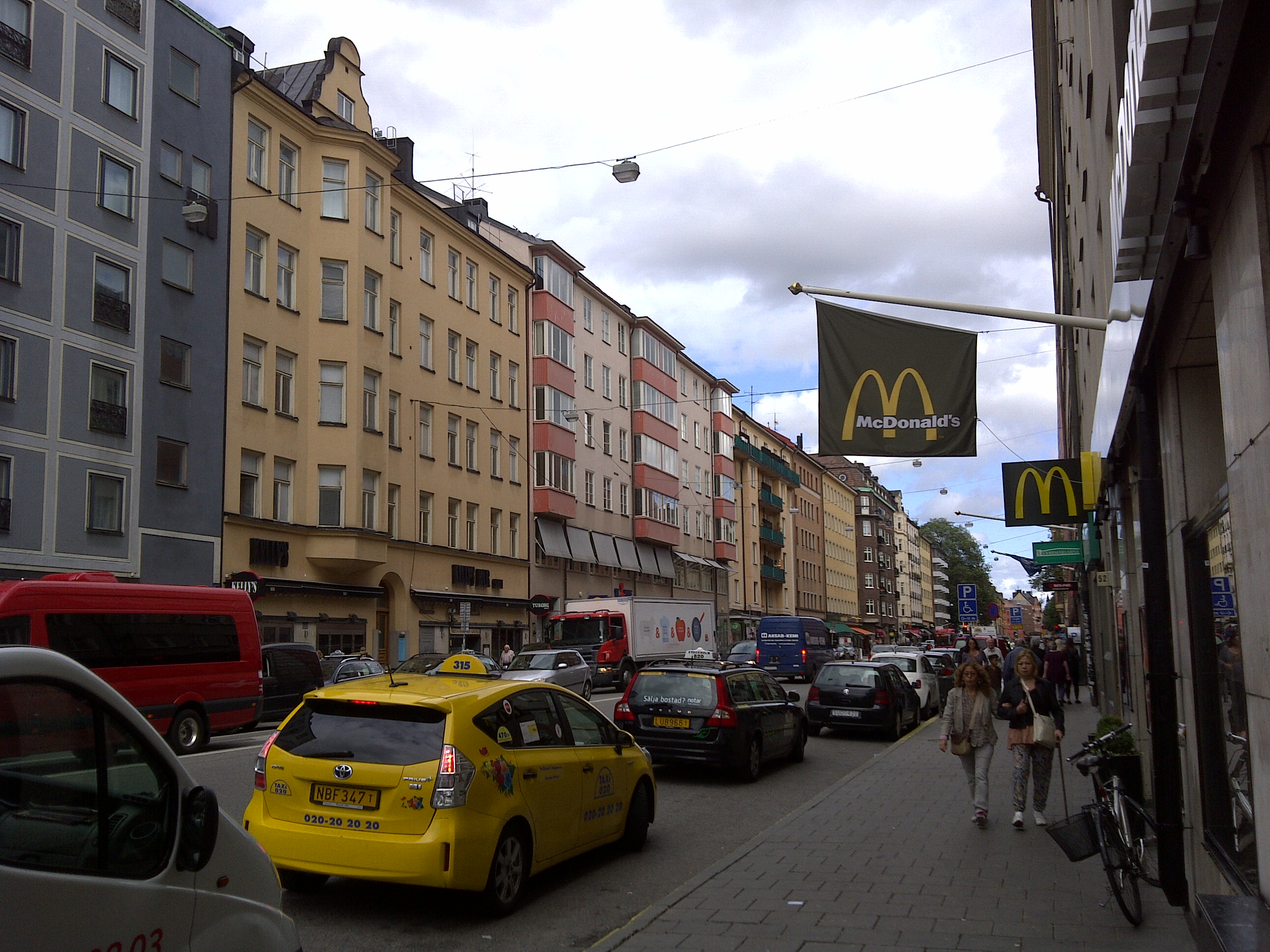
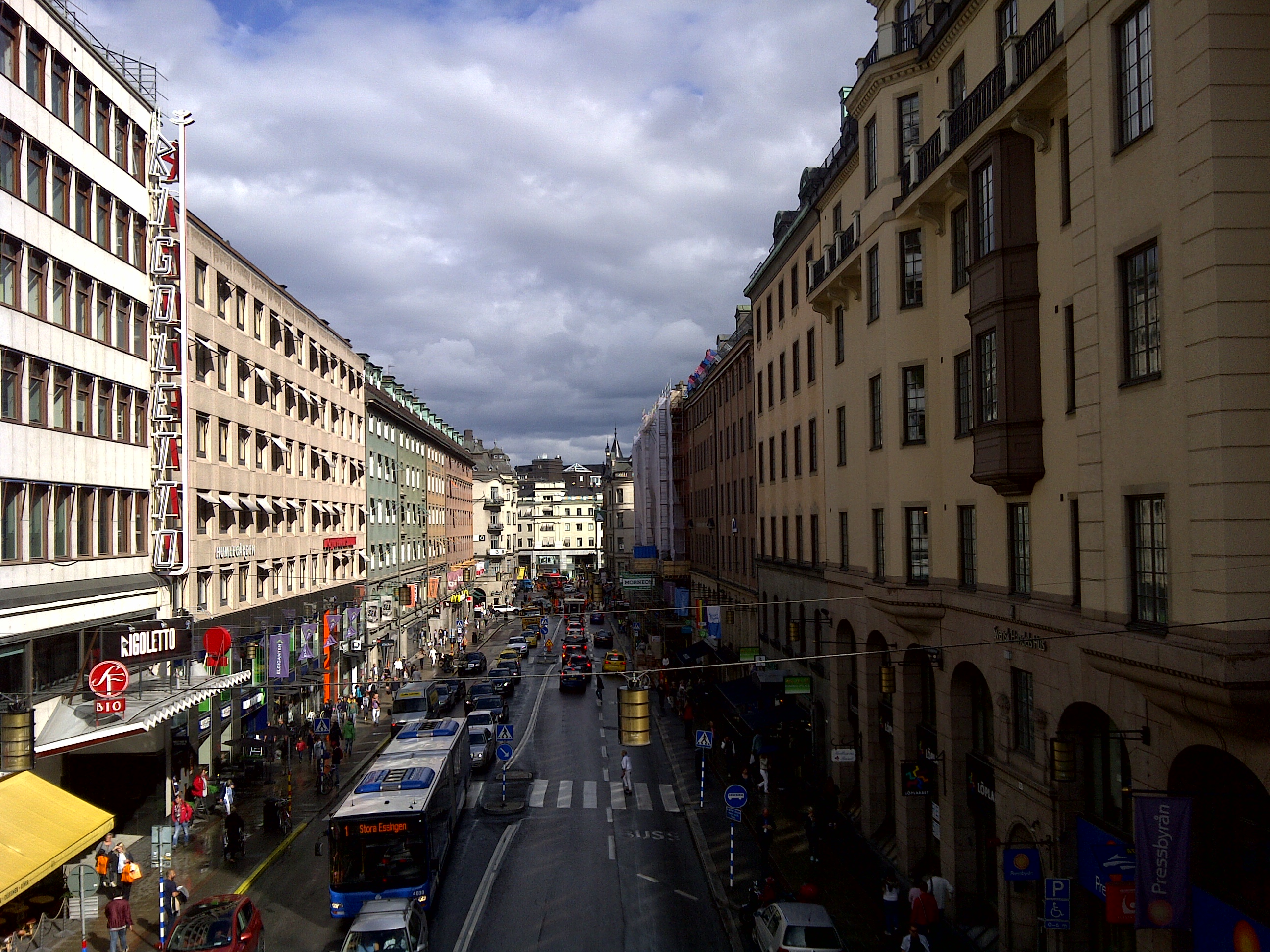