Stop Imitating the High Line
I streamed a longer version of this on Twitch on Tuesday, but the recording cut out, so instead of uploading to YouTube as a vlog, I’m summarizing it here
Manhattan has an attractive, amply-used park in the Meatpacking District, called the High Line. Here it is, just west of 10th Avenue:

It was originally a freight rail branch of the New York Central, running down the West Side of Manhattan to complement the railroad’s main line to Grand Central, currently the Harlem Line of Metro-North. As such, it was a narrow el with little direct interface with the neighborhood, unlike the rapid transit els like that on Ninth Avenue. The freight line was not useful for long: the twin inventions of trucking and electrification led to the deurbanization of manufacturing to land-intensive, single-story big box-style structures. Thus, for decades, it lay unused. As late as 2007, railfans were dreaming about reactivating it for passenger rail use, but it was already being converted to a park, opening in 2009. The High Line park is a successful addition to the neighborhood, and has spawned poor attempt at imitation, like the Low Line (an underground rapid transit terminal since bypassed by the subway), the Queensway (a similar disused line in Central Queens), and some plans in Jersey City. So what makes the High Line so good?
- The neighborhood, as can be seen above in the picture, has little park space. The tower-in-a-park housing visible to the east of the High Line, Chelsea-Elliott Houses, has some greenery but it’s not useful as a neighborhood park. The little greenery to the west is on the wrong side of 12th Avenue, a remnant of the West Side Highway that is not safe for pedestrians to cross, car traffic is so fast and heavy. Thus, it provides a service that the neighborhood previously did not have.
- The area has very high density, both residential and commercial. Chelsea is a dense residential neighborhood, but at both ends of the line there is extensive commercial development. Off-screen just to the south, bounded by Eighth, Ninth, 15th, and 16th, is Google’s building in New York, with more floor area than the Empire State Building and almost as much as One World Trade Center. Off-screen just to the north is the Hudson Yards development, which was conceived simultaneously with the High Line. This guarantees extensive foot traffic through the park.
- The linear park is embedded in a transit-rich street grid. Getting on at one end and off at the other is not much of a detour to the pedestrian tourist, or to anyone with access to the subway near both ends, making it a convenient urban trail.
These three conditions are not common, and trying to replicate the same linear park in their absence is unlikely to produce good results. For example, consider the Rockaway Cutoff, or Rockaway Beach Branch:
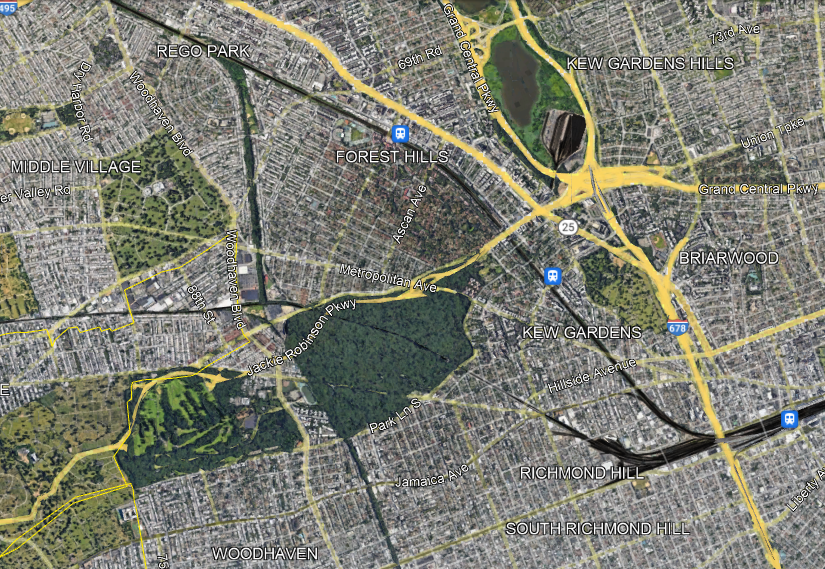
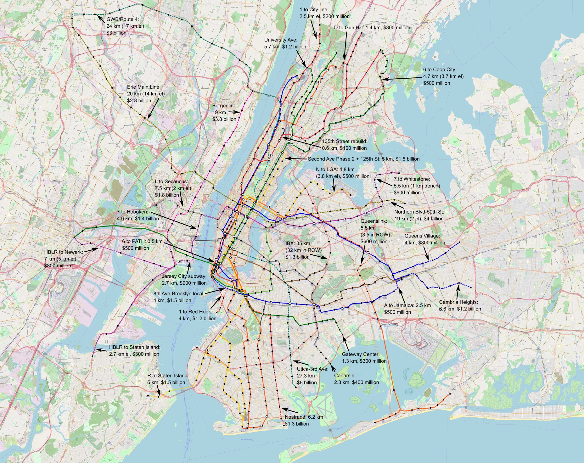
The Cutoff has two competing proposals for what to do with this disused LIRR branch: the Queenslink, aiming to convert it to a rapid transit branch (connecting to the subway, not the LIRR), and the Queensway, aiming to convert it to a linear park. The Queenslink proposal is somewhat awkward (which doesn’t mean it’s bad), but the Queensway one is completely drunk. Look at the satellite photo above and compare to that of the High Line:
- The area is full of greenery and recreation already, easily accessible from adjoining areas. Moreover, many residents live in houses with backyards.
- The density is moderate at the ends (Forest Hills and Woodhaven) and fairly low in between, with all these parks, cemeteries, and neighborhoods of single-family houses and missing middle density. Thus, local usage is unlikely to be high. Nor is this area anyone’s destination – there are some jobs at the northern margin of the area along Queens Boulevard (the wide road signed as Route 25 just north of the LIRR) but even then the main job concentrations in Queens are elsewhere.
- There is no real reason someone should use this as a hiking trail unless they want to hike it twice, one way and then back. The nearest viable parallel transit route, Woodhaven, is a bus rather than a subway.
The idea of a park is always enticing to local neighborhood NIMBYs. It’s land use that only they get to have, designed to be useless to outsiders; it is also at most marginally useful to neighborhood residents, but neighborhood politics is petty and centers exclusion of others rather than the actual benefits to residents, most of whom either don’t know their self-appointed neighborhood advocates or quietly loathe them and think of them as Karens and Beckies. Moreover, the neighborhood residents don’t pay for this – it’s a city project, a great opportunity to hog at the trough of other people’s money. Not for nothing, the Queensway website talks about how this is a community-supported solution, a good indication that it is a total waste of money.
But in reality, this is not going to be a useful park. The first park in a neighborhood is nice. The second can be, too. The fifth is just fallow land that should be used for something more productive, which can be housing, retail, or in this case a transportation artery for other people (since there aren’t enough people within walking distance of a trail to justify purely local use). The city should push back against neighborhood boosters who think that what worked in the Manhattan core will work in their explicitly anti-Manhattan areas, and preserve the right-of-way for future subway or commuter rail expansion.