The American conversation about high-speed rail has an internal debate that greatly bothers me, about whether investments should be incremental or not. An interview with the author of a new book about the Northeast Corridor reminded me of this; this is not the focus of the interview, but there was an invocation of incremental vs. full-fat high-speed rail, which doesn’t really mean much. The problem is that the debate over incrementalism can be broken down into separate categories – infrastructure, top speed, planning paradigm, operations, marketing; for example, investment can be mostly on existing tracks or mostly on a new right-of-way, or something in between, but this is a separate questions from whether operations planning should remain similar to how it works today or be thrown away in favor of something entirely new. And what’s more, in some cases the answers to these questions have negative rather than positive correlations – for example, the most aggressively revolutionary answer for infrastructure is putting high-speed trains on dedicated tracks the entire way, including new urban approaches and tunnels at all major cities, but this also implies a deeply conservative operating paradigm with respect to commuter rail.
Instead of talking about incrementalism, it’s better to think in terms of these questions separately. As always, one must start with goals, and then move on to service planning, constraints, and budgets.
Planners who instead start with absolute political demands, like “use preexisting rights-of-way and never carve new ones through private property,” end up failing; California High-Speed Rail began with that demand, as a result of which it planned to use existing freight rail corridors that pass through unserved small towns with grade crossings; this was untenable, so eventually the High-Speed Rail Authority switched to swerving around these unserved towns through farmland, but by then it had made implicit promises to the farmers not to use eminent domain on their land, and when it had to violate the promise, it led to political controversy.
Switzerland
Instead of California’s negative example, we can look to more successful ones, none of which is in an English-speaking country. I bring up Switzerland over and over, because as far as infrastructure goes, it has an incremental intercity rail network – there are only a handful of recently-built high-speed lines and they’re both slow (usually 200 km/h, occasionally 250 km/h) and discontinuous – but its service planning is innovative. This has several features:
Infrastructure-rolling stock-timetable integration
To reduce the costs of infrastructure, Swiss planning integrates the decision of what kind of train to run into the investment plan. To avoid having to spend money on lengthening platforms, Switzerland bought double-deck trains as part of its Rail 2000 plan; double-deckers have their drawbacks, mainly in passenger egress time, but in the case of Switzerland, which has small cities with a surplus of platform tracks, double-deckers are the right choice.
California made many other errors, but its decision to get single-deck trains is correct in its use case: the high-speed trainset market is almost entirely single-deck, and the issue of platform length is not relevant to captive high-speed rail since the number of stations that need high-speed rail service is small and controllable.
Timetable integration is even more important. If the point is to build a rail network for more than just point-to-point trips connecting Zurich, Basel, Bern, and Geneva, then trains have to connect at certain nodes; already in the 1970s, SBB timetables were such that trains arrived at Zurich shortly before the hour every hour and departed on or shortly after the hour. The Rail 2000 plan expanded these timed connections, called Knoten or knots, to more cities, and prioritized speed increases that would enable trains to connect two knots in just less than an hour, to avoid wasting time for passengers and equipment. The slogan is run trains as fast as necessary, not as fast as possible: expensive investment is justifiable to get the trip times between two knots to be a little less than an hour instead of a little more than an hour, but beyond that, it isn’t worth it, because connecting passengers would not benefit.
Tunnels where necessary
The incremental approach of Rail 2000, borne out of a political need to limit construction costs, is sometimes cited by German rail advocates and NIMBYs who assume that Switzerland does not build physical infrastructure. Since the 1980s, when investment in the Zurich S-Bahn and Rail 2000 began, Switzerland has built rail tunnels with gusto, and not just across the Alpine mountain passes for freight but also in and between cities to speed up passenger trains and create more capacity. Relative to population, Switzerland has built more rail tunnel per capita than Germany since the 1980s, let alone France, excluding the trans-Alpine base tunnels.
So overall, this is a program that’s very incremental and conservative when it comes to top speed (200 km/h, rarely 250), and moderately incremental when it comes to infrastructure but does build strategic bypasses, tunnels to allow trains to run as fast as necessary, and capacity improvements. But its planning paradigm and operations are both innovative – Rail 2000 was the first national plan to integrate infrastructure improvements into a knot system, and its successes have been exported into the Netherlands, Austria, and more slowly Germany.
Incrementalism in operations versus in infrastructure
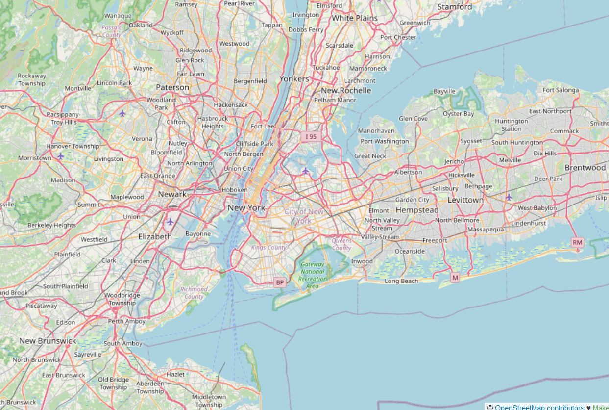
The current trip times between New York and New Haven are 1:37 on intercity trains and 2:02 to 2:08 on commuter trains depending on how many stops they skip between Stamford and New Haven. The technical capability of modern trainsets with modern timetabling is 52 minutes on intercity trains and about 1:17 on commuter trains making the stopping patterns of today’s 2:08 trains.
This requires a single deviation from the right-of-way, at Shell Interlocking just south of New Rochelle, which deviation is calibrated not to damage a historic building close to the track and may not require any building demolitions at all; the main purpose of the Shell Interlocking project is to grade-separate the junction for more capacity, not to plow a right-of-way for fast trains. The impact of this single project on the schedule is hard to quantify but large, because it simplifies timetabling to the point that late trains on one line would not delay others on connecting lines; Switzerland pads the timetable 7%, whereas the TGV network (largely on dedicated tracks, thus relatively insulated from delays) pads 11-14%, and the much more exposed German intercity rail network pads 20-30%. The extent of timetable padding in and around New York is comparable to the German level or even worse; those two-hour trip times include what appears to be about 25 minutes of padding. The related LIRR has what appears to be 32% padding on its Main Line, as of nine years ago.
So in that sense, it’s possible to be fairly conservative with infrastructure, while upending operations completely through tighter scheduling and better trainsets. This should then be reinforced through upending planning completely through providing fewer train stopping patterns, in order to, again, reduce the dependence of different train types on one another.
Is this incremental? It doesn’t involve a lot of physical construction, so in a way, the answer is yes. The equivalent of Shell on the opposite side of New York, Hunter Interlocking, is on the slate of thoroughly incremental improvement projects that New Jersey Transit wishes to invest in, and while it has not been funded yet unfortunately, it is fairly likely to be funded soon.
But it also means throwing out 70 years of how American rail agencies have thought about operations. American agencies separate commuter and intercity rail into different classes of train with price differentiation, rather than letting passengers ride intercity trains within a large metropolitan area for the same price as commuter rail so long as they don’t book a seat. They don’t run repeating timetables all day, but instead aim to provide each suburban station direct service to city center with as few stops as possible at rush hour, with little concern for the off-peak. They certainly don’t integrate infrastructure with rolling stock or timetable decisions.
Incrementalism in different parts of the corridor
The answer to questions of incrementalism does not have to be the same across the country, or even across different parts of the same line. It matters whether the line is easy to bypass, how many passengers are affected, what the cost is, and so on.
Between New York and New Haven, it’s possible to reduce trip times by 7 minutes through various bypasses requiring new rights-of-way, including some tunneling and takings of a number of houses in the low hundreds, generally in wealthy areas. My estimate for how much these bypasses should cost is around $5 billion in total. Is it worth it? Maybe. But it’s not really necessary, and there are lower-hanging fruit elsewhere. (One bypass, west of Stamford, may be desirable – it would save maybe 100 seconds for maybe $500 million, and also provide more capacity on a more constrained section, whereas the other potential bypasses are east of Stamford, where there is much less commuter traffic.)
Between New Haven and Kingston, in contrast, the same $5 billion in bypass would permit a 320 km/h line to run continuously from just east of New Haven to not far south of Providence, with no tunnels, and limited takings. The difference in trip times is 25 minutes. Is that worth it? It should be – it’s a factor of around 1.2 in the New York-Boston trip times, so close to a factor of 1.5 in the projected ridership, which means its value is comparable to spending $15 billion on the difference between this service (including the $5 billion for the bypass) and not having any trains between New York and Boston at all.
South of New York, the more Devin and I look at the infrastructure, the more convinced I am that significant deviations from the right-of-way are unnecessary. The curves on the line are just not that significant, and there are long stretches in New Jersey where the current infrastructure is good and just needs cheap fixes to signals and electrification, not tunnels. Even very tight curves that should be fixed, like Frankford Junction in Philadelphia, are justifiable on the basis of a high benefit-cost ratio but are not make-or-break decisions; getting the timetabling integration right is much more important. This could, again, be construed to mean incrementalism, but we’re also looking at New York-Philadelphia trip times of around 46 minutes where the Acela takes about 1:09 today.
Overall, this program can be described as incremental in the sense of, over than 500 km between Boston and Philadelphia, only proposing 120 km of new right-of-way, plus a handful of junction fixes, switch rebuilds, and curve modifications; curve regradings within the right-of-way can be done by a track-laying machine cheaply and quickly. But it also assumes running trains without any of the many overly conservative assumptions of service in the United States, which used to be enshrined in FRA regulations but no longer are, concerning speed on curves, signaling, rolling stock quality, etc. If the trip time between Boston and Philadelphia is reduced by a factor of 1.8, how incremental is this program, exactly?
Incrementalism in marketing and fares
Finally, there are questions about business planning, marketing, segmentation, and fares. Here, the incremental option depends on what is the prior norm. In France, after market research in advance of the TGV showed that passengers expected the new trains to charge premium fares, SNCF heavily marketed the trains as TGV pour tous, promising to charge the same fares for 260 km/h trains as for 160 km/h ones. Since then, TGV fares have been revamped to resemble airline pricing with fare buckets, but the average fares remain low, around 0.11€/km. But international trains run by companies where SNCF has majority stake, namely Thalys and Eurostar, charge premium fares, going exclusively after the business travel market.
This, too, can be done as a break from the past or as a more incremental system. The American system on the Northeast Corridor is, frankly, bad: there are Acela and Regional trains, branded separately with separate tickets, the Regionals charging around twice as much as European intercity trains per km and the Acelas more than three times as much. Incrementalism means keeping this distinction – but then again, this distinction was not traditional and was instead created for the new Acela trains as they entered into service in 2000. (California High-Speed Rail promised even lower fares than the European average in the 2000s.)
Conclusion
There’s no single meaning to incrementalism in rail investment. Systems that are recognized for avoiding flashy infrastructure can be highly innovative in other ways, as is the case for Rail 2000. At the same time, such systems often do build extensive new infrastructure, just not in ways that makes for sleek maps of high-speed rail infrastructure in the mold of Japan, France, or now China.
What’s more, the question of how much to break from the past in infrastructure, operations, or even marketing depends on both what the past is and what the local geography is. The same planner could come to different conclusions for different lines, or different sections on the same line; it leads to bad planning if the assumption is that the entire line must be turned into 300+ km/h high-speed rail at once or none of it may be, instead of different sections having different solutions. Benefit-cost analyses need to rule the day, with prioritization based on centrally planned criteria of ridership and costs, rather than demands to be incremental or to be bold.


 , and
, and  ; my post just looks at specific high-speed rail connections rather than trying to abstract it out, but the point is that in the presence of an initial network, even weaker-looking extensions can be worth it because of the connections to more nodes. Finally, this builds on what I said five days ago about