Is There Room for Optimism About New York Construction Costs?
This year, there have been some positive signs about things changing in New York on subway construction – and yet, I’m uncertain about them. There are some signs that construction costs for Second Avenue Subway Phase 2 are coming under control. The New York Post broke in January that the MTA is eying smaller station designs, to reduce costs, to the tun of $300 million; an article released a few hours ago adds that there may be another $600 million in potential savings. So, in theory, costs are going down, and they’re going down as the MTA implements something we’ve been screaming about at the Transit Costs Project, so we should be happy.
And yet, I’m uncertain – not negative, but still somewhat pessimistic about whether this portends an era in which New York can finally build more subways. The main reason isn’t even some mistrust in the MTA at this point – the reduction in station footprints is a genuinely good thing, and to the extent it’s incomplete, it’s because it’s a longstanding project with older designs. Rather, it’s a combination of what this means for future projects, and how it interacts with federal funding. In brief, federal funding is at the level of the project rather than agency, and this makes it hard for cost savings to be plugged into the most straightforward benefit – namely, being able to build more on the same budget.
How is the money being saved?
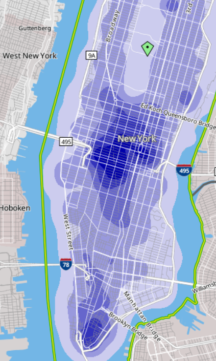
The New York Post is relying on an MTA presentation from January that defends the cost structure but talks about how to reduce station costs through reducing back-of-house space. Phase 1 of Second Avenue Subway built two deep-mined intermediate stations, at 72nd and 86th Streets; the platforms are 610′ (187 meters) long, and there are no serious prospects of ever running longer trains since the line is an extension of older lines, but the station caverns are, respectively, 398 and 295 meters long, where the norm in the European comparison cases we’ve seen is that the station dig is 3-15% longer than the platforms, not twice as long.
Both stations have extensive back-of-house space, which New York City Transit demanded so that each department using the station would have its own space; 72nd also has a crossover inherited from older designs that would have permitted some trains from the south to terminate there on a third station track, which was later removed from scope to reduce costs. (The terminal station, the cut-and-cover 96th Street, is a 485 meter long dig, but that’s an artifact of block-level geology: the northern end had to go as far as 99th in order to connect with an older tunnel built in the 1970s, whereas the southern end had to go as far as 92nd because the underground geology changes abruptly there and it was easier to start boring at 92nd than at 96th.)
The plan for Phase 2 initially included much longer digs than the platform, for the same reason. However, it has since changed, and now the digs are substantially reduced. The MTA’s presentation looks like the overage at 125th Street is reduced from somewhat more than 100% in the 2004 plan to about 40-50% in the 2023 plan, and the overage at 106th and 116th is somewhat less than that, maybe 30-40%. While the 125th Street station dig is still as deep as in prior plans, the deep-mined station will also extend less far up, reducing the extent of space required to be outfit with systems.
The MTA could shrink the stations’ footprint further and save more money, but it’s fairly late in the design, and thus the opportunity to take full benefit of this improvement is for future projects. If this establishes precedent for future station construction, then it’s an unmixed blessing.
Money is saved. So what?
The broader issue is that the savings from shrinking the stations’ footprint – totaling potentially $1 billion out of a budget of $7 billion – don’t have much to go. The rub is that the project already has a Full Funding Grant Agreement. If the MTA manages to do it for less, then the most obvious, and most pessimistic, answer to where the money goes is “preventing future overruns.” The savings, in the worst case, then transfer waste from one basket, namely oversize stations, to other baskets, which could be future conflict with contractors, last-minute design changes, or betterments to the neighborhood.
That said, there are plans to spend it on something useful. But the problem is that this is limited by the scope of the project itself. Second Avenue Subway in its current iteration dates to the 1990s, and is reusing some infrastructure from the 1970s. The intention in the 1990s was to do the entire thing, or at least Phases 1 and 2, together, and the project was only chopped into four phases due to high costs. There was design work done 20 years ago or more, and the environmental impact statement is roughly that old.
I suspect the reason the cost saving from shrinking the stations is $1 billion and not much more – we estimated that Phase 1’s cost would have been halved if the stations had been only as long as the platforms – is that the designs are already spoken for, with 20 years of optimization involved. Thus the change is reducing the hard costs of construction, but not the soft costs. It will not surprise me if a postmortem will reveal an elevated ratio of soft to hard costs, purely because the cost savings are happening at such a late stage; in this case, and only in this case, it is important to forgive a high ratio of soft to hard costs, since it portends that future designs will be cheaper, and future cost savings larger. Normally, a high soft-to-hard cost ratio suggests red tape and waste involving consultants, but in this one case, it would suggest something else; I highlight this so that watchdogs for government waste, including the New York Post, realize what is going on and avoid hitting the project if it turns out to indeed have a high soft-to-hard cost ratio as I expect.
Current plans include potentially continuing the tunnel boring under 125th Street. Governor Hochul expressed some interest in a subway extension under 125th Street, extending Phase 2 from 125th/Lexington to the Hudson, with stops at the intersections with the subway lines, at Lenox (2/3), St. Nicholas (A/B/C/D), and Broadway (1 and also potential commuter rail). Such an extension was long on the wishlist of New York-area railfans, and an operations planner mentioned it to me as a future desire more than 10 years ago, unprompted. But there is no way to just reallocate $1 billion to this line; that’s not how federal funding works. At best, it will be possible to continue boring the tunnel all the way to the west, and leave the systems and stations to a future project.
My pessimism is that the cost figure given for the 125th Street extension is $7.6 billion, around $3.3 billion per kilometer. Even taking into account future inflation, it’s costlier than Second Avenue Subway Phases 1 and 2. Now, this is an early number, one that hasn’t really made it into any plans. I hope that the current cost savings are then plugged into the 125th Street extension plan, and that this project is pursued seriously at a much lower cost figure; since all stations would have to be complex digs underneath older north-south subway lines, the benefits of shrinking station footprint are especially large. But I worry that this will not happen; I’ve had hopes dashed before – for example, FRA reform did not lead American commuter rail agencies to start buying alt-compliant vehicles. We’ll see what happens if there’s more detailed work on the 125th Street extension proposal.
Funding projects vs. funding agencies
The current way federal funding works for public transportation in the United States is that the government funds specific capital projects. The MTA can ask for funding for big-ticket items like Second Avenue Subway Phase 1, Phase 2, a future 125th Street subway, the Interborough Express, or any similar such line. It can also ask for a rolling program of improvements, for example installing elevators at stations to make them accessible in line with the Americans with Disabilities Act. But the federal government does not make it easy to move money between such projects.
Phase 2 is just one project, but imagine that there are three subway lines funded concurrently: Phase 2, a subway extension under Nostrand, and a subway extension under Utica. If the MTA finds 25% cost savings, it can’t easily flex the money to a fourth line, say under 125th. It would need to start the planning process early, which is so cumbersome and expensive that it wouldn’t do so for a project it wasn’t certain it wanted to do; there is no shelf of subway extensions that are approved and are just waiting for money.
This makes the incentives for cost savings uncertain: cost savings could be used to establish the agency’s bona fides with a distrustful public, or to establish a warchest guarding against future cost overruns, or to trial new ways of working that could lead to bigger cost savings in the future, but the most straightforward benefit of cost savings – building more infrastructure on the same budget – is not generally available. For Phase 2, the best that can happen is, again, continuing boring the tunnel to the western end of 125th Street, which could be connected with the current project because the geology under the street is the same from Second Avenue to Broadway so might as well future-proof it.
And unfortunately, in the United States, the current examples of funding agencies rather than projects have been lacking. The programs in Los Angeles and Seattle, funded by sales taxes, in effect fund the agencies. There are long lists of projects in both metro areas that are funded from them, but they come from the same pool of money in each region. The situation in Los Angeles is that there’s a decided priority list, with money allocated through the end of the 2050s; if Los Angeles figures out how to cut costs significantly, all of the opening dates will be moved closer and additional lines could be planned and built with the money (the planning and environmental review process takes years, not decades, so by 2050 they will have reviews for the additional subways they could build).
And yet, the same process that’s produced lush agency-level funding in both regions has also led to bad prioritization. New York may have the world’s highest construction costs, but at least what it’s building is what it should be building: Second Avenue Subway Phase 2 is indeed the highest priority right now, and among the next priorities, the Interborough Express and 125th Street are solid choices, according to most area rail advocates two of the top five, and potentially even the top two (the other three are Nostrand, Utica, and an elevated extension of the Astoria Line to LaGuardia). In contrast, Los Angeles is prioritizing the wrong projects. The same ballot proposition process there that produces agency-level funding also requires the agency to bribe local actors who care little for public transportation or for ideological politics with lines to their own subregions of the county, not because they or their constituents will ride the trains, but because they will be able to tell their constituents “I managed to force the county to give us infrastructure money.” This way, each region of the county gets a light rail extension, no matter how lightly-ridden, while the core of the system receives little investment: while the busiest bus corridor in Los Angeles, Wilshire, is getting a subway in the D (Purple) Line Extension, the next two busiest, Vermont and Western, are not getting any rail through the 2050s, despite calls from advocates to built a line on Vermont to turn the B (Red) Line into a north-south line rather than a branch with the Purple Line.
Incentives for the future
The MTA is clearly capable of saving money. The question is now how to incentivize doing more of it. First of all, I urge New York-area advocates to pursue the 125th Street extension, and demand that the cost savings identified for Phase 2 apply to it too. The savings may even potentially be relevant to the Interborough Express, though with at-grade and above-ground stations, the impact is greatly reduced. The Phase 2 savings are reactive; applying them to future lines is proactive.
Second, I urge both the MTA and advocates to look for cost savings in areas where it is easier to flex money – namely, ADA accessibility. Being able to make a station accessible not for the current budget of about $70 million per station with contingency but the $25 million of Boston or $10 million of Madrid would enable New York to have an all-accessible subway system not in the 2050s but in the early 2030s.
Finally, at the federal level, it is useful to figure out how to fund agencies with a positive track record and not just specific projects. Potentially, agencies could be encouraged to submit wishlists of future projects that may be cleared in case money becomes available on short notice; this is useful not just in the case of cost savings, but also in the case of an unexpected infrastructure stimulus – neither the scope of the 2009 stimulus in the early Obama era nor that of 2021 under Biden had been telegraphed until shortly before, and so agencies have not always been able to take maximum advantage of the additional funds.


