Transit and Scale Variance Part 3: Grids
This is my third post about scale variance in transit planning; see parts 1 and 2. In part 1, I discussed how good bus networks exist at a certain scale, which can’t easily be replicated at larger scale (where the slowness of city buses makes them less useful). In part 2, I went over a subway planning feature, especially common in the communist bloc, that again works only at a specific scale, namely cities with enough population for 3-4 subway lines; it gets more complex in larger cities, and cannot be imported to bus networks with 3-4 lines. In this post, I will focus on one scale-variant feature of surface transit: the grid.
The grid works only for surface transit and not for rapid transit, and only at a specific scale, so constrained as to never be maximally useful in an entire city, only in a section of a city. This contrasts with what Jarrett Walker claims about grids. Per Jarrett, grids are the perfect form of a transit network and are for the most part scale-invariant (except in very small networks). One of the impetuses for this post is to push back against this: grids are the most useful at the scale of part of a transit city.
Grid Networks Versus Radial Networks
I’ve written a few posts exhorting subway planners to build their networks in a certain way, which, in the most perfect form, is radial. In particular, tangential subway lines, such as the G train in New York (especially when it ran to Forest Hills), Line 10 in Paris, and Lines 3 and 6 in Shanghai, are weak. When the G train was running to Forest Hills, most local passengers would switch from it to the next Manhattan-bound train, leading New York City Transit to send more Manhattan-bound local subways to Forest Hills and eventually to cut back the G to Long Island City. Based on these examples, I contend that on a subway network, every line should be either radial, serving the CBD, or circumferential, going around the CBD.
My post about New York light rail proposes a network with some lines that are neither: in the Bronx, my proposal is essentially a grid, with north-south routes (Grand Concourse, Webster, 3rd) and east-west ones (161st, Tremont, Fordham) and one that combines both (145th-Southern). Regular commenter NewtonMARunner criticized me for this on Twitter. I answered that the lines in my proposal are based on the busiest buses in the Bronx, but this simply shifts the locus of the question to the existing network: if transit lines should be radial or circumferential, then why are the tangential Bx19 bus (145th-Southern) or the Bx40/42 and Bx36 (Tremont, with a long radial eastern tail) so successful?
To answer this requires thinking more carefully about the role of circumferential routes, which by definition don’t serve the most intensely-used nodes. In Paris, Lines 2 and 6 form a ring that misses five out of six train stations and passes just outside the CBD, and yet they are both busy lines, ranking fourth and fifth in ridership per km. The reason is that they are useful for connecting to radial Metro lines and to some RER lines (namely, the RER A and the southern half of the RER B). Tangential lines miss connections much more easily: in the west, Line 10 here has a decent transfer to Line 9 and a somewhat decent one to Line 8, but to Lines 12 and 13 it’s already not very direct. The G train in New York has the same problem to the south – few connections to lines that actually do go into Manhattan.
Consider the following three possible networks:
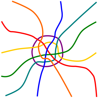


The radial network is a typical subway network. The full grid lets you go from everywhere to everywhere with just one transfer, at the cost of having far more route length than the radial network. The partial grid no longer lets you go from everywhere to everywhere easily, and has the outer two lines in each service direction missing city center, but still has more overall route-length than the radial network. The principle here is that a grid plan is useful only if the grid can be complete.
The scale, then, is that rapid transit is so expensive that there’s no money for a complete grid, making a radial plan more appropriate. But surface transit, especially by bus, can be spread across a grid more readily. The Bronx’s size, density, and bus ridership patterns are such that a mostly complete grid is feasible within the western two-thirds of the borough, supplemented by the subway. In this environment, a tangential route is fine because it hits all the radial routes it could, and could provide useful two-seat rides to a large variety of destinations.
Are Grids Really Grids?
Chicago has a relentless bus grid. The three busiest north-south routes are the tangential 8 (Halsted), 9 (Ashland), and 49 (Western), which are 22, 29, and 26 km long respectively. None enters the Loop; Halsted, the easternmost, is at the closest approach 800 meters from the Loop, across a freeway. The two busiest east-west routes, the 77 (Belmont) and 79 (79th), are also far from the Loop.
However, I contend that these routes don’t really form a grid, at least not in the sense that passengers ride between two arbitrary points in Chicago by riding a north-south bus and connecting to an east-west bus. Instead, their outer ends form tails, which people ride to the L, while their inner ends are standard circumferentials, linking two L branches. The L in turn is purely radial and doesn’t follow the Chicago grid, with the Blue Line’s O’Hare Branch, the Orange Line, and the Brown Line all running diagonally.
Vancouver is similar. The north-south routes are radial, veering to enter Downtown. The east-west ones are more circumferential than tangential: they connect the Expo and Canada Lines, and most also connect to UBC. The Broadway buses (9 and 99) pass so close to Downtown Vancouver they’re more tangential, but they also offer the shortest path between the Expo and Canada Lines (making them a strong circumferential) while at the same time serving high job density on Central Broadway (giving them some characteristics of a radial).
In the absence of a radial rail network to connect to, long grid routes are less useful. Cities have a center and a periphery, and the center will always get more ridership, especially transit ridership. The outermost grid routes are often so weak that they should be pruned, but then they weaken the lines they connect to, making it necessary to prune even more lines until the grid is broken.
The Optimal Scale for a Grid
A strong transit grid will not form in a city too small for it. There needs to be a large enough center with enough demand for transit ridership to justify more than a purely radial bus network with a timed transfer. At the same time, the city cannot be too big, or else the arterial buses are too slow to be useful for ordinary work and leisure trips, as in Los Angeles.
What’s more, there is no Goldilocks zone, just right for a grid. Chicago is already too big for a bus grid without the radial rail layer. It’s also too big for what Jarrett calls grid accelerators – that is, rapid transit routes that replace bus grid lines: the Red Line is plausibly a grid accelerator, but the other lines in Chicago are not, and if there were L lines only at grid points, then the Red Line and the one east-west route would get overcrowded heading toward the Loop. Even Vancouver, a compact metro area hemmed by mountains and the ocean, relies on the diagonal Expo Line to serve Downtown and doesn’t really have a grid beyond city limits. A less dense city in the same land area could have a grid, but without much traffic or a strong CBD, cars would always beat transit on time and only the poor would ride the bus.
The scale in which grid networks work more or less on their own seems to be that of Vancouver proper, or that of the Bronx. Vancouver is 115 km^2 and the Bronx is 110 km^2; Vancouver’s bus grid spills over to Metrotown and the Bronx’s to Upper Manhattan, but in both cases these are small increases in the relevant land area.
Tellingly, Vancouver still relies on the bus network to feed SkyTrain; the Canada Line is a grid accelerator, but the Expo Line is not. The Bronx is the more interesting case, because it is not a city or even the center of the city, but rather a dense outlying portion of the city with an internal arterial grid. In both cases, the grid is supplementary to the radial rail core, even if the routes that use it have a lot of independent utility (Metro Vancouver has higher bus ridership than rail ridership, and the Bronx buses combined have slightly more ridership than the combined number of boardings on the Bronx subway stations).
Geographical constraints matter as well. The Bronx and Upper Manhattan are hemmed by water and by the administrative border of the city (which also includes a sharp density gradient), and Vancouver is hemmed by water and by a density gradient in the east. This makes it easier to equip both with grids that are close enough to the complete grid in the middle image above rather than the incomplete one in the third image. The Bronx’s lower-density eastern tails happen to meet up with those of Queens, forming circumferential routes, and also have enough north-south subway lines to feed that they remain useful.
In a transit city, the grid cannot come first. Even if there is a street grid, the spine of the network has to be radial as soon as there is demand for more than two rapid transit lines. The role of surface transit remains feeding rapid transit. Grids look attractive, but the optimal scale for them is awkward: large-scale surface transit grids are too slow, forcing the city to have a rapid transit backbone, and if the city is too small for that then the arterial grid provides too good auto access for public transit to be useful.

Maybe Jarrett’s most famous project, Houston, is the perfect grid city?
Houston’s results are mixed, to say the least. Initial gains eroded quickly and now grid proponents are largely hanging their hats on weekend increases only.
Grids haven’t done too well in small and mid-sized cities that have undergone budget-neutral service revisions.
Tallahassee reconfigured their network in 2011 to allow more transfers outside of downtown. I don’t have data on ridership, but looking at their system map they are mostly back to a pulsed hub-and-spoke system.
Davenport, Iowa reconfigured their hub-and-spoke network of 30-60 minute headway routes into a grid system. Ridership fell 37 percent. http://qctimes.com/news/local/government-and-politics/citibus-ridership-still-adjusting-to-route-changes/article_b727b7a6-1f68-5f26-bd1a-60e59612162d.html
Systems in car-oriented cities that kept a hub-and-spoke focus in their recent restructures have seen slight ridership increases. See Cedar Rapids, which bumped their main route from 30 to 15 minute headways by cutting a low-ridership route http://www.thegazette.com/subject/news/government/local/ridership-up-after-cedar-rapids-transit-changes-20171224 and Lincoln, NE, which straightened routes with numerous turns and coordinated departures between routes to create 15 minute headways in a few travel markets http://lincoln.ne.gov/city/pworks/startran/advisory-board/pdf/2017-11-30-minutes.pdf
Grids have some nice features. Particularly, any destination pair on a grid is separated by at most 1 transfer and 150% of the straight line distance between them. Certain destination pairs on a radial network can easily be separated by 3 transfers and 1000% of the straight line distance.
But, as they say, there’s no such thing as a free lunch. I think your analysis picks up the fact that grids have inherent, unavoidable trade-offs. But I think there’s a subtlety that you’re missing.
You point out that the various routes in a grid are also radial, tangential or circumferential routes in their own right. This is true. The subtle point is that a collection of radial, tangential and circumferential routes is not automatically a grid. In order to be a grid, the various grid lines must be operated at a consistent or nearly consistent level of service. Without this consistency in service level, most of the transfers become inconvenient and your grid reverts back to a collection of radial and circumferential lines.
So the (very real) benefits of a grid come at the cost of diverting resources away from your city’s radial lines and towards the circumferential ones. That is spending less on the highest ridership radial routes in order to increase the coverage of the network.
I speculate that this would feed into the processes you describe. Where resources are limited, the temptation is to operate some grid lines as circumferential routes instead, which means increased headways and decreased span of hours. While the route continues to exist, it ceases to be a useful part of the grid. Eventually, so much of the grid gets eroded that the whole thing ceases to be useful.
I’m no expert, so maybe I’m way off base, but that’s how it seems to me.
One example of a grid system that works amazingly well for busses, and at fairly long distances, is LA.
The failure of the LA bus grid to be useful is part of what motivated my post. The bus takes 3 times as long as driving, and bus lanes are only a partial fix because cars can use the freeways. Freeway buses get some ridership, e.g. the Silver Line to San Pedro, whereas the basic arterial grid doesn’t get much ridership at the same range, relying instead on shorter-range trips.
Looking at your “radial city”, I notice it is not “entirely” radial. Outside the ring line, the ends of the lines are indeed quite radial. But inside the ring line, the lines do not meet at a single point, but rather intentionally wander to form an irregular grid, with all area covered, and transfers provided at many separate nodes.
When a city grows and needs new rapid transit lines, what is the best way of building these lines? A ring line is one possibility. Moscow built a ring, now it is outgrowing its ring and building a couple more rings further out. Beijing on the other hand built a ring which turned out to be much too small, and has another route awkwardly ending at the corners of its ring. Tehran is taking a different approach, with L-shaped lines crossing each other, framing the core.
Concentric ring lines along with radials can supply a sort of grid network – in math terms, like a polar rather than Cartesian graph. But this is hard to make work in a city where the streets form a rigid Cartesian grid. Beijing also has problems with its radial lines, particularly 4, which zig-zags from the city center to the northwest, making for an awkward transfer with the 9. Similarly Phoenix light rail and Miami Metrorail are forced to zigzag in order to go radially. This makes them slower, and makes hypothetical future additions to the network more complicated.
I’m not sure if I have a single thesis in this comment, except maybe “radial routes are not so simple”
Yes! Even making a hypothetical map makes some of the limitations clear. The biggest one is something that I realized when a friend who is not a railfan looked at the map and said that it looks like a city built on a river. But then I looked more closely and couldn’t find where the river should go, and neither could the friend, at least assuming city center is on one side of the river, as is the case in London and Paris. Most reasonable routes for rivers end up with some lines mostly serving the wrong bank (e.g. South London or the Left Bank of Paris). Realistically, such a city would have to have three-way transfers, which I purposely avoided when I made my map.
In gridded cities, the best thing to do is to build diagonal routes using TBMs, going under private property. Such routes, offering direct connections where the rest of the network snaps to the grid, are likely to be very popular: in Paris, the Metro has some grid elements in it, and the diagonal lines, 14 and 11, are very popular, ranking third and sixth in ridership per route-km respectively. Above ground or at-grade it’s often possible to use diagonal streets or ROWs cutting across the grid, such as the Expo Line (or Kingsway) in Vancouver, or Milwaukee Avenue in Chicago.
Do you think there is a difference between high- and mid-income cities, i.e. high-income cities have jobs concentrated in a small area like the City of London, while mid-income cities like in China have large factory districts far from the center, so a radial layout is less suitable?
Factory towns in China would be more like low-income cities. Extremely low-income by British standards.
One network effect that I don’t think you’ve discussed is branching. A single line can be branched at its ends, in order to serve more peripheral destinations, while the frequency to those destinations is appropriately low. If ridership grows until the core segment is overwhelmed, then it is necessary to build a second core segment in parallel. The two lines will have a transfer at the station from which the branches formerly split.
What do you think is the ideal way to serve a sprawled out region like San Jose, which is trying to create a bus grid like LA, but is geographically smaller? I think it will be an interesting challenge given how badly transit has failed so far, but there are signs that land use is starting to densify. Downtown San Jose is attracting jobs and residents, and there are a few attempts to intensify land use at a few sub-centers like Santana Row and North Bayshore in Mountain View.