Agency Turf Battles and Construction Costs
This is a touched-up version of an article I tried publishing earlier this year, changed to be more relevant to regular blog readers, who know e.g. what Gateway is.
I’ve talked a lot about high rail construction costs in the US, especially in New York: see here for a master list of posts giving cost figures, and here and here for posts about things that I do not think are major reasons. In this post, I’d like to talk about one thing that I do think is relevant, but not for every project: agency turf battles.
The German/Swiss planning slogan, organization before electronics before concrete, means that transit agencies should first make sure all modes of public transit are coordinated to work together (organization) before engaging in expensive capital construction. In the US, most urban transit agencies do this reasonably well, with integrated planning between buses and trains (light rail or subway); there’s a lot of room for improvement, but basics like “don’t run buses that duplicate a subway line” and “let people take both buses and subways on one ticket” are for the most part done. Readers from the San Francisco Bay Area will object to this characterization, but you guys are the exception; New York in contrast is pretty good; Chicago, Boston, and Philadelphia are decent; and newer cities run the gamut, with Seattle’s bus reorganization for its light rail being especially good.
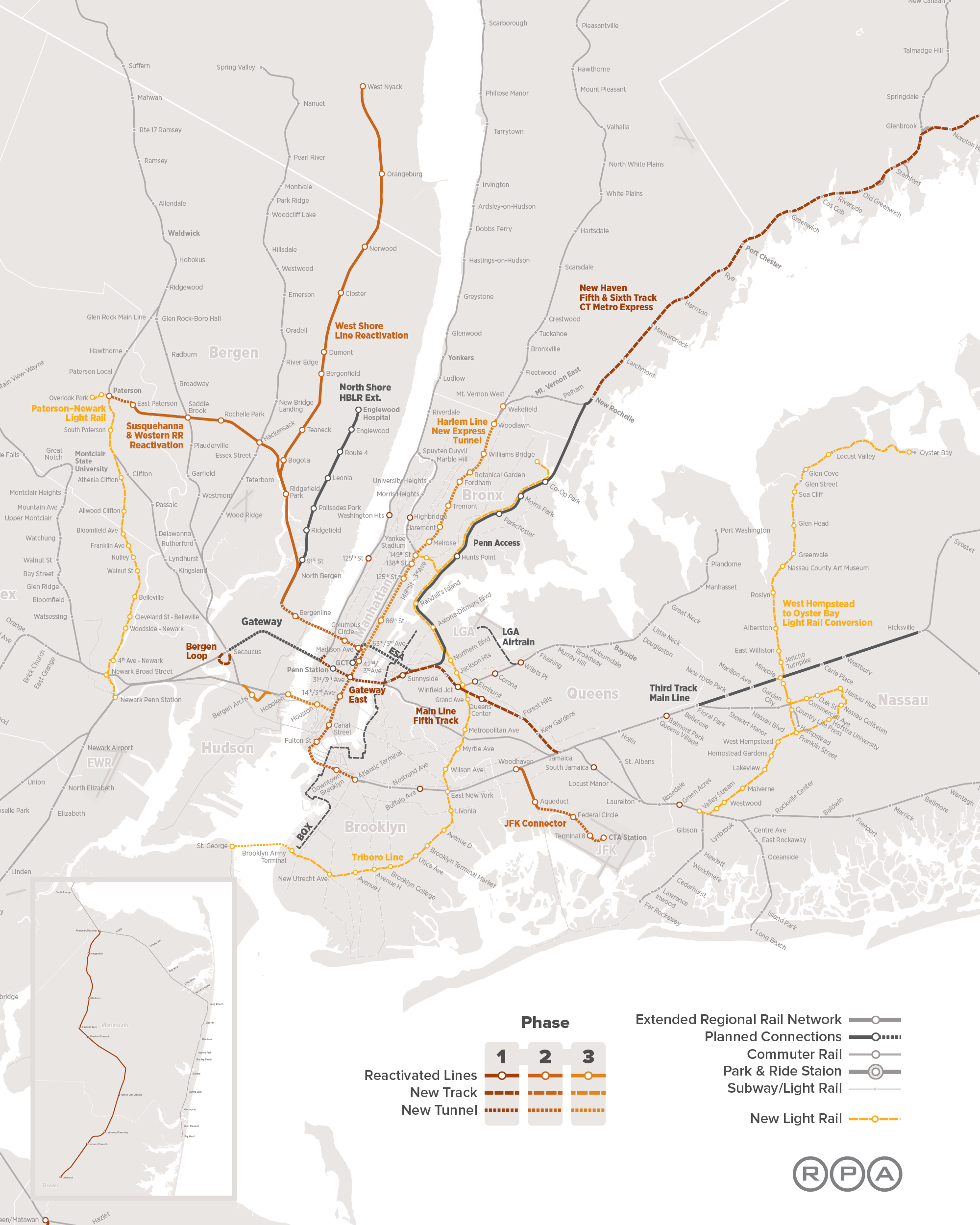
But then there’s mainline rail, with too many conflicting agencies and traditions. There is no place in the US that has commuter rail and successfully avoids agency turf battles, even regions where the integration of all other modes is quite good, such as New York and Boston. I have complained about this in Philadelphia, and more recently criticized the RPA’s Fourth Regional Plan for letting Long Island claim the East River Tunnels as its own fief.
But all of this pales compared with what is actually going on with the Gateway tunnel. The New York region’s political leaders have demanded funding for a $25 billion rail tunnel between New York Penn Station and New Jersey. When Donald Trump had just won the election, Schumer proposed Gateway as a project on which he could cooperate with the new president; Booker got some federal money earlier, in the Obama administration.
The circumstances leading to the Gateway announcement are themselves steeped in inter-agency intrigue. Gateway is the successor to an older scheme to build a rail tunnel under the Hudson, called ARC. In 2010, Chris Christie acquired some notoriety for canceling it as construction started.
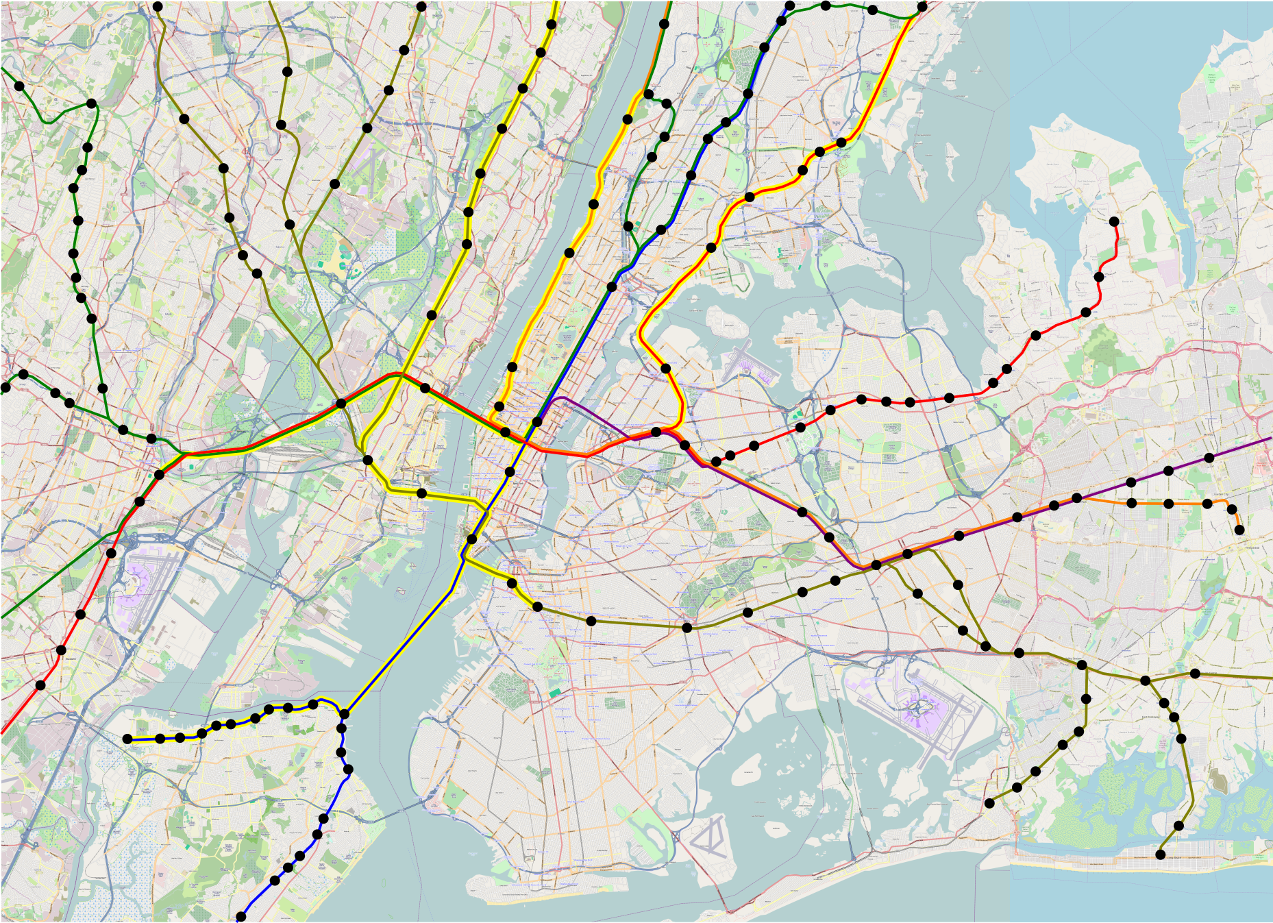
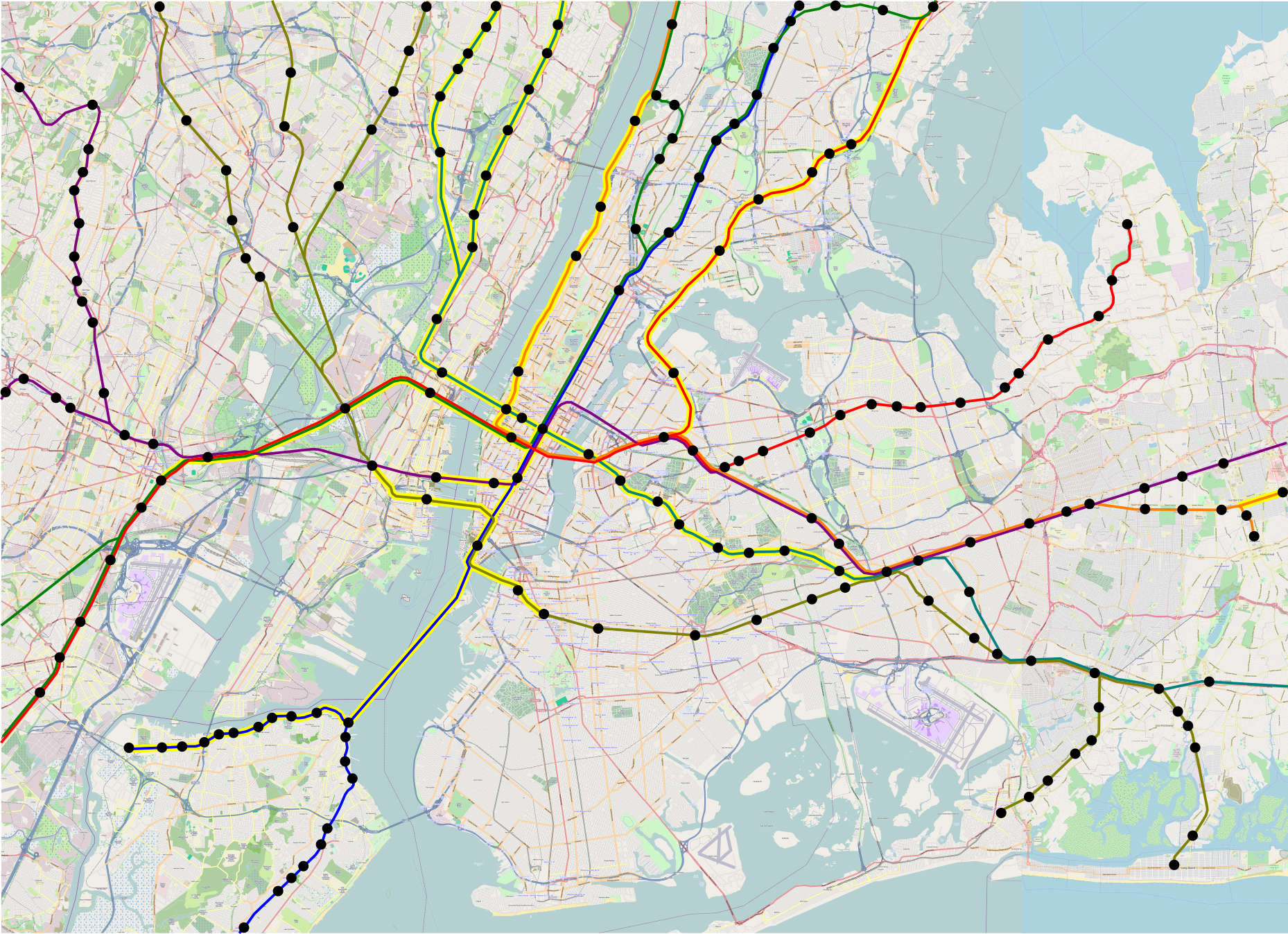
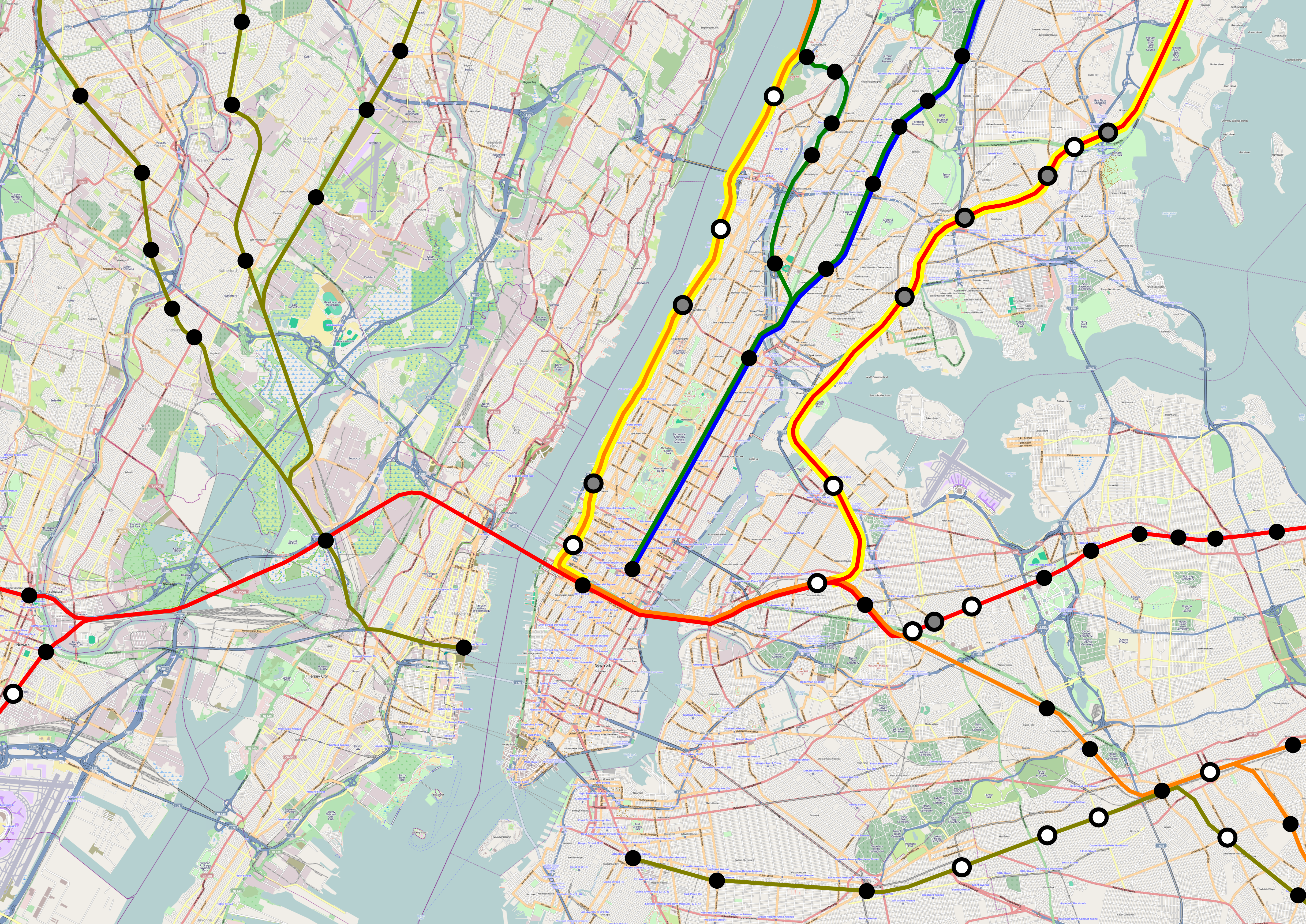
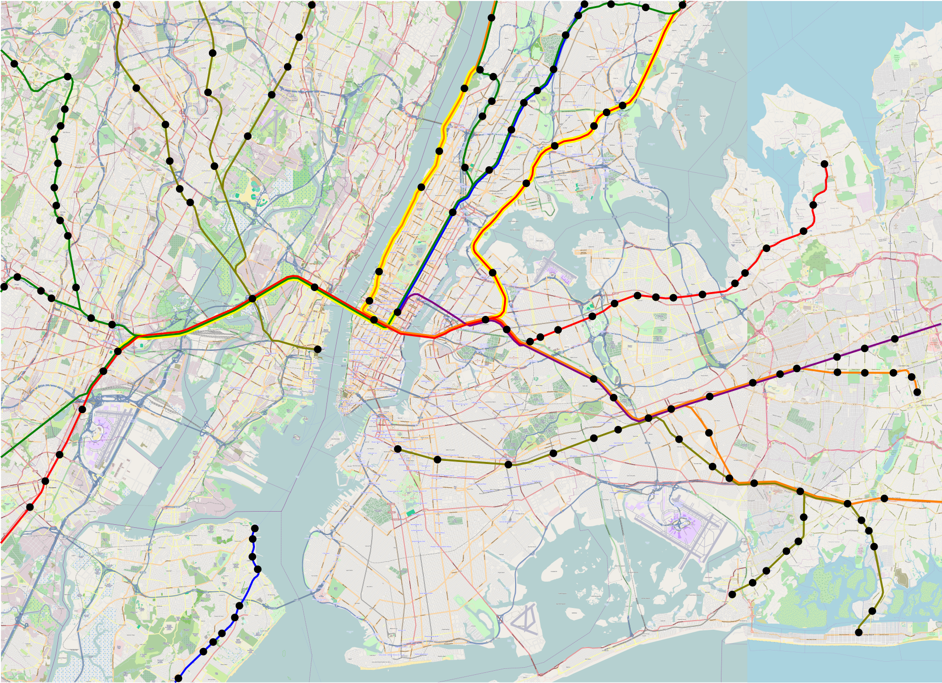
Earlier, in 2003, Port Authority studied three ARC alternatives. Alt P would just serve Penn Station with a new cavern adding more terminal tracks; Alt G would serve Penn Station and build a new tunnel connecting to Grand Central; Alt S would serve Penn Station and build a new tunnel to Long Island, at Sunnyside. The three options each cost about $3 billion, but Alt G had the highest projected ridership. Alt G had the opportunity to unite New Jersey Transit’s operations with those of Metro-North. Instead, Alt P was chosen, and the cavern was involved in the cost escalations that led Christie to cancel the project, saying the then-current budget of $9 billion would run over to $12.5 billion.
It is hard to say why Port Authority originally chose Alt P over Alt G. Stephen Smith spent years sending freedom of information requests to the relevant agencies, but never received the full study. Agency turf battles between New Jersey Transit and Metro-North are not certain, but likely to be the reason.
I talked to Foster Nichols a few months ago, while researching my Streetsblog piece criticizing the RPA plan for kowtowing to Long Island’s political demands too much. Nichols oversaw the reconstruction of Penn Station’s LIRR turf in the 1990s, which added corridors for passenger circulation and access points to the tracks used by the LIRR; he subsequently consulted on the RPA plan for Penn Station. Nichols himself supports the current Gateway plan, which includes the $7 billion Penn Station South complex, but he admitted to me that it is not necessary, just useful for simplifying planning. The Pennsylvania Railroad designed Penn Station with provisions for a third tunnel going east under 31st Street, which Alts S and G would leverage; Alts S and G are still possible. The one caveat is that the construction of Sixth Avenue Subway, decades after Penn Station opened, may constrain the tunnel profile – the ARC documents assumed locomotive-friendly 2% grades, but with EMU-friendly 4% grades it’s certainly possible.
With this background, I believe Alt G was certainly feasible in the mid-2000s, and is still feasible today. This is why I keep pushing it in all of my plans. It’s also why I suspect that the reason Port Authority decided not to build Alt G was political: the hard numbers in the study, and the background that I got from Nichols, portray Alt G as superior to Alt P. The one complaint Nichols had, track capacity, misses the mark in one crucial way: the limiting factor is dwell times at Penn Station’s narrow platforms, and having two Midtown stations (Penn Station and Grand Central) would allow trains to dwell much less time, so if anything capacity should be higher than under any alternative in which trains only serve one of the two.
The upshot is that Christie had legitimate criticism of ARC; he just chose to cancel it instead of managing it better, which Aaron Renn called the Chainsaw Al school of government. After Christie canceled ARC, Amtrak stepped in, creating today’s Gateway project. Even without the cavern, Gateway’s estimate, $13.5 billion in 2011, was already higher than when Christie canceled ARC; it has since risen, and the highest estimate I’ve seen (by Metro, so caveat emptor) is $29 billion. This includes superfluous scope like Penn South, which at one point was supposed to cost $6 billion, but more recently Nichols told me it would be $7 billion.
While bare tunnels would provide the additional capacity required at lower cost, they would require interagency cooperation. Amtrak, New Jersey Transit, and the LIRR would need to integrate schedules and operations. Some trains from New Jersey Transit might run through to the east as LIRR trains and vice versa. This would make it easier to fit traffic within the existing station, and only add bare tunnels; the Penn Station-Grand Central section, at the southern end of the station, would keep dwell times down by having two Midtown stations, and the section connecting New Jersey Transit with Long Island (probably just Penn Station Access and one LIRR branch, probably the Port Washington Branch) would have 8 station tracks to play with, making dwell times less relevant. Unfortunately, this solution requires agencies to share turf, which they won’t – even the Penn Station concourses today are divided between Amtrak, New Jersey Transit, and LIRR zones.
Gateway is not the only rail project suffering from cost blowouts; it is merely the largest. The LIRR is building East Side Access (ESA), to connect to Grand Central; right now, it only serves Penn Station. ESA uses an underwater tunnel built in the 1960s and 70s to get to Manhattan, and is now boring a 2 km tunnel to Grand Central, at a cost of $10 billion, by far the most expensive rail tunnel in the world per unit length. But the tunnel itself is not the biggest cost driver. Instead of having the LIRR and Metro-North share tracks, ESA includes a deep cavern underneath Grand Central for the LIRR’s sole use, similar to the one in ARC that Christie canceled. About $2 billion of the cost of ESA is attributed to the cavern alone.
Agency turf wars are not unique to New York. In California, the same problem is driving up the costs of California HSR. In inflation-adjusted dollars, the project’s cost has risen from $33 billion in 2008 to $53 billion today. Most of the overrun is because the project includes more tunnels and viaducts today than it did in 2008. Much of that, in turn, is due to conflicts between different agencies, especially in the San Francisco Bay Area. The worst example is San Jose Diridon Station.
Diridon Station is named after still-living former California HSR Authority board member Rod Diridon, previously responsible for the disaster that is VTA Light Rail, setting nationwide records for low ridership and poor cost recovery. The station’s main user today is Caltrain. California HSR is planned to serve it on its way between Los Angeles and San Francisco, while Caltrain and smaller users plan to grow, each using its own turf at the station. The planned expansion of track capacity and new viaducts for high-speed rail is estimated to cost about a billion dollars. Clem Tillier calls it “Diridon Pan-galactic” and notes ways this billion-dollar cost could be eliminated, if the users of the stations shared turfs. Clem identifies $2.7 billion in potential savings in the Bay Area through better cooperation between high-speed rail, Caltrain, and other transit systems.
It is not a coincidence that the worst offenders – Gateway, East Side Access, and California High-Speed Rail – involve mainline rail. American and Canadian passenger railroads tend to be technologically and managerially conservative. Most still involve conductors punching commuter tickets as they did in the 1930s; for my NYU presentation, I found this picture from 1934.
I suspect that this comes from a Make Railroading Great Again attitude. Old-time railroaders intimately understand the decline of mainline rail in the United States in the middle third of the 20th century, turning giants like the Pennsylvania Railroad into bankrupt firms in need of federal bailouts. This means that they think that what needs to be done is in line with what the railroads wanted in the 1920s, 30s, 40s, and 50s. Back then, people lived in the suburbs and commuted downtown at rush hour, so there was no need for intra-suburban service, for in-city stops (those were for working- and middle-class city residents, not rich suburbanites in Westchester), or for high off-peak frequency. There was no need for cooperation between different railroads then, since commuters would rarely need to make an onward connection, which led to a culture encouraging competition over cooperation.
Among all the explanations for high construction costs, turf battles is the single most optimistic. But Americans should be optimistic about building cost-effective passenger rail. If this is the main culprit – and it is in the Bay Area, and one of several big culprits in New York – then all it takes to fix the cost problem is bringing organizational practices to the 21st century, which is cheap. It is too late for East Side Access, but it is possible to drastically reduce the cost of Gateway by removing unnecessary items such as Penn Station South. This can be repeated for smaller projects in the San Francisco Bay Area and everywhere in the US where two separate transit agencies fight over station space.
Am I optimistic that Americans will actually do this? I am not. Even outfits that should know better (again, the RPA) seem too conservative and too politically constrained; the RPA is proposing systemwide integration in its Fourth Plan, but in a way that incorporates each player’s wishlist rather than in a way that uses integration to reduce capital investment needs. In California, the HSR Authority seems to be responding to demands for value engineering by procrastinating difficult decisions, and it comes down to whether in the moment of truth it will have politicians in the state and federal governments who are willing to pay billions of dollars of extra money.
However, I do think that a few places might be interested in running public transit better. Americans are not incorrigible, and can learn to adapt best industry practices from other countries, given enough pressure. From time to time, there is enough pressure, it’s just not consistent enough to ensure the entire country (or at least the most important transit cities, led by New York) modernizes.