Last month, New York’s Regional Plan Association published a report, Overlooked Boroughs, proposing various transit improvements in New York outside the Manhattan core to complement the existing Manhattan-centric subway network. I’ve been thinking for a while what to say about the report. I don’t want to mock too much, since the RPA clearly tries to improve things. But the report falls short in every way, and plays into fads about buses. The one point of light is a brief mention of subways under Utica and Nostrand Avenues, but it is vague and doesn’t even make any of the maps the RPA is producing for additional rail and bus service. Even the RPA’s positive past contribution to the region’s transit proposals, Triboro RX, is replaced by the inferior Crossboro system. All this is on top of wooden analysis of preexisting transportation options.
The Analysis
The technical report talks about low transit usage for travel within the Outer Boroughs, which for the study’s purposes include Upper Manhattan. Figure 3 on page 7 breaks down mode choice as transit versus other modes. This works in Queens, but in Upper Manhattan and the South Bronx, car ownership rates are so low that local transit is competing with walking (and biking). In the Bronx in general, the mode share for borough-internal commutes is 40% transit and 36% car; in Brooklyn, the corresponding numbers are 42% and 32%. Eyeballing figure 3, Upper Manhattan’s transit share looks like 35%, but the car share is almost certainly much lower, given very low car ownership. This means there’s a huge volume of non-mechanized transportation in those regions.
The study does mention expanding bike infrastructure, on pp. 50-51, with an emphasis on bike share. However, its conclusion is directly at odds with the fact that non-mechanized transportation is quite popular in Upper Manhattan, the Bronx, and Brooklyn. It calls for incremental enlargement of the current system’s coverage, which consists of Manhattan south of 59th Street and the innermost parts of Brooklyn. It specifically warns against rapid expansion, “so as not to spread the program too thin,” and says the next areas for coverage should be the bridge landings in Brooklyn and Queens and the Upper East and West Sides. Inexplicably, low-income Bedford-Stuyvesant, which is adjacent to the current coverage area, is explicitly listed as a future phase and not a current priority.
A better proposal would call for rapid expansion of bike share and bike lanes; this costs money, but so does transit. Moreover, since the neighborhoods that would gain the most are low-income, the city should give some thought to how to make its bike share system easier to use for low-income residents. The current system requires a debit or credit card and puts a $101 security hold per pass. A city-subsidized system allowing qualified low-income residents to ride without a security hold is required; for example, the city could allow EBT cards to be used in lieu of a security hold, even if their holders then need to put in cash or a MetroCard to pay, in case the federal government disallows using the cards for biking and not just food stamps.
Then, a few pages after the analysis of intra-borough commutes, the report makes another mistake: on table 2, it lists mode shares for commutes between city boroughs and suburban counties, as well as likely transit options. Where commuter rail exists, it lists it as an option: thus, the Manhattan, Queens, or Brooklyn to Essex County rows list “subway to New Jersey Transit” as an option, despite the fact that New Jersey Transit is expensive and infrequent in the reverse-peak direction. Most likely, transit commuters from New York to Essex County work in or near Downtown Newark and take PATH, or at the airport and take a bus.
Now, the report does talk about commuter rail’s deficiency in attracting urban riders, both in the discussion surrounding tables 2 and 3 and in the proposal to improve commuter rail on pp. 49-50. But it says little about frequency for reverse commuting. Even when it does acknowledge the LIRR’s one-way peak service, it pulls its punches and only says it “recommends this project” (three-tracking the LIRR Main Line); proposing to instead do away with peak express service in order to permit reverse-peak service on the other track – as is practiced on the two-track segments of the Chuo Line – is beyond its scope. The punch-pulling is significant; as we will see over and over, the report repeatedly lets itself be defined by current practices and low-level current proposals.
Finally, the analysis of buses leaves something to be desired. The report talks at length about issues regarding span, frequency, and speed, on the list of nine characteristics that determine the attractiveness of transit. There’s no attempt to look systematically at what the busiest bus corridors in the city are. At some places, the corridors proposed match those of busy bus routes, for example the main crosstown routes in Brooklyn, the B35 and B6. At others, they neglect them entirely: as Alexander Rapp noted in comments recently, Grand Concourse, hosting the Bx1/2, is one of the busiest bus corridors in the city, even though it parallels the subway – it’s busier than Nostrand, which is now a Select Bus Service (SBS) route. The third busiest Bronx route, the Bx19, running on Southern to 145th in Manhattan, is also neglected.
We Just Call It “The Bus”
I think it’s Zoltána who said that what Americans call bus rapid transit, Londoners call “the bus.” As she noted in the past, three-door buses with all-door boarding are ubiquitous in Italy. German-speaking cities tend toward all-door boarding as well, as does Paris, but the buses usually have just two doors. All of this is years-old discussion, here and on related blogs such as Human Transit.
The significance of this is that it throws a wrench in any and all attempts to plan surface transit in New York around SBS, which is a bundle of features: enforced off-board fare payment, longer stop spacing, dedicated (but not physically separated) bus lanes. Vancouver engages in similar bundling with the B-Lines, but at least gets it right by not enforcing off-board fare payment: there are no machines printing tickets at any B-Line bus stop, but instead passengers can pay the driver at the front, or board from any door if they have a monthly pass or a transfer slip, which most do. But even Vancouver makes a mistake by requiring everyone to board from the front and pay the driver on all but a handful of bus lines. Vancouver, at least, establishes B-Line routes to mark where it considers building SkyTrain extensions in the future. In New York, it’s not about subway extensions; the planners really do think these features are special, and should be combined.
The RPA could have pushed for citywide off-board fare collection. Instead, it chose to smother any such push:
Set up off-vehicle fare payment using a proof of payment system. Passengers will not only board faster, but they will also be able to board using either front or back doors. However, the high cost of this option makes it impractical for system-wide implementation. Alternatively, the MTA should shift to touch or vicinity passes, the successor to the MetroCard, which is fast becoming obsolete.
First, the invocation of high cost in any plan that includes subway extensions, as this report does, is laughable. One-word replies to this point include any city where all buses already use proof of payment (POP), such as Paris, Berlin, Zurich, or Singapore. This is especially true now that the front end of smartcard technology is so cheap that there are top-up consumer items sold for $30. The cost of putting a card reader at every bus stop and at every bus door is, in 2015, trivial; what is not trivial is the cost of paying drivers to idle while bus riders are dipping their MetroCards at the front one by one.
If we accept citywide POP and bus stop consolidation – again looking at practices in Europe (and in Singapore), bus stops here are spaced every 400 meters and not 200-250 as in the US – then the rationale for SBS breaks down completely. All that’s left is corridors that require bus lanes, and those do not need to be continuous, as a bus can run partly on dedicated lanes and partly in mixed traffic.
Planning for the best corridors for specially upgraded surface transit requires thinking in terms of key bus corridors; the report does this because it assumes SBS is special, and the discussion with Alexander Rapp about Grand Concourse was about light rail. But if this is really just about bus lanes, then planning should be in terms of street segments. Bus lanes are required whenever there are busy buses on congested streets, and feasible when the streets are wide enough to permit car lanes and parking lanes in addition to the bus lanes. The importance of congestion means that a citywide bus lane map would be much more Manhattan-centric: potentially all Manhattan avenues and most two-way streets should have bus lanes since Manhattan traffic is so slow, even if there are key corridors elsewhere in the city with higher ridership.
At this point it’s useful to step back and think about relative advantages of surface transit (in this case buses) and rapid transit. Surface transit will always be slower, more expensive to operate, and far cheaper to deploy than rapid transit. This is why bus maps look like dense grids or meshes in every major city whereas subway maps only do in a small number of megacities.
The upshot is that there’s less need to force buses into a few key corridors. If New York were to build a subway or even light rail on a corridor, it would have to choose the routing in a way that would replace multiple parallel buses. For example, light rail on Tremont would replace both the Bx40/42 and the Bx36, which run on or parallel to Tremont in different parts of the Bronx. There’s no need to do that with bus-based transit: the Bx40/42 and the Bx36 can stay where they are. Route consolidation is only beneficial insofar as it boosts frequency, which means it’s required on minor routes but optional on major ones – this is why there’s a bus on every Manhattan avenue except Park, with no consolidation of the various one-way avenue pairs. The Bx40/42 runs every 10 minutes in the midday off-peak, and the Bx36 runs every 7-8 minutes, so there’s no need for a combined corridor.
Another key difference, ignored in the report, is that surface transit needs to run on straight, continuous streets whenever possible. Turns slow the bus down much more than they slow the subway (although they do increase the subway’s construction costs, since the subway would need to go under private property). This is partly because the bus is already slower, so the extra travel distance is more onerous, and partly because turning from one street to another requires red-light cycles that may not be easily eliminated via signal priority.
One upshot of this is that the report’s proposed bus map has some routes that are completely insane. Figure 14, on page 40, has two proposed new SBS routes in the Bronx: one paralleling the Bx36 and Bx40/42 in a circuitous manner, and going north-south in the East Bronx with several jogs and turns larger than 180 degrees. Nobody needs such circuitous routes.
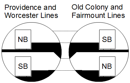
Another upshot is the situation in Brooklyn. Brooklyn has five of the city’s top ten routes: the crosstown B35 and B6, and the radial B41 (Flatbush), B44 (Nostrand), and B46 (Utica). The latter three follow their streets nearly the entire way. The first two do not, as Brooklyn does not have continuously important crosstown arterial streets the way it has Flatbush, Nostrand, and Utica. Now, to be fair, the B6 is as fast as the three radials, all averaging 11 km/h on local buses and 12-13 on limited ones, but the B35 is much slower, 8 km/h local and 9 km/h limited; all average speeds are computed departing eastbound or northbound at noon. Between this and the B6’s somewhat zigzaggy route, the circumferentials are slowed more than the radials, which means rapid transit becomes more useful.
Enter Triboro RX, which appears in modified form (see below) in the report. Although it doesn’t closely parallel the B35 or B6, it provides a similar kind of service, and could poach significant ridership from both. This means that the introduction of rapid transit service there would make it less important to upgrade the B35 and B6 beyond the upgrades all other buses receive; conversely, such service would get much more ridership than we see today on buses, since it would offer such a large speed benefit. Of course the same is true of subway extension on Nostrand and Utica, but the rail bias over the existing 12-13 km/h options is a bit less than over a 9 km/h option; it’s only the easy tie-in to the 2, 3, 4, and 5 trains and the very high ridership of three closely parallel bus routes that make two subway lines pencil out.
Unfortunately, there’s no attempt at combined planning in the report. There’s no attempt to tie upgraded bus routes in Brooklyn and Queens to new transfer points created by Triboro. At the city’s other end, in the Bronx, Second Avenue Subway Phase 2 would make an East 125th Street terminus desirable for some Bronx buses; this is again not shown. Figure 14 on page 40 doesn’t show subway extensions, and figure 15 on page 44 doesn’t show SBS routes.
Finally, one notable inclusion is that of North Shore Branch SBS. Everything I could say about this I said three and a half years ago; it’s a terrible plan, and the fact that the RPA is going through with it instead of explaining why a second Staten Island Railway line would be better speaks volumes to how little the RPA is willing to come up with its own ideas instead of following whatever fads the city and MTA engage in.
Rail: Even When It’s Right, It’s Wrong
The report’s proposals for subway and commuter rail expansion have good kernels, but manage to make big mistakes on top of them, producing projects of limited transportation value. Here the RPA’s mistake is less overrelying on bad government planning (there is none as far as rail is concerned) and more overrelying on its own hype and that of similar organizations.
The plan for Second Avenue Subway is still in place. However, one key proposal regarding phasing worries me:
There is a strong argument to move quickly to build the north segment first as far as 116th Street, which would be relatively inexpensive since much of the tunnel is in place from earlier work, leaving the more expensive last piece to 125th Street for later. This report supports this argument.
Although in East Harlem, 116th Street is the key throughfare, a connection to 125th Street is crucial, for the transfer to Metro-North and the 4, 5, and 6 trains. It’s not even too much more expensive than a Phase 1.5 to 116th Street, since the 106th and 116th Street stations would still need to be dug, and the stations are the dominant part of Second Avenue Subway’s cost, three quarters of Phase 1 if I remember correctly.
Moreover, the report suggests various tie-ins, all on page 43: going west across 125th, going north into the Bronx, going south to Brooklyn via a new tunnel and taking over the Atlantic Branch of the LIRR. The first one would be golden, but isn’t even depicted on the associated map, figure 15 on page 44. As with the Nostrand and Utica subways discussed on the same page, the best ideas in the report are presented as afterthoughts and not depicted on any map. The Bronx extensions are harmless, but the routes shown on figure 15 are at times circuitous. The Atlantic Branch plan, fortunately not shown either, is the worst: the Atlantic Branch should be part of a modernized commuter rail plan. Despite the fact that the report does talk about commuter rail upgrades, it still considers cannibalizing a key route for a Second Avenue Subway extension.
The second key piece of rail infrastructure proposed, Triboro RX, is the RPA’s key contribution, dating back to 1996. Michael Frumin worked on this project and, together with Jeff Zupan, one of this report’s two authors, estimated its ridership at 76,000 commuters, each taking a roundtrip per weekday, for about 150,000 weekday boardings. Unfortunately, this report scraps many of the useful features of Triboro, replacing the line with Penn Design’s inferior Crossboro, which runs alongside the Northeast Corridor in the Bronx instead of completing the semicircle around Manhattan.
Moreover, for reasons I do not understand, the report widens the interstations on Triboro. The original plan called for a station every 800 meters, excluding the Hell Gate Bridge; including it, there would be about a station every kilometer. The current version of the route has a station every 1.8 km; even excluding the Bronx and Hell Gate portions, this is a station every 1.6 km. Broadway Junction, a key transfer point with connections to the A, C, and J, is deleted; trains run nonstop from New Utrecht to the Brooklyn Army Terminal; successive spokes in Brooklyn get no stations between them, even when the distance between the radial lines is such that most subway networks would put in a station in the middle.
Finally, commuter rail modernization falls flat. The RPA correctly calls for lower fares and higher off-peak frequencies – but then fails to follow through with demanding reductions in marginal operating costs. A discussion of high off-peak frequency and subway-competitive fares is a waste of time if each train is staffed with five conductors. A more reasonable number of conductors, zero, is required for this to financially pencil out.
But even if we ignore the costs, the plan does not look like a plan with modernized commuter rail. There are no infill stations proposed. High frequencies and mode-neutral fares would make Astoria a desirable commuter rail stop; but the stations mentioned on pp. 49-50 for Penn Station Access service are only the ones currently proposed in the Bronx, omitting Astoria. Similarly, despite wild plans, not depicted on maps, to construct a commuter rail branch on Utica, there’s no mention of simply adding a Utica stop to Atlantic Branch trains. Nobody is going to use Utica or Astoria for today’s fares or on today’s schedules, but frequent, cheap commuter rail service to these areas would be very popular.
All of the ideas proposed for rail are good, in principle. I’m glad that Second Avenue Subway is receiving priority, that Triboro is on this map, and that there’s talk of commuter rail modernization. But every when the RPA gets it right, it wrecks things with bad details about phasing, station placement, and lack of consideration of what commuter rail modernization would do to demand patterns.
Where are the Forward-Thinking Proposals?
The report simply cobbles together various proposals by organizations and politicians, without trying to turn them into a coherent whole: some bus upgrades here, some subway and commuter rail expansions there, no real attempt to even make the various modes work together. Even within each tranche, the report often rehashes current city plans, no matter how inappropriate.
Is the RPA thinking forward here? I don’t see any evidence of forward thought in the report. Where Paris is beginning construction on 200 kilometers of driverless rapid transit, mostly underground, the RPA is proposing 10 km of subway in future Second Avenue Subway phases and 40 km of rapid transit on existing right-of-way in Triboro RX. If New York could build subways at Paris’s prices, about $250 million per kilometer, Ile-de-France’s budget for Grand Paris Express, about $35 billion, would build the entirety of Second Avenue Subway eleven times over. There would be money for multiple radial and crosstown subway extensions and commuter rail tunnels (at Parisian costs, my commuter rail through-running tunnels would together be $20 billion or somewhat less); bus upgrades, done right, would show as a rounding error in streetscaping, and actually save money since higher speeds would reduce operating costs.
The Third Regional Plan did talk about things that other people were not proposing at the time. It had more Second Avenue Subway tie-ins, for one. Here all the RPA is doing is slapping its logo on a bad bus upgrade plan and reminding people that there’s a Second Avenue Subway project waiting to be finished. What happened to the RPA?

