In major transit cities, rich areas have better access to public transportation than poor areas – in fact, what makes them valuable is precisely the easy access to high-paying jobs. Even in cities with bad transit, this is often the case: the transit systems of cities with mode shares in the 10-15% area, like Boston and Chicago, tend to be good at serving city center and little else, and city center workers tend to be richer because professional work tends to cluster whereas low-skill work tends to disperse.
However, there are exceptions to this rule. One, the French Riviera, occurs in a city region with a transit mode share of 13%, comparable to that of American city regions where transit commuters outearn solo drivers. Two more cities are would-be exceptions, for opposite reasons: Providence has no public transit to speak of, but if it invested in creating a transit network, the natural corridors would serve the poor better than the rich; and Vancouver currently has better SkyTrain service in working-class areas than in richer ones, but its current investment is in middle-class areas, and moreover its extensive transit-oriented development has been middle-class as well.
Moreover, all three cities have patterns that generalize. The situation in the Riviera arises because of the classed nature of work there, and generalizes to other places with extensive tourism. That in Providence arises because of the city’s industrial history, and may generalize to other deindustrialized small cities with underutilized legacy rail networks. In Vancouver, part of this situation is because easy rail corridors were more readily available in poorer areas for an essentially random reason, but another part is extensive transit-oriented development concentrating working-class jobs near train stations.
The Riviera: the casinos are walkable, the tech jobs aren’t
Before I go any further, I’d like to stress something important: my observation of the Riviera is largely based on qualitative observations. I don’t know of INSEE data comparable to the Census Bureau’s Means of Transportation to Work by Selected Characteristics table, which could allow me to test the theory that transit ridership in the Riviera skews poor. All I am going by is what I have seen riding trains and occasionally buses as well as what I know of the distribution of jobs.
What I’ve seen is that transit use in the Riviera skews working class. Middle-class Parisians sometimes drive and sometimes take the trains. In contrast, the rich people who I’ve met in the Riviera have as far as I can tell never set foot on the TER. This is despite the fact that the TER is competitive with driving on the area’s main arterial road, the Moyenne Corniche, and is even competitive with the A8 freeway over short distances because the A8 has difficult access time to the relevant exits. Not for nothing, train stations in rich areas have very little ridership: per SNCF’s ridership data, stations in rich areas like Cap d’Ail and Cap Martin-Roquebrune have around 60,000 boardings plus alightings per year, so around 100 weekday boardings, whereas in working- and lower-middle-class Menton the annual total is 1.4 million, or around 2,300 weekday boardings.
The train stations, too, signal poverty. They’re not neglected, but what I’ve seen of them reminded me of working-class suburbs of Paris like Boissy much more than middle-class ones like Bures-sur-Yvette. I was even warned off of spending too much time near Nice’s train station by people echoing local middle-class prejudices. The buses look even poorer: the main east-west bus on the Moyenne Corniche is full of migrant workers.
A key clue for what is happening can be found when selecting a destination station at the fare machines in Menton. As far as I remember, the first option given is not Nice, but Monaco. SNCF’s data table doesn’t include ridership for Monaco, but Wikipedia claims 5.5 million a year without citation, and SNCF’s own blurb claims more than 6 million. Either figure is narrowly behind Nice’s 6.9 million for second in the Riviera and well ahead of third-place Cannes’s 3.2 million – and Nice also has some intercity traffic.
While Monaco’s residents are rich, its commuters are not. There are no corporate jobs in Monaco, because its tax haven status does not extend to corporations with substantial sales outside the city-state, only to local businesses like restaurants and stores. The commuters work low-pay service jobs at hotels and casinos, which they access by train, or perhaps on foot if they live in Beausoleil, as many a domestic service worker in Monaco does.
In contrast, the mass of middle-class jobs cluster in a purpose-built edge city in Antibes, called Sophia-Antipolis. While Antibes itself has a decent transit mode share for residents (10.5%, cf. Menton’s 14.8% and Nice’s 25.4%), and its train station gets 1.6 million annual boardings and alightings, the edge city is unwalkable and far from the train. There’s some traffic in the Riviera, but not enough that middle-class people, who can afford cars, clamor for transit alternatives to their suburban jobs.
The main lesson here is that while the jobs most likely to cluster are usually middle-class city center jobs, working-class tourism jobs cluster as well in regions that have plenty of them. Tourism in the Riviera is the most intense in Monaco specifically and in other coastal cities generally, which encourages travel along the linear corridor, where rail shines. It’s usually hard to see, because for the most part the top tourist destinations are enormous like London, Paris, and New York, but in specialized tourist regions the separation is clearer.
Already we see some evidence of this in Las Vegas, where working-class jobs cluster along the Strip. The city has a monorail, serving the hotels and casinos rather than city center. Were it interested in improving public transportation, it could build an elevated railroad on the Strip itself for better service.
Orlando is another potential example. I named it as a specific example of a region that would be difficult to retrofit for public transit earlier this year, but Disney World remains a major clustering of working-class jobs as well as some middle-class leisure travel. The problem there is that Disney World is far from the train and, unlike the Riviera, does not lie on any line with other potential ridership draws; nonetheless, a train connecting the Orlando CBD, the airport, and Disney World could get some traffic.
Finally, picturesque mountain resorts that happen to lie near rail could see working-class travel on the train to their tourism jobs. Many of these resorts are where they are specifically because a legacy rail trunk happened to be there and the railroad developed the area to generate demand for its services; this is the case for Jasper, Lake Louise, and Banff, all on the Alberta side of the Continental Divide. Aspen is not on a railroad, but is on a road where buses carry working-class commuters displaced by the town’s high housing costs.
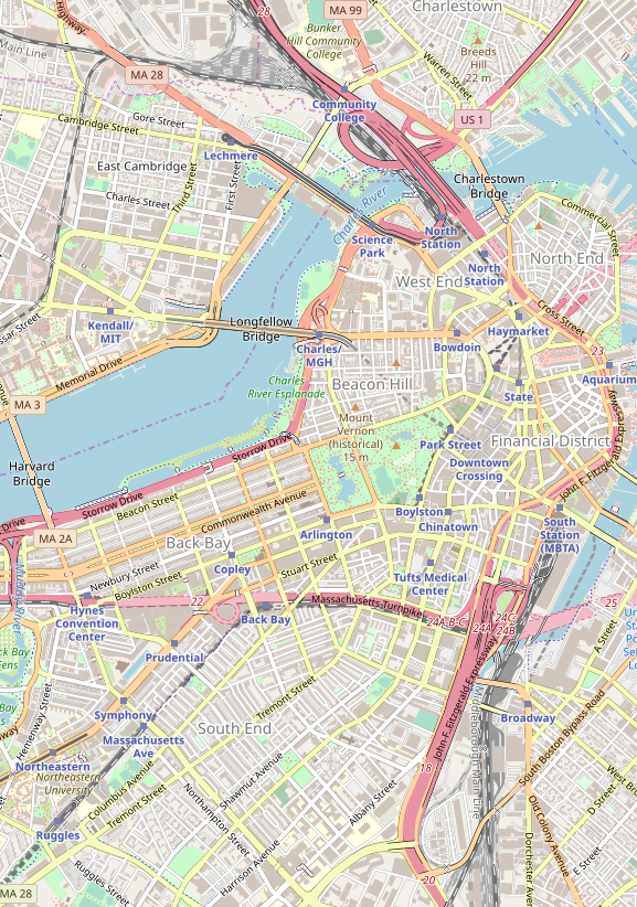
Providence: once upon a time, there were factories near the railroad
When I lived in Providence seven years ago, I discussed transit improvements with local urbanists who I met through Greater City: Providence. We talked about improvements to both bus and rail; we had little appetite for the proposed city center streetcar, which has since been downgraded to a proposed frequent bus, and instead talked about improvements to the busiest buses as well as rail service along the main spine of the Northeast Corridor.
The improvements to the busiest buses were already under discussion by the state, including signal priority on key routes and investment in queue jump lanes and shelter amenities. The two routes that were by far the state’s busiest, the 99 on North Main and 11 on Broad, were permanently combined to a single through-running service branded as the R bus, for rapid, with limited-stop service. These routes serve very poor parts of the built-up area, including Pawtucket on the 99 and South Providence on the 11. This is a consequence of the fact that transit in Rhode Island is so bad that only the poor use it, and thus the preexisting busy routes serve poor areas; the best physical bus infrastructure is a bus tunnel to College Hill, the richest neighborhood in the city, but ridership there is weak and therefore the routes were never high priorities for further investment.
The improvements to rail never went beyond blogging; we didn’t have the pull of Boston’s TransitMatters, which itself is better at proposing small improvements than big ones that go up against political obstruction. What we called for was frequent local rail within the urban area: Peter Brassard wrote up the initial proposal, and I added some refinements. The Northeast Corridor, where the service would run, is primarily an intercity rail corridor, but there is room for four tracks in the right-of-way, and while there is freight traffic, it runs at the same approximate speed of a local passenger train.
As we discussed this proposal, Greater City’s Jef Nickerson noted something: what the train would do if implemented is produce better transit service in working-class areas than in more comfortable ones. Unlike the situation with the buses, this was not an intentional process. We would like Rhode Island to improve rail service using an existing right-of-way, which happens to serve Central Falls, Pawtucket, Olneyville, Hartford, Cranston, and Warwick, and miss the East Side and the middle-class suburbs. We realized that the city and inner-suburbs like Pawtucket are poorer than the proper suburbs, but that the train would serve Olneyville but not the East Side seemed like a coincidence.
But is it really a coincidence? Providence developed from east to west. The city was initially founded on the western side of what is now the East Side, sloping down to the river. What is now Downcity was only the second part of the city to develop. It became the center of the city because, as the Northeast Corridor was constructed, it was not possible to provide through-service via the hilly historic core of the city, only via the flatter areas that are now Downcity. A tunnel across College Hill opened in 1908, but by then the city’s basic urban geography was set: the university and port jobs on the East Side, industrial jobs to the west near the rail mainline.
The industrial jobs are long gone now. New England was the first part of America to industrialize and the first to deindustrialize, the mills moving to lower-wage Southern states already in the middle of the 20th century. In very large cities, declining industrial jobs can be replaced with urban renewal serving the middle class: the West India Docks became Canary Wharf, the freight railyards of Gare de Lyon became Bercy, the industrial Manhattan and Brooklyn waterfronts became sites for condos with nice views. In Providence-size cities, no such urban renewal is possible: there is no large mass of middle-class people clamoring to live or work in Olneyville, so the neighborhood became impoverished.
While factories may seem like attractive targets for transit commuting, they’re so clustered, in reality they have not been walkable ever since electrification made open-plan single-story factories viable. Factories are land-intensive and have been since around the 1910s. Moreover, whereas hotels and retail have a reason to locate in walkable areas for their consumption amenities – tourists like walking around the city – factories do not, and if anything depress an area’s desirability through noise and pollution. Working industrial districts are not attractive for transit, but post-industrial ones are, even if they are not gentrified the way so much of London, Paris, and New York have.
A large number of cities share Providence’s history as a medium-size post-industrial city. Nearly every English city except London qualifies, as do the cities of the American Northeast and Midwest below the size class of Boston and Philadelphia. Moreover, all of these cities have undergone extensive middle-class flight, with the racial dimension of white flight in the US but even without it in Britain; thus, the relatively dense neighborhoods, where transit service is more viable, are disproportionately poor. However, the feasibility of mainline rail service to post-industrial neighborhoods is uneven, and depends on local idiosyncrasies.
One positive example I’m more familiar with that’s a lot like Providence is in New Haven. Its best potential local rail route, the Farmington Canal Trail, serves lower middle-class areas like Hamden, and fortunately parallels the busiest bus route, the D-Dixwell. While Hamden is not poor, such service would still lead to the inversion we discussed for Providence, since the rich live in thoroughly auto-oriented suburbs or within walking distance of Yale. The main drawbacks are that it would require replacing an active trail with rail service, and that either street running or brief tunneling would be needed in the final few hundred meters in Downtown New Haven.
Vancouver: easy corridors and TOD for the working class
With a modal share of 21%, Vancouver is in a somewhat higher class of transit quality than the Riviera, Boston, or Chicago. However, it remains a far cry from the numbers beginning with a 3, 4, and 5 seen in New York and in European and Asian transit cities. As with the Riviera, I am somewhat speculating from my own observations, lacking a table that clearly states transit usage by socioeconomic class. However, two factors make me believe that transit in Vancouver serves the working class better than it does the middle class.
The first factor is the corridors served by SkyTrain. The first to be built, the Expo Line, runs in a preexisting interurban right-of-way, with minor greenfield elevated and underground construction; even the downtown tunnel is repurposed from a disused mainline rail branch. It passes through a mixture of working-class and lower middle-class neighborhoods on its way to Surrey, which is working-class and very negatively stereotyped. The second, the Millennium Line, branches east, to lower middle-class suburbs, running on a greenfield el. The third, the Canada Line, is a partially tunneled, partially elevated route through the middle-class West Side to working-class Richmond. Only the fourth line to be built, the Evergreen extension of the Millennium Line, finally serves a comfortable area, as will the next line, the Broadway extension of the Millennium Line deeper into the West Side.
The second factor is the job distribution within Metro Vancouver. Usually, we see concentration of professional jobs in city centers and dispersal of working-class jobs among many stores. In the Riviera this relationship between job concentration and income is only inverted because the working-class jobs are disproportionately in tourism while the professional ones are in an edge city. In Vancouver I don’t believe there is any such inversion, but there is leveling: jobs of either type are concentrated in transit-rich areas. This leveling is the result of extensive commercial transit-oriented development, most notably Metrotown, which has many office jobs on top of Canada’s third largest shopping mall.
The first factor is idiosyncratic. The easy corridors happened to serve poorer areas, on a line from East Vancouver to Surrey. The rich live in North Vancouver, which has a ferry and doesn’t have enough population density for a SkyTrain tunnel; on the West Side, which is separated from downtown by False Creek and was thus late to get a rail connection; and in Port Moody and Coquitlam, which were only connected to SkyTrain recently via the Evergreen extension.
The second factor is more systemic. While American and European cities rarely have big urban shopping malls, Canadian cities are full of them. The Metropolis at Metrotown has 27 million annual visitors, not far behind the 37 million of the Forum des Halles, at the center of a metro area five times the size of Metro Vancouver – and the Metropolis has more than twice the total commercial floor area. In this, Canada is similar to Israel and Singapore, which like Canada have harsh climates, only hot instead of cold. Moreover, Vancouver has encouraged this centralization through TOD: Burnaby built Metrotown from scratch in the 1980s, simultaneously with the Expo Line.
It is difficult to engage in concerted residential TOD for the working class, since it requires extensive housing subsidies. Vancouver’s residential TOD near SkyTrain stations is thoroughly middle-class. However, concerted commercial TOD is easier: hospitals, universities, and shopping centers all employ armies of unskilled workers (the first two also employing many professional ones), the first two while satisfying general social goals for health care and education provision and the last while making the owners a profit on the open market.
Moreover, Vancouver’s TOD within downtown, too, has made it easier to provide transit service for the working and lower middle classes. Where constraints on office towers lead to high office rents, only the most critical jobs are in city centers, and those are typically high-end ones; in the US, it’s common for big corporations to site their top jobs in the center of New York or Chicago or another large city but outsource lower-end office jobs to cheaper cities. In Vancouver, as elsewhere in Canada, extensive downtown commercialization means that even semi-skilled office jobs like tech support can stay in the center rather than at suburban office parks.
Conclusion
Based on my own observations, I believe the Riviera provides better public transportation for the working class than for the middle class, and to some extent so does Vancouver. Providence provides uniformly poor transit service, but its lowest-hanging fruit are in working-class urban neighborhoods.
The reasons vary, but the unifying theme is that, in the Riviera and Vancouver, there is none of the typical big-city pattern in which the rich work in walkable city centers more than the poor (e.g. in New York). In Vancouver it’s the result of commercial TOD as well as a Canadian culture of urban shopping centers; in the Riviera it’s the result of unique dependence on tourism. In Providence the situation is not about job concentration but about residential concentration: lower-income neighborhoods are likelier to arise near rail because historically that’s where industry arose, and all that remains is for Providence to actually run local passenger trains on the mainline.
It is not possible to replicate culture. If your city does not have the tourism dependence of Monaco, or the shopping mall culture of Vancouver, or the post-industrial history of Providence, there’s little it can do to encourage better urban geography for working-class transit use. At best, can build up more office space in the center, as Vancouver did, and hope that this encourages firms to locate their entire operations there rather than splitting them between a high-end head office and lower-end outlying ones. Fortunately, there exist many cities that do have the special factors of the Riviera, Vancouver, or Providence. In such cities, transit planners should make note of how they can use existing urban geography to help improve transit service for the population that most depends on it.

